
Doubling Point Lighthouse
Near Bath, ME
DOUBLING POINT
A BRIEF SUMMARY OF DOUBLING POINT
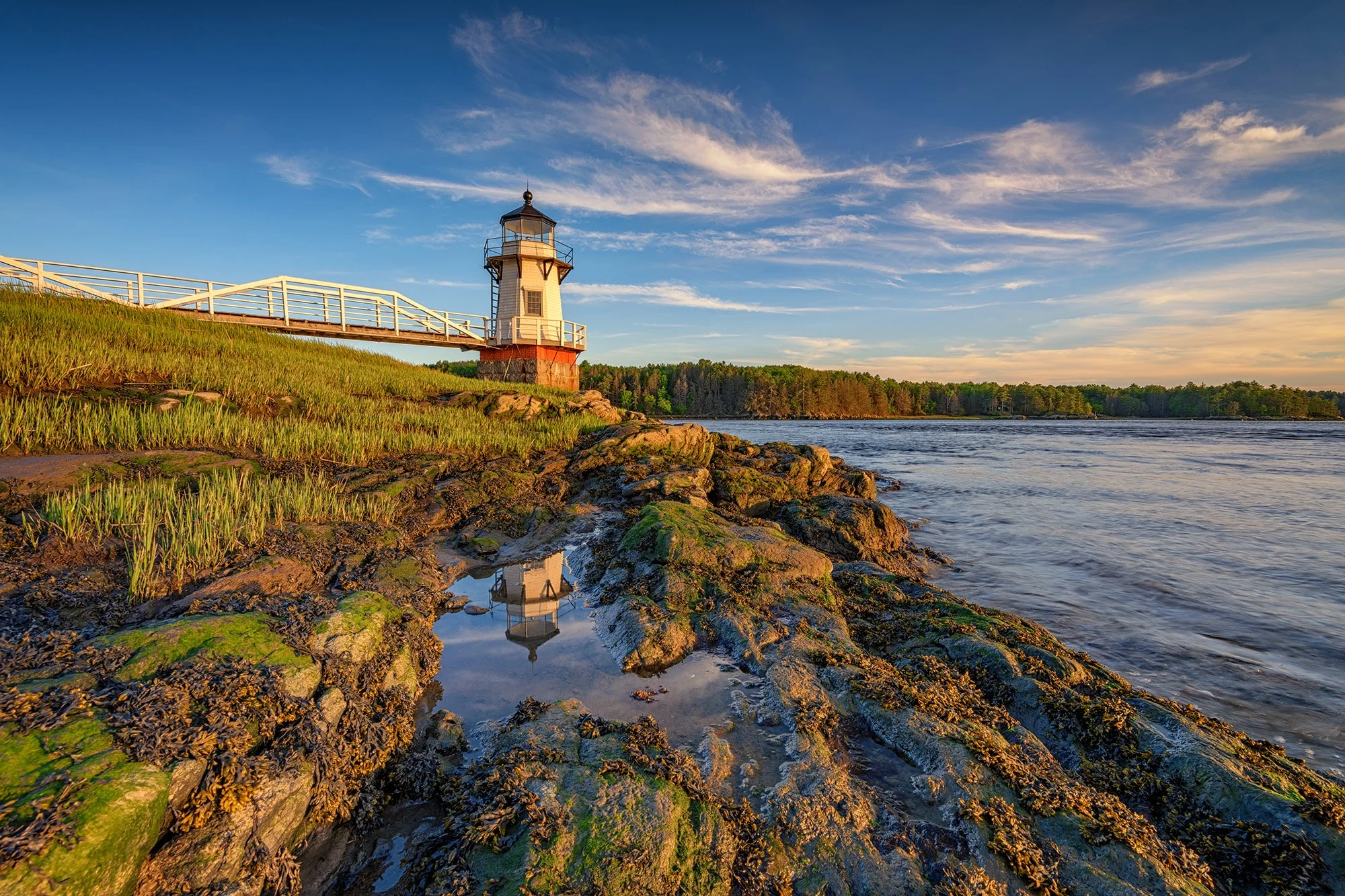
Doubling Point Lighthouse, located on the Kennebec River just downriver from Bath, Maine, was built in 1898 to help aid ships in navigation of a bend in the river as they sailed into Bath Iron Works, a major shipbuilder.
It was built at the same time as Squirrel Point Lighthouse, and features a keeper's house, shed, and oil house. The keeper's house is set away from the river's edge, among a stand of trees, and thus difficult to include in photos. The lighthouse is a popular stop for lighthouse enthusiasts and photographers.
IMPORTANT: There’s been a change to Doubling Point Lighthouse’s accessibility. Fairly recently, there have been signs put up that state visiting hours are between 9am and 5pm. They also have signs stating No Trespassing and that security cameras are in use. According to the website, you can email lighthouse@doublingpoint.org to get permission to be there outside of the stated hours.
Photos and location summary by Rick Berk

Annual Subscription
Lifetime Membership
DATA POINTS INCLUDED WITH DOUBLING POINT SUMMARY
You can drive all the way up to the keeper's house, where there is parking for 3-4 cars. From there make your way down to the lighthouse. The trail is easy for the most part, but if you make your way into the grasses either north or south of the lighthouse, be aware that at times these areas are underwater. The Kennebec River is tidal in this area, and at extreme high tides those marshy areas are inundated, which means when the waters recede, thick mud and pools are left behind below the tall grass. Waterproof boots are recommended for venturing into these areas, which offer some of the best angles on the lighthouse.
These were all taken at low tide, or as the tide was coming back in but not yet at high tide. This allows you to get down to water's edge and get a good angle on the lighthouse from the side. Check tide tables for Doubling Point to see what time the tides are.
Wide angle and standard length lenses will work well here.
The main image above was taken at 16mm focal length.
Sea Level Ft. Elevation
Other Resources Available with Membership
Detailed Directions
Best Time of Day to Shoot
Best Time of Year to Shoot
Equipment Needed
Required Permits
KMZ Trail File
Direction of Shot
Google Maps Birds-Eye-View
Number of Photographers to Expect
Cell Service
Current Weather
Lodging & Camping
Area Guides and Workshops
Other Resources
LOCATION SUMMARIES WRITTEN BY PROFESSIONAL PHOTOGRAPHERS


