
Willard Beach
South Portland, ME
WILLARD BEACH
A BRIEF SUMMARY OF WILLARD BEACH
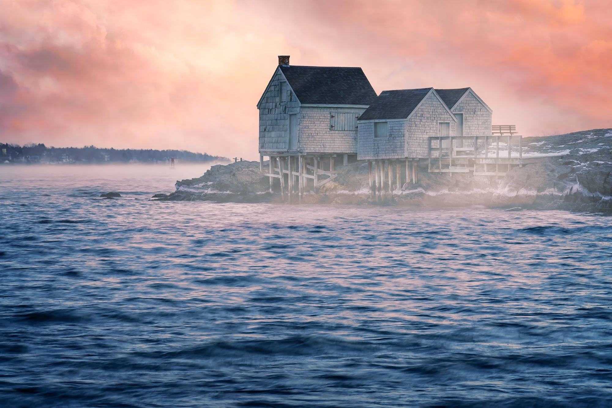
Willard Beach is a beach and neighborhood located in South Portland, Maine. It has become popular with photographers due to the fishing shacks located on what is known as Fisherman's Point, on the south end of the beach.
The beach also features a view of Portland Head Lighthouse from Fisherman's Point, and Spring Point Ledge Lighthouse can be seen from the beach, and a short walk over the beach to the north leads to Fort Preble, an old fort which was built in 1808, and Spring Point Ledge Lighthouse, on the campus of Southern Maine Community College. From the north end of the beach, facing south, Portland Head Lighthouse is visible behind the fishing shacks.
Photos and location summary by Rick Berk
IMPORTANT NOTE: the Willard Beach fishing stacks were destroyed in a storm in the winter of 2023. The city is planning to rebuild them. However, not time frame is set.

Annual Subscription
Lifetime Membership
DATA POINTS INCLUDED WITH WILLARD BEACH SUMMARY
It's a short walk from the parking area to the beach, transitioning from pavement to soft sand. Once on the beach, the shacks at Fisherman's point lay to the right (south), and Spring Point Ledge and Fort Preble are to the left (north).
For the sea smoke shot, simply walk out onto the beach and choose a composition you like. Both the images of Spring Point Ledge Lighthouse and the sea smoke image of the shacks were taken along the beach. The red sunrise image was captured by walking along the beach to the north end, and climbing steps up to the Southern Maine Community College campus to get the proper angle for stacking Portland Head Light behind the fishing shacks.
Standard length zoom such as a 24-70 and telephoto zooms such as a 100mm-400mm or even a 150mm-600mm will be useful here. A longer focal length is particularly useful for the compressed perspective of Portland Head Lighthouse behind the fishing shacks, as seen in the red sunrise image.
The above image was taken at 143mm focal length.
Sea Level Ft. Elevation
Other Resources Available with Membership
Detailed Directions
Best Time of Day to Shoot
Best Time of Year to Shoot
Equipment Needed
Required Permits
KMZ Trail File
Direction of Shot
Google Maps Birds-Eye-View
Number of Photographers to Expect
Cell Service
Current Weather
Lodging & Camping
Area Guides and Workshops
Other Resources
LOCATION SUMMARIES WRITTEN BY PROFESSIONAL PHOTOGRAPHERS


