Offline Maps
Using OFFLINE MAPS
One of the most valuable tools for a landscape photographer is a detailed topographical map with waypoints and routes. Photographers often spend hours planning the details – waypoints for potential image locations, routes, lighting conditions, and so on. A fully prepped topographical map is an essential tool for a successful photography trip.

SAVED ON YOUR DEVICE
Offline maps are static in your device's memory (not cache) and is not dependent on having access to cell service.
When connected to a strong cell signal, you can rely on real-time map access via applications such as Gaia GPS, Google, and AllTrails. However, many of the locations landscape photographers want to capture are in remote locations that are difficult to reach and far from services, especially cellular services with data capabilities.
Without good cell service, the GPS coordinates and/or trails you downloaded to your favorite locations as waypoints are all but useless. And getting lost in the desert, forest, or another unknown place can be frustrating and potentially life-threatening.
There is a straightforward solution that most of my photography buddies and I use on each trip – an offline mapping system. At the heart of any offline system is a good, reliable GPS tracking app.
GPS TRACKING APPS
Key features to look for with a GPS tracking app
Different Offline Map Options
Gaia GPS
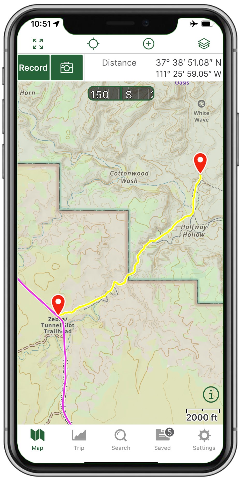
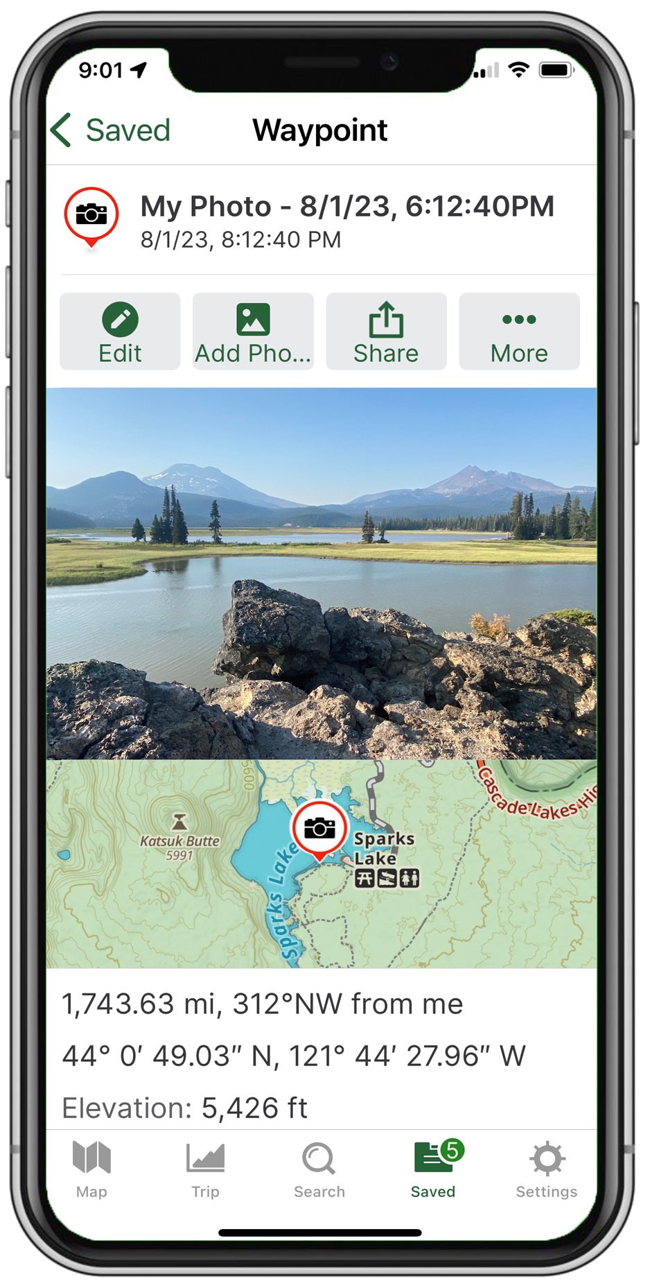
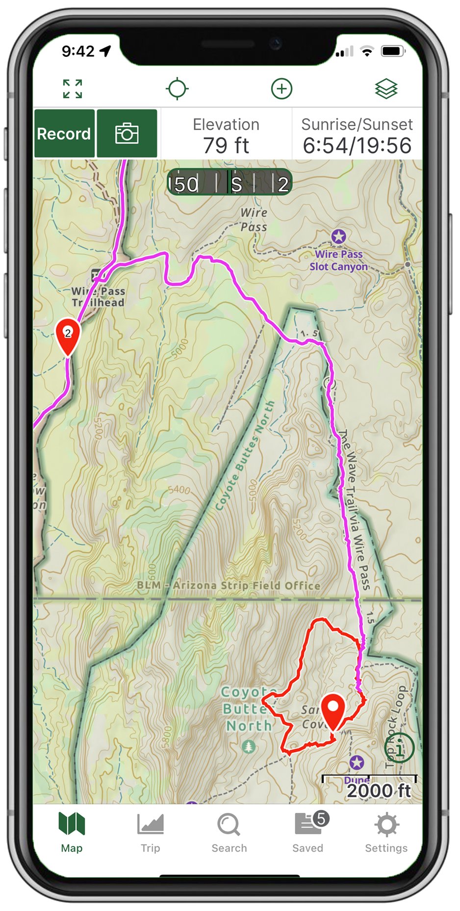
There are many good mapping apps, and everyone has their favorites. Gaia GPS (www.gaiagps.com) is my favorite, as it has the functions I need and rely on, such as personal tracking, the ability to drop waypoints, tag locations with reference pictures, and, most importantly - accurate information within a few feet. The app allows me to download offline maps from anywhere in the US.
Transparency: I have no relationship with Gaia GPS whatsoever. It is simply currently my personal choice.

Google Offline Maps
Google also provides a powerful offline solution with its offline maps option. The main advantages are that it is free, and once downloaded, you can still use standard Google search features even when you no longer have access to cell service. However, my experience with using Google offline maps is that its reliability could be better, and I have yet to find a way to upload KMZ or other trail options. Also, dropping waypoints and reference picture locations is challenging.
I have found through experience that maintaining Gaia GPS and Google offline maps simultaneously provides thorough coverage for all my potential needs. Gaia GPS records my photography locations, other waypoints, routes, and tracks. Google provides a backup source for my location while providing routing directions offline (a feature not currently available in Gaia GPS).

AllTrails
AllTrails is a GPS hiking tracking app with access to thousands of trails and works great when you have cell data service. The app also allows you to download the hike/trails to your phone in advance to track your route and destination. This app falls short of my needs because it only allows you to upload other GPS coordinates and trails on the AllTrails system. Also, it will not allow you to download complete maps for an area or state. This is important as you travel in areas without cell service; you have no way of navigating.
National or State Atlas
A low-tech Atlas can also be very helpful in many rural areas. Delorme, and sometimes Rand McNally and National Geographic, sell Atlas for both the entire country and each state separately. I have traveled to many parts of the US and know many areas pretty well. However, when planning a trip, I always download offline maps for Gaia GPS and Google Maps for the places I am going - and I ALWAYS bring my Atlas. I have used it countless times through the years. You can purchase Atlas on Amazon and oftentimes at REI.

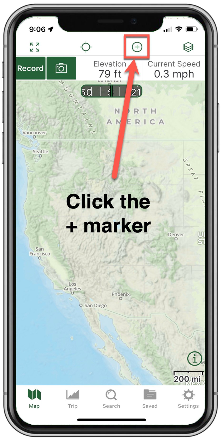
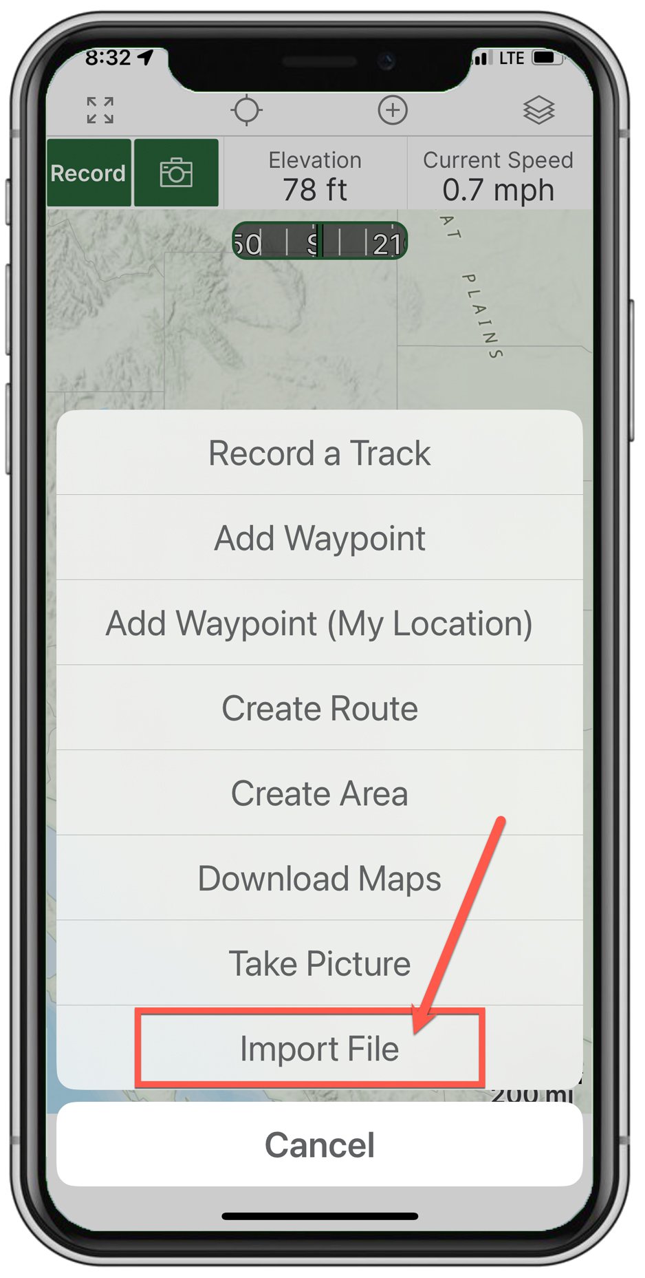
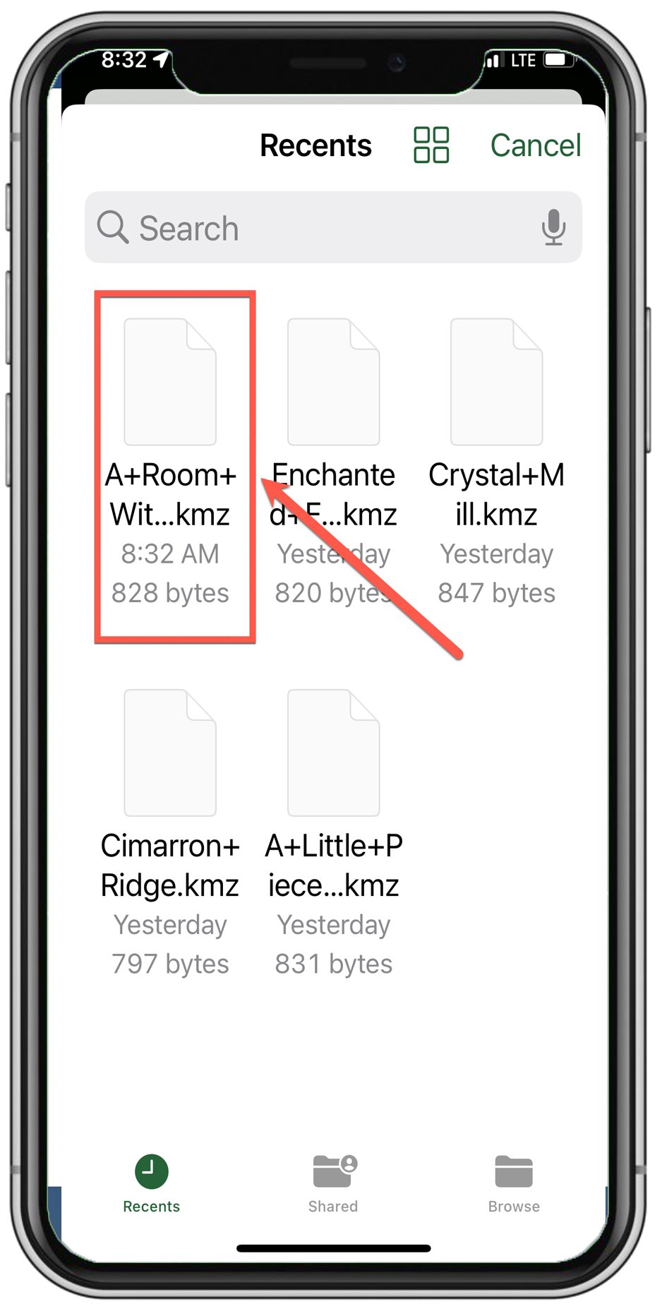
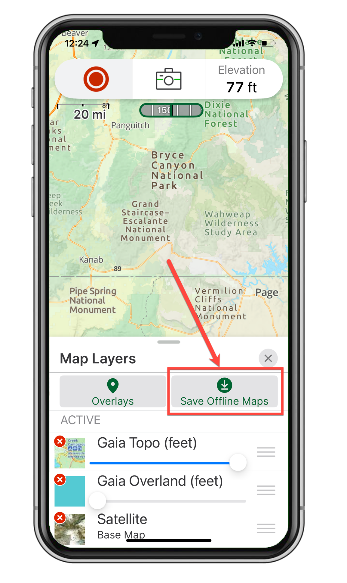
how to Download offline maps with GAIA GPS
IMPORTANT: If you have Gaia GPS Free plan - it does not allow you to download OFFLINE MAPS. This option is only available with their Premium ($4.99 a month) or Outside ($7.99 a month) plans.


Once you have downloaded Gaia GPS and signed up for either their Premium or Get Outside plans, follow the directions below to save OFFLINE MAPS to your phone. Repeat on your tablet if you choose to.


IMPORTANT: Download the OFFLINE MAPS in an area with a strong Wi-Fi connection (like your home or hotel room). Downloading on the road via your cell phone is not ideal, as OFFLINE MAPS are large files that will consume a significant portion of your data allotment and may take a long time to download.
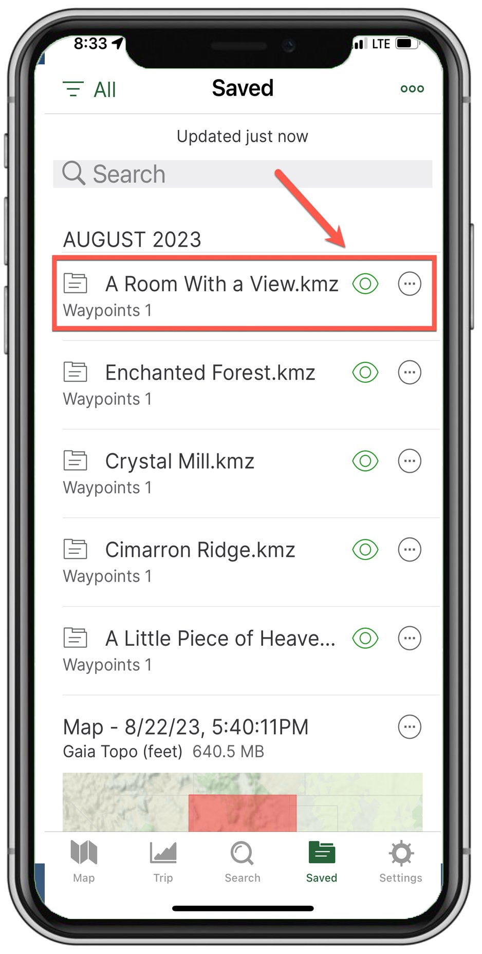
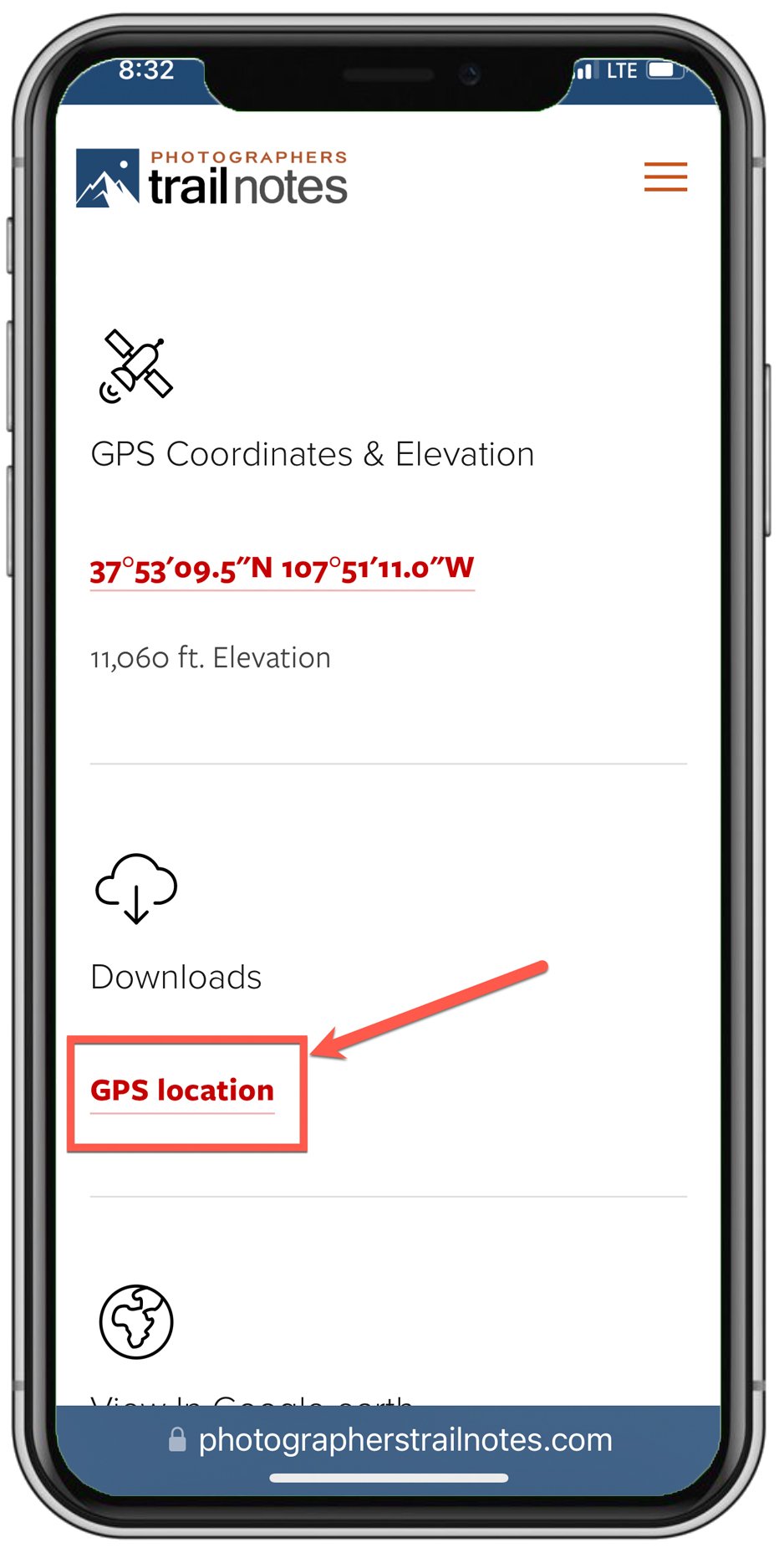
Adding GPS locations to your smartphone
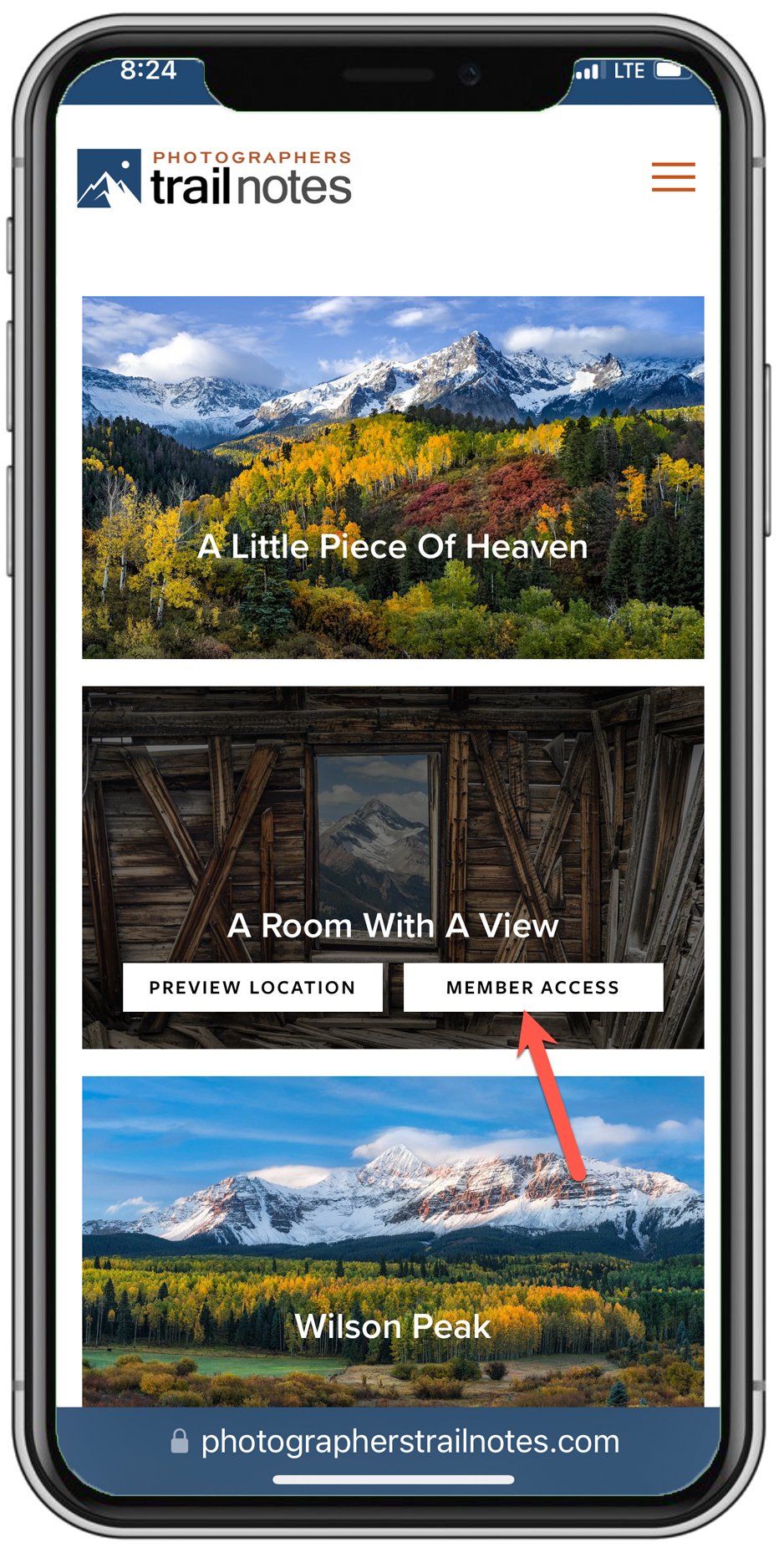
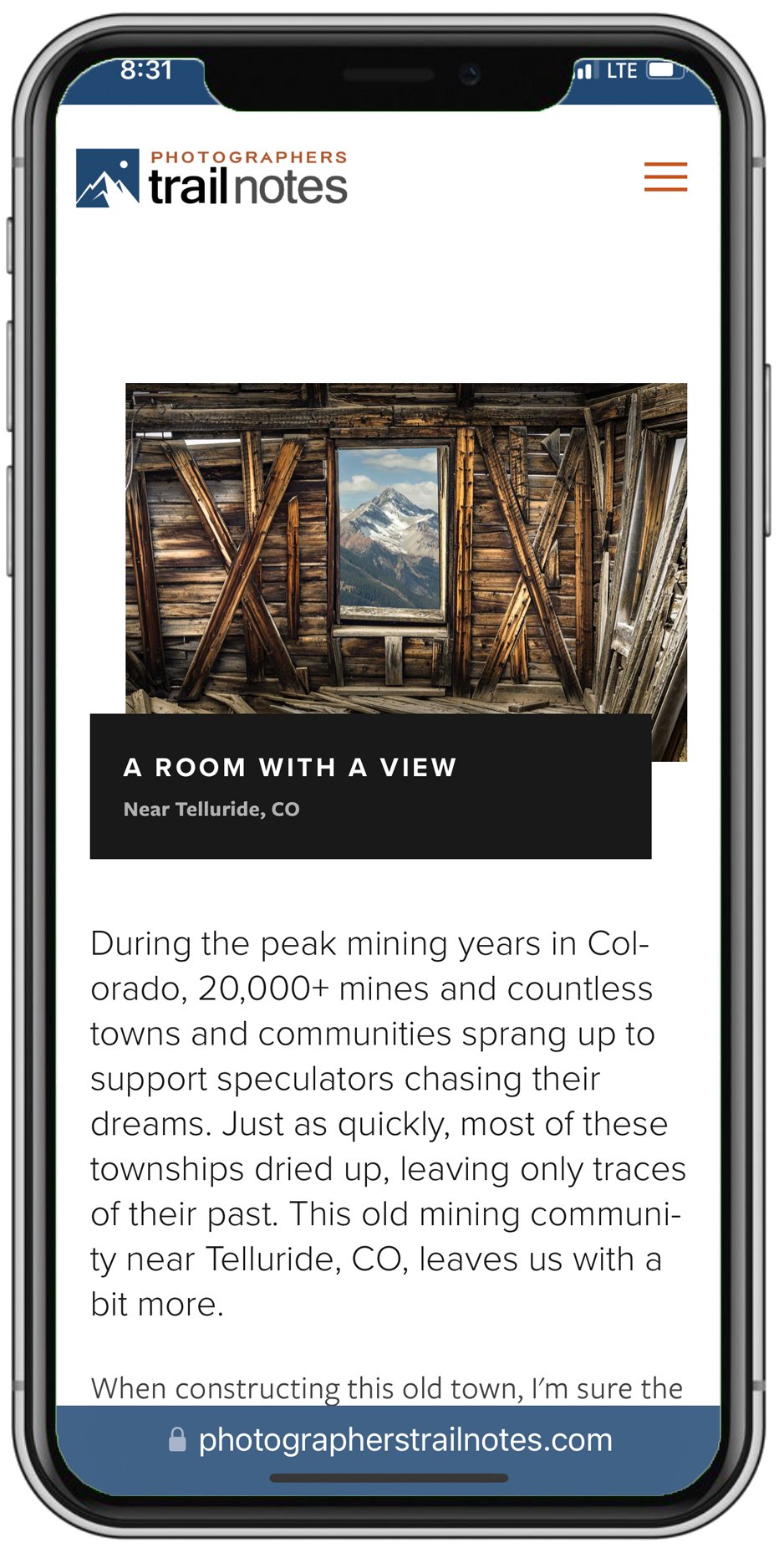
Open PTN And Find The Location You Want To Download
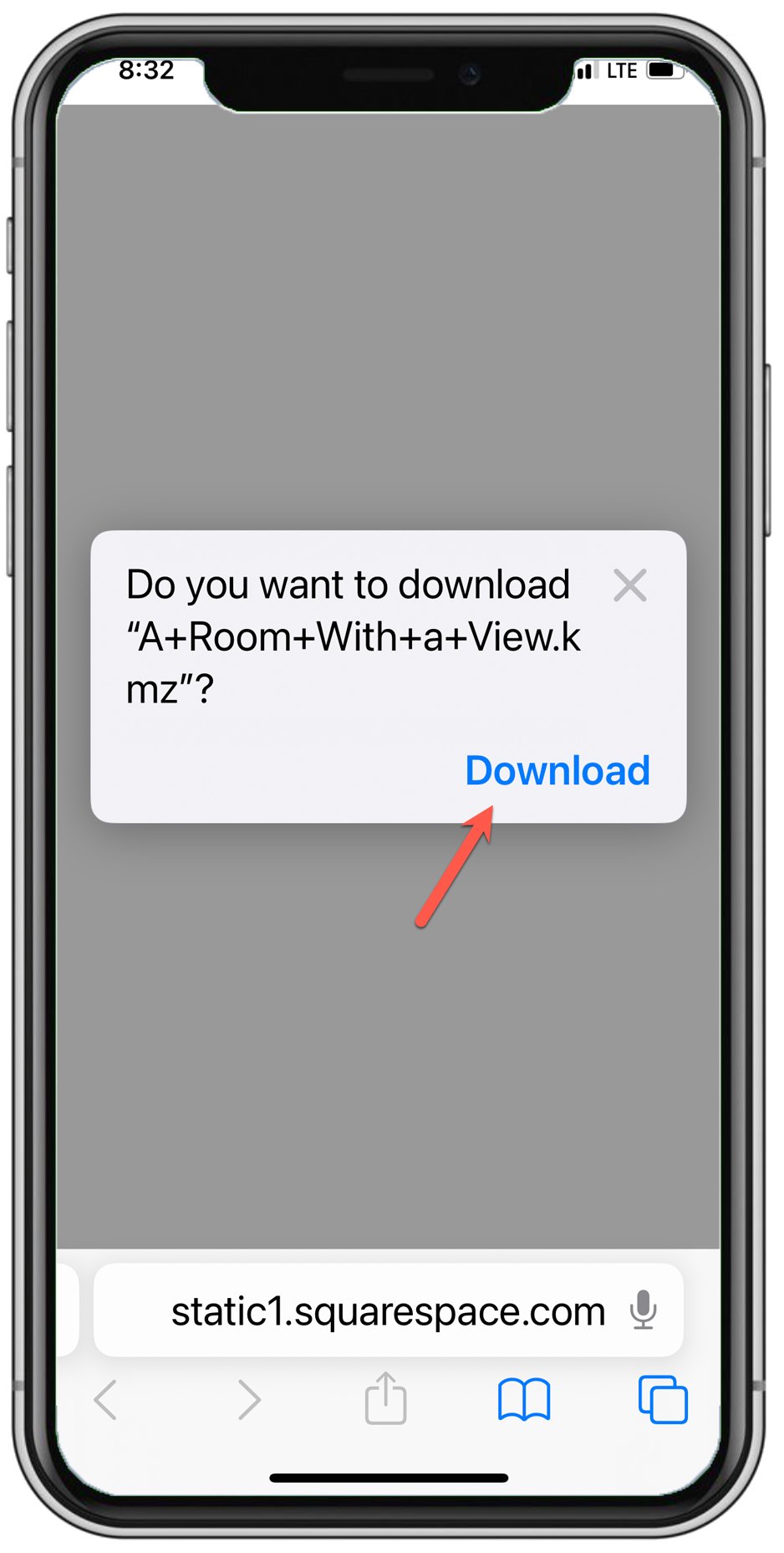
Open The Gaia GPS App