
Alstrom Point

Alstrom Point
Near Page, AZ
Sunset (or sunrise) Alstrom Point is like few others you will ever witness in the American southwest. But like many beautiful things, there can be a heavy price to pay to see it. The road to Alstrom Point is mean, tough and long and should only be done with a high clearance 4-wheel drive vehicle.
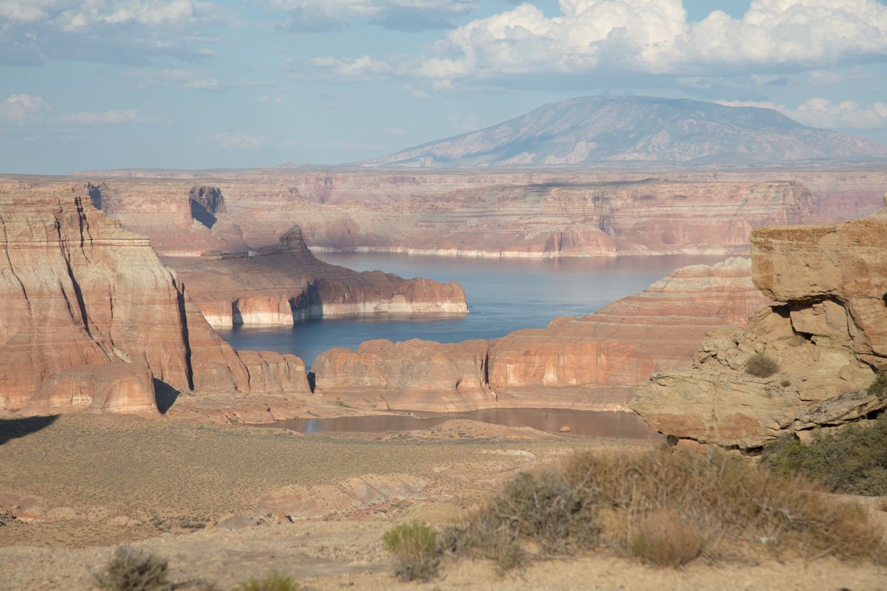
Lake Powell is a product of the Glen Canyon Dam and is the second-largest reservoir in the US (behind Lake Mead). The lake is just north of Page, AZ, and straddles the states of Arizona and Utah (mostly Utah). The scenes created by Lake Powell are stunning as it sets in the area of endless coves, buttes, and colorful sandstone. However, in my opinion, the best views of Lake Powell are from Alstrom Point.
Images and location summary by Tim Wier
Trail Difficulty - DIFFICULT TO EXTREME
I would rate the difficulty of this trail as a 5 on a scale of 1-5 (with 5 being most difficult). I would only attempt the road to Alstrom Point in a high clearance 4x4 vehicle! The first 23 miles (of the total 25 miles) is on a rocky/dirt road that passes through a few washes. However, at mile 23, you have to climb a pretty nasty uphill which requires high clearance 4x4. And for the next 1.6 miles, the road (if you can call it that) is VERY rocky and bumpy.
GPS Coordinates & Elevation
4,690 Ft Elevation
Download KMZ Trail File
Click Here to download the KMZ file for this location.
Photography Tips
Alstrom Point is a stunning location that can take your breath away. However, sometimes it is difficult to capture the essence of this grand vista. Walk around and try to find a nice location that includes something (like a rock or rock formation) as an anchor. Otherwise, you just have a wide shot of a nice lake with some red buttes.
Directions
CLICK HERE to get driving directions to Alstrom Point.
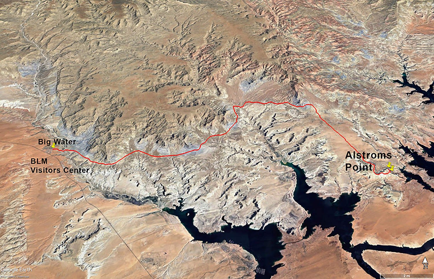
The closest town to Alstrom Point is Page, AZ.
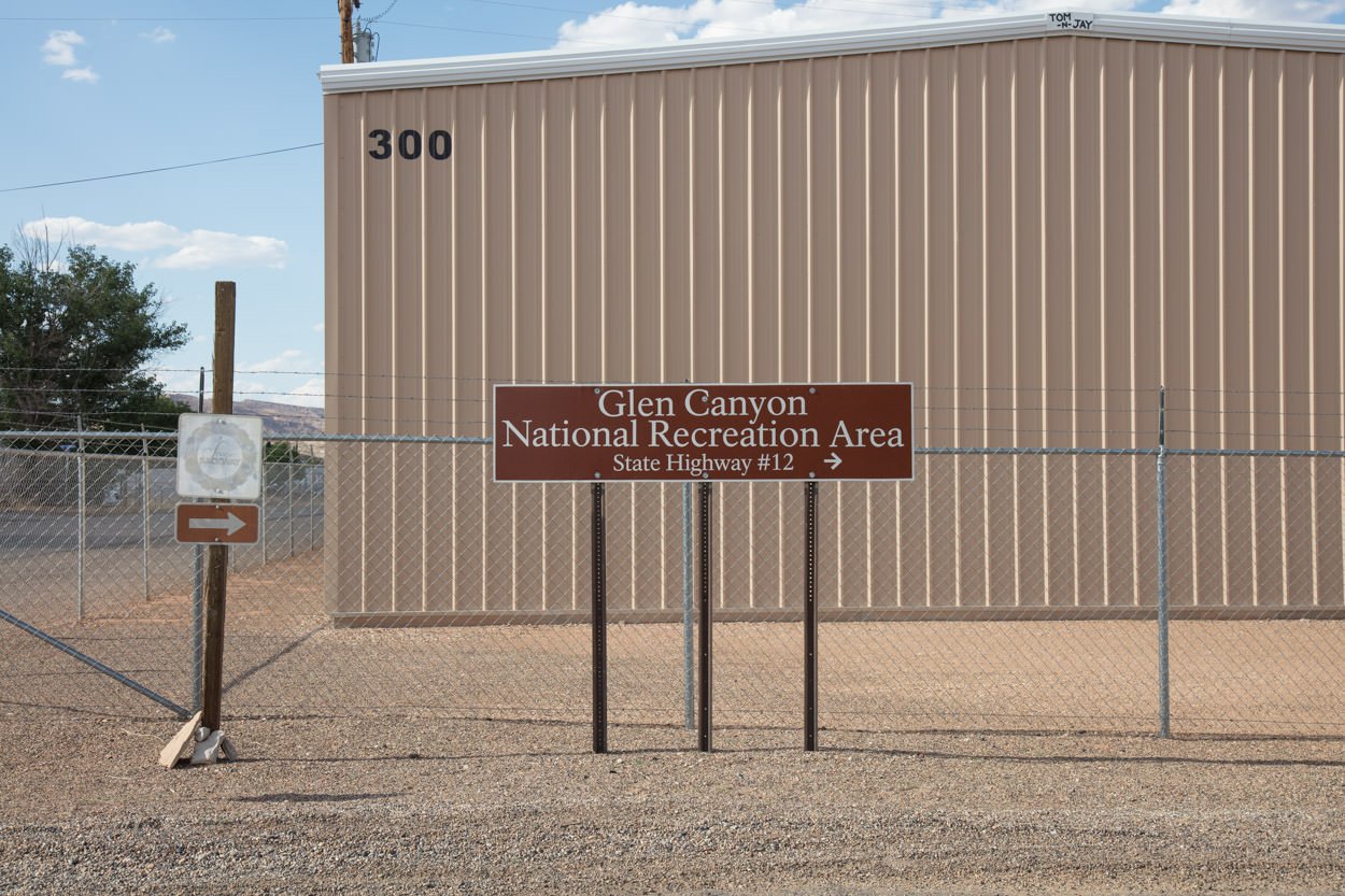
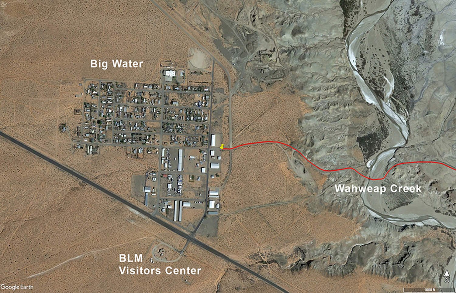
From Page, AZ travel north on US 89 (you will cross the Glen Canyon Dam). Once you cross the dam, drive on US 89 west 14.5 miles to the little community of Big Water. When you get to Big Water, take a right on Ethan Allen Way (directly across from the BLM Visitors Center). Drive on Ethan Allen Way 0.3 miles and make a right onto Glen Canyon National Park Road.
STOP AND SET YOUR VEHICLES ODOMETER.
At 0.5 mile you will come to the Wahweap Creek. At this point, it is wise to take inventory of the weather, the forecast, and the surroundings. Wahweap Creek is a major wash (areas where waters go during a flash flood) and if it fills up while you are at Alstrom Point it will be impassable for several days.

Wahweap Creek (wash)
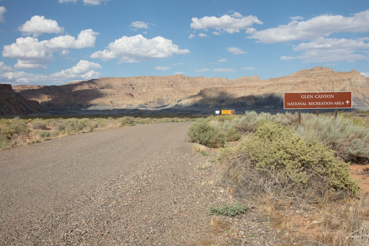
Once passing over Wahweap Creek drive the gravel road and at 9.0 miles you will see a sign for WARM CREEK BAY - stay straight/left.

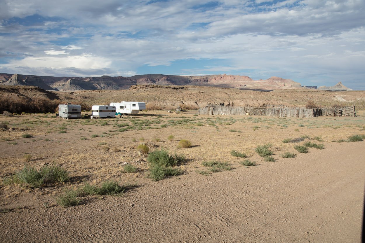
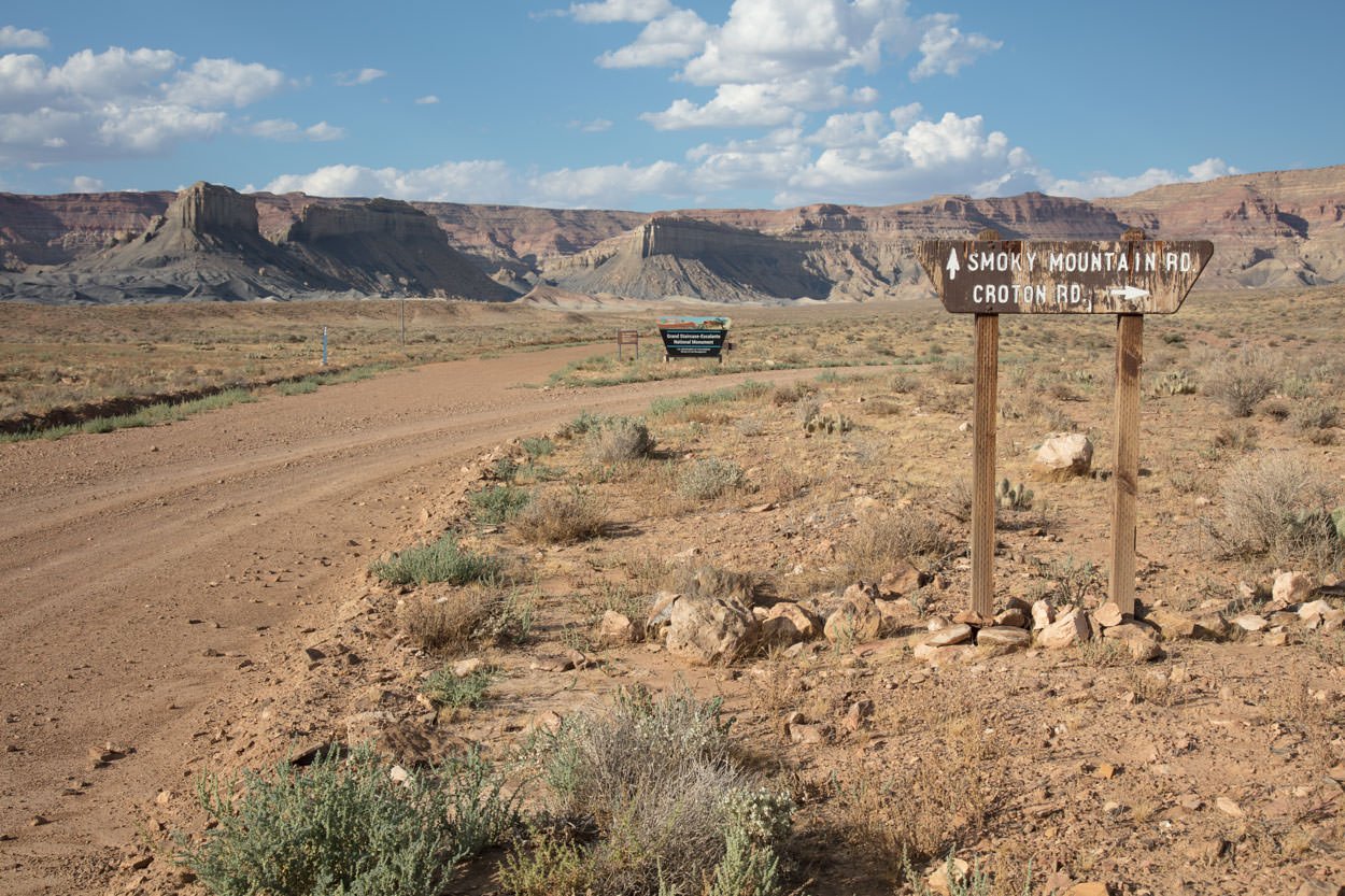
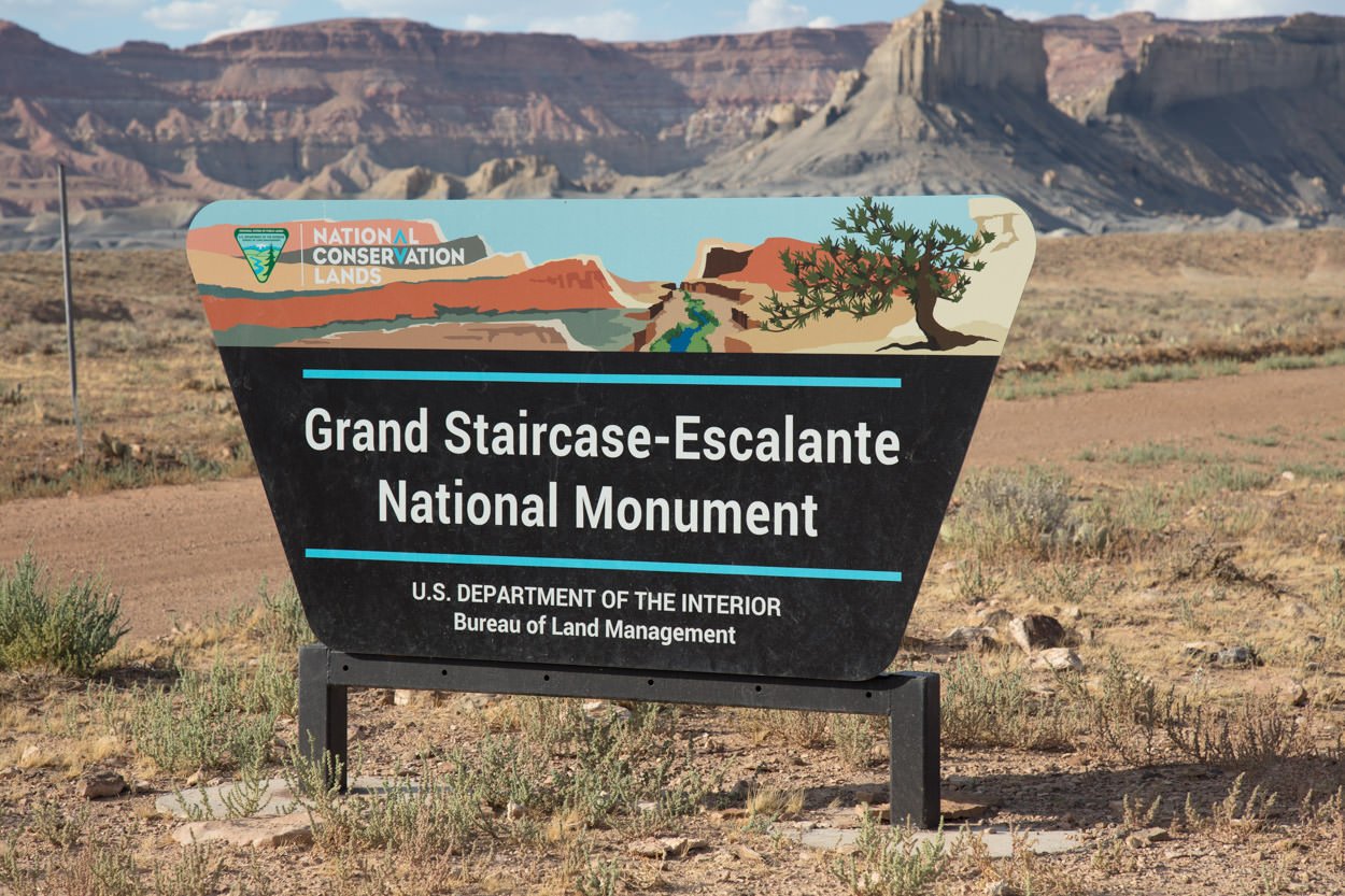
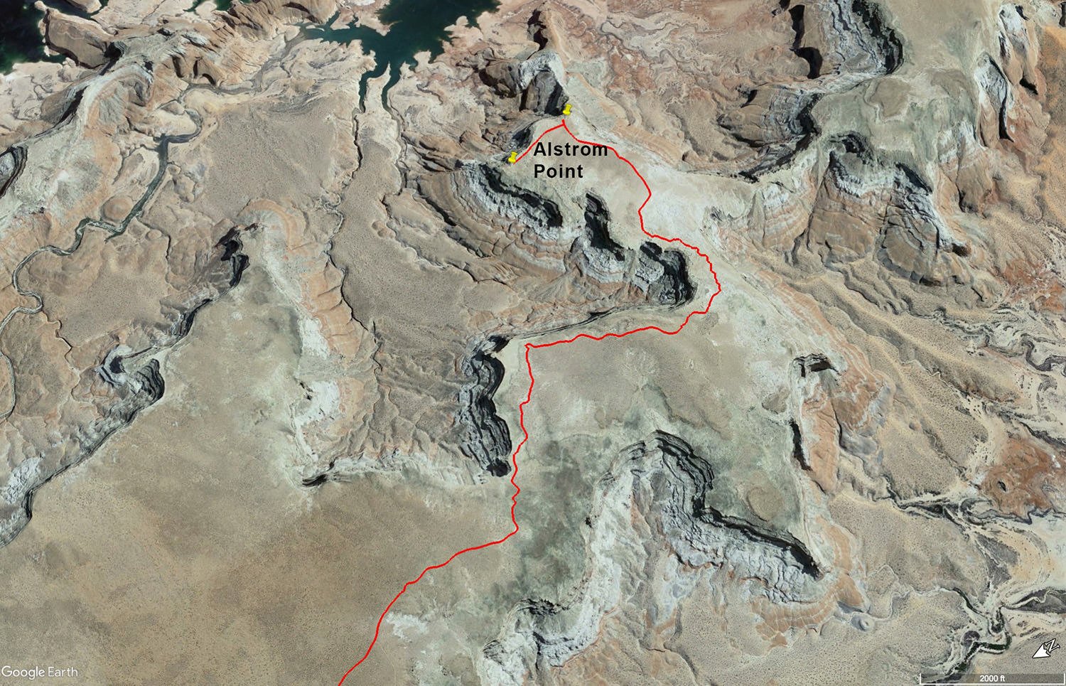
Continue on the dirt/gravel road for another 3.7 miles (at MILE 12.5) you will come to the intersection with Smoky Mountain Road and TURN RIGHT (after the turn, on the left about a 1/4 mile down the dirt road you will see a small homestead).
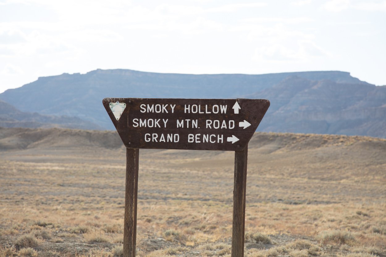
Continue for 1 mile (at MILE 13.5) you will come to a split. TURN RIGHT onto Recreation Road 230/340.
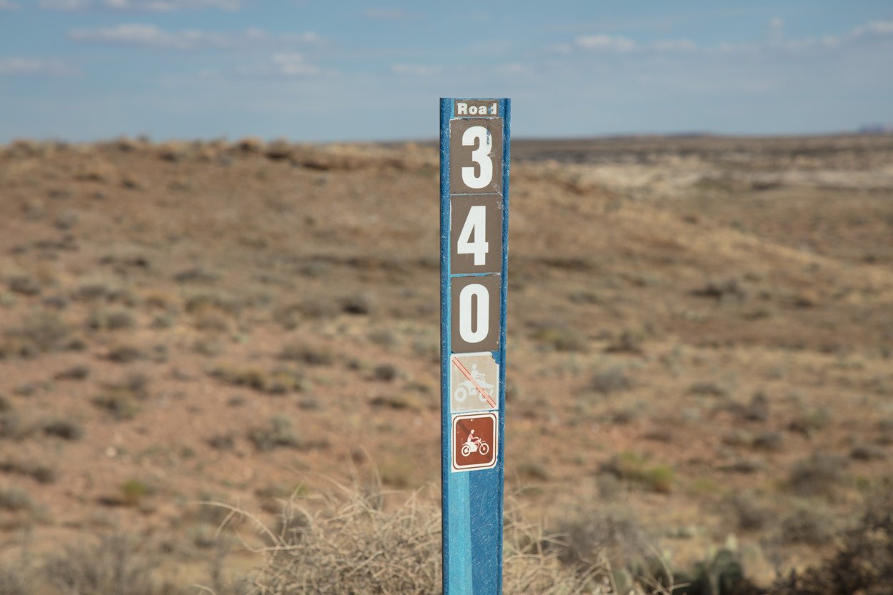
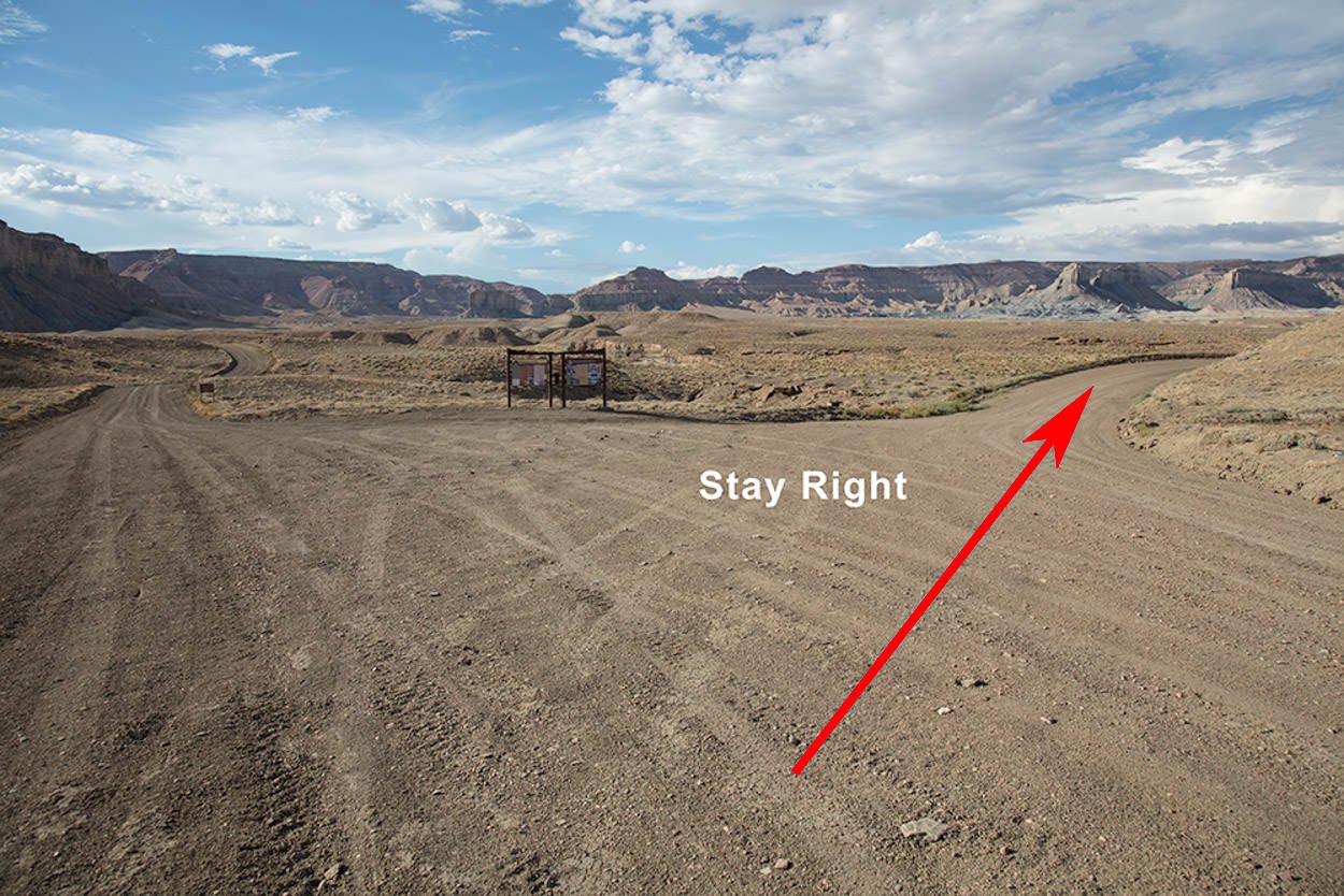
Take Recreation Road 230/340 4.2 miles (at MILE 17.6) to the intersection with Road #264 and TURN RIGHT – drive for 4.5 miles to the first Lake Powell overlook. If you do not have a high clearance 4-wheel drive – this should be as far as you go.
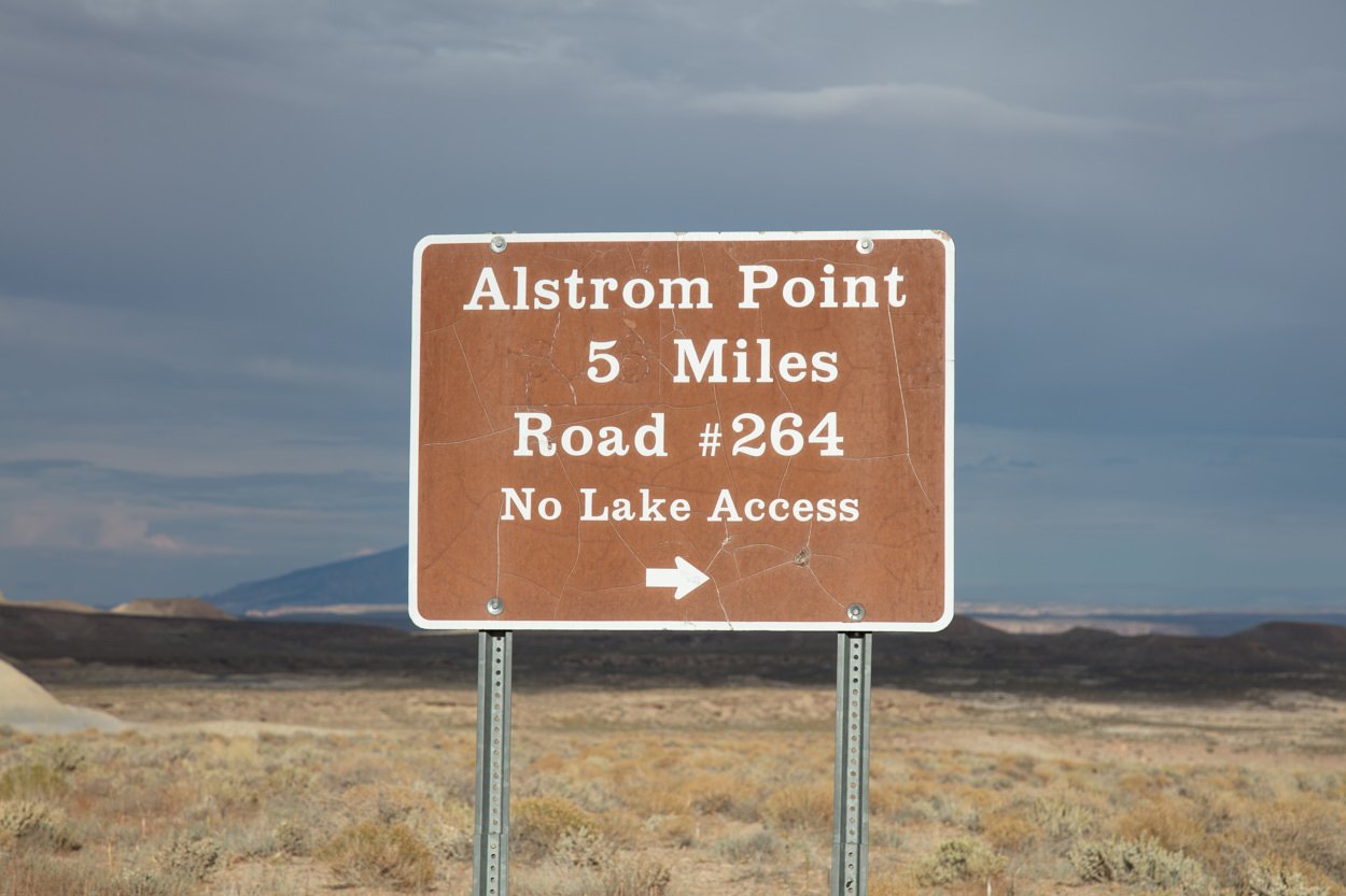
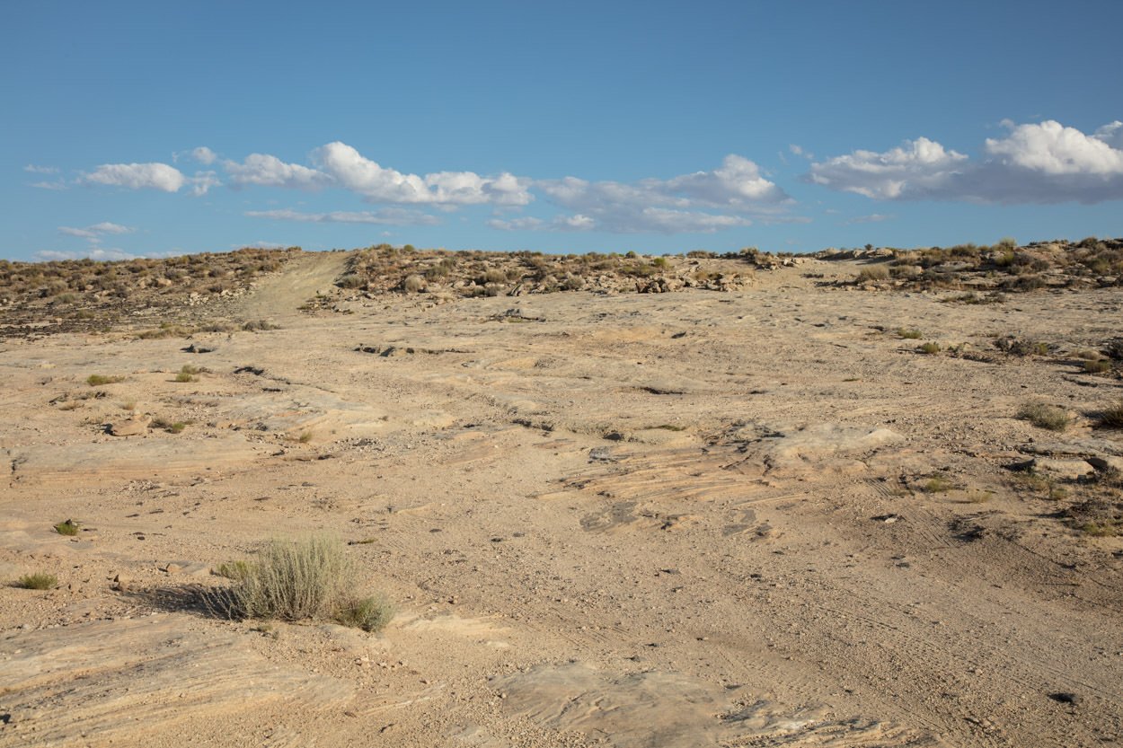
From this point, the road becomes high clearance 4-wheel drive travel only. The rest of the way to Alstrom Point (2 miles) is unmarked and travels over slickrock for a portion of the time. At times, the road is hard to follow with periodic cairns rocks over the slickrock. Once past the slickrock, you can pick up the gravel road the rest of the way to Alstrom Point. THIS ROAD IS NOT FOR EVERYONE AND SHOULD ONLY BE DRIVEN WITH HIGH CLEARANCE 4-WHEEL DRIVE. The trip to Alstrom Point takes about 1 1/2 to 2 hours from Page.
It is very important to know that during the monsoon season (in late summer) this area is subject to violent but brief thunderstorms. If you are at Alstrom Point during or after a serious rainstorm, don’t attempt to travel back until the roads dry out. There are several creeks and washes along the route back that will most likely be impassable. Additionally, there are several places on the route back where you will be encountering what is called “Blue Clay”. YOU DO NOT WANT TO DRIVE THROUGH “BLUE CLAY” WHEN IT IS WET. The clay will get in your tires, wheels, brakes, suspension, and underbelly of your vehicle. When the clay dries, it is like cement and you will spend hours and hours and dollars and dollars removing it.
Google Earth
EXIF Data
Focal Length – 40mm - 3 stitch pano
Exposure – 200th sec @ f 8.0
ISO – 100
Date – Feb 8th
Time – 5:31pm
Best Time of Day to Shoot
The best times to shoot Alstrom Point are at sunset or sunrise. If you are able, shot sunset and stay over and shot sunrise.
For a sunset shot, it is worth noting that there is a mountain in the western horizon and the red glow of the sun is gone several minutes before the stated sunset time.
Best Time of Year
If you can get to Alstrom Point, any time of the year is good to visit and photograph. However, I like to go during the late summer months as you normally get clouds which make for a better photograph.
The above image was taken on Feb 8th
Lens(es) Needed
For most photographers, this is a wide-angle vista, so bring a wide-angle lens or do a pano.
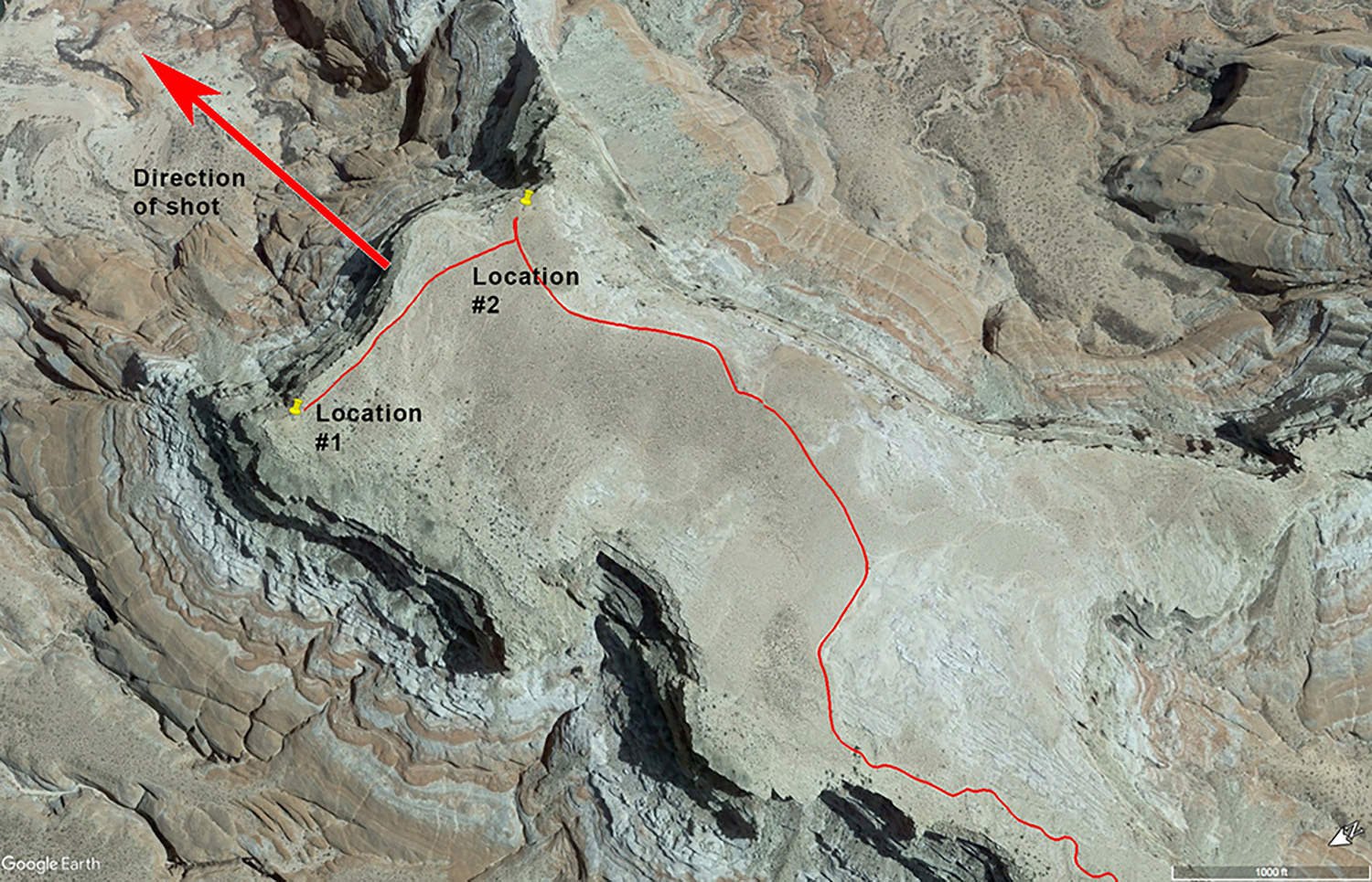
Birds-Eye View From Google Earth Pro
Permits
At the time of the writing (June 2023), there are no permits required.
Direction of the Shot
The shot is east around @ 90°
Equipment Needed
Other than a tripod, there is no special photography equipment needed unless you plan on doing a panoramic shot. You may also want to consider using a tilt/shift lens if you have one to compensate for the slight keystone effect while pointing down toward the lake.
Number of Other Photographers to Expect
This spot is VERY difficult to get to so you most likely won’t have to worry about large crowds. However, I have been to Alstrom Point 5-6 times and I always see other people (campers or photographers) there.
Weather
Alstom Point is in a high desert climate where temperatures can change up to 50° a day. Spring and fall are wonderful, but summer can get into the 100s. If you are out hiking/camping, it is important to know that the temperatures can drop dramatically after the sun goes down.
It is very important to know that during monsoon season (in late summer) this area is subject to violent but brief thunderstorms, which often cause flash floods. On the drive to Alstrom Point, you cross over Wahweap Creek which is a major wash (areas where waters go during a flash flood) that feeds into Lake Powell. Always be aware of the potential rain in the area before driving to Alstrom Point.
Cell Service
I have Verizon and surprisingly you will have cell service most of the way to Alstrom Point and have pretty good coverage once you arrive.
Lodging & Camping
The closest town to Alstrom Point is Page, AZ which is a nice town with plenty of lodging and places to eat. The only campground/RV park in Page is the Page Lake Powell Campground. It is a very nice facility with good Wi-Fi, laundry, and showers.
Camping - click on the campground below for directions
Page Lake Powell Campground - Page, AZ
Nearby Restaurants
I really enjoy the town of Page, AZ. It is a nice place with friendly people along with some good restaurants and watering holes. My two favorite places to eat and relax after a long day in the canyons are the Dam Bar & Grille or El Tapatio. The Dam Bar & Grille has a good menu, tasty food, cold brew, and a fun sports bar. El Tapatio is a nice family restaurant with excellent Mexican food and LARGE margaritas. For lunch, the Birdhouse has a nice selection of fresh chicken, wings, sandwiches, and salads.
Nearby Restaurants - click on the restaurant below for yelp review
Dam Bar & Grille
(928) 645-2161
644 N Navajo Dr, Page, AZ
El Tapatio
(928) 645-4055
25 Lake Powell Blvd, Page, AZ
Birdhouse
(928) 645-4087
707 N Navajo Dr, Page, AZ
Area Guides and Workshops
None
Other Resources
Alstrom Point - The best overlook on Lake Powell - this is a GREAT resource for your trip to Alstrom Point. Make sure you watch the video on the flash floods and the road to Alstrom Point.