
Sparks Lake
Sparks Lake
Central Oregon
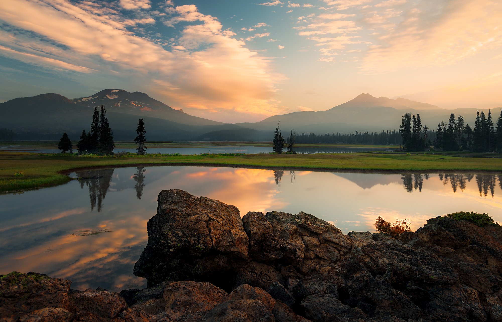
Oregon, with its hundreds of stunning waterfalls and pristine lakes, is a paradise for outdoor enthusiasts and photographers alike. One of my favorite locations to visit and photograph is Sparks Lake, situated in the central Cascade Range. Standing here at sunrise can be truly magical.
Typically, it's just you and a few ducks witnessing the dawn of a new day, with the calm waters reflecting the sunrise and the distant views of the South Sister and Broken Top mountains. Just be sure not to be late, as the sun waits for no one.
Images and location summary by Tim Wier
Trail Difficulty - EASY
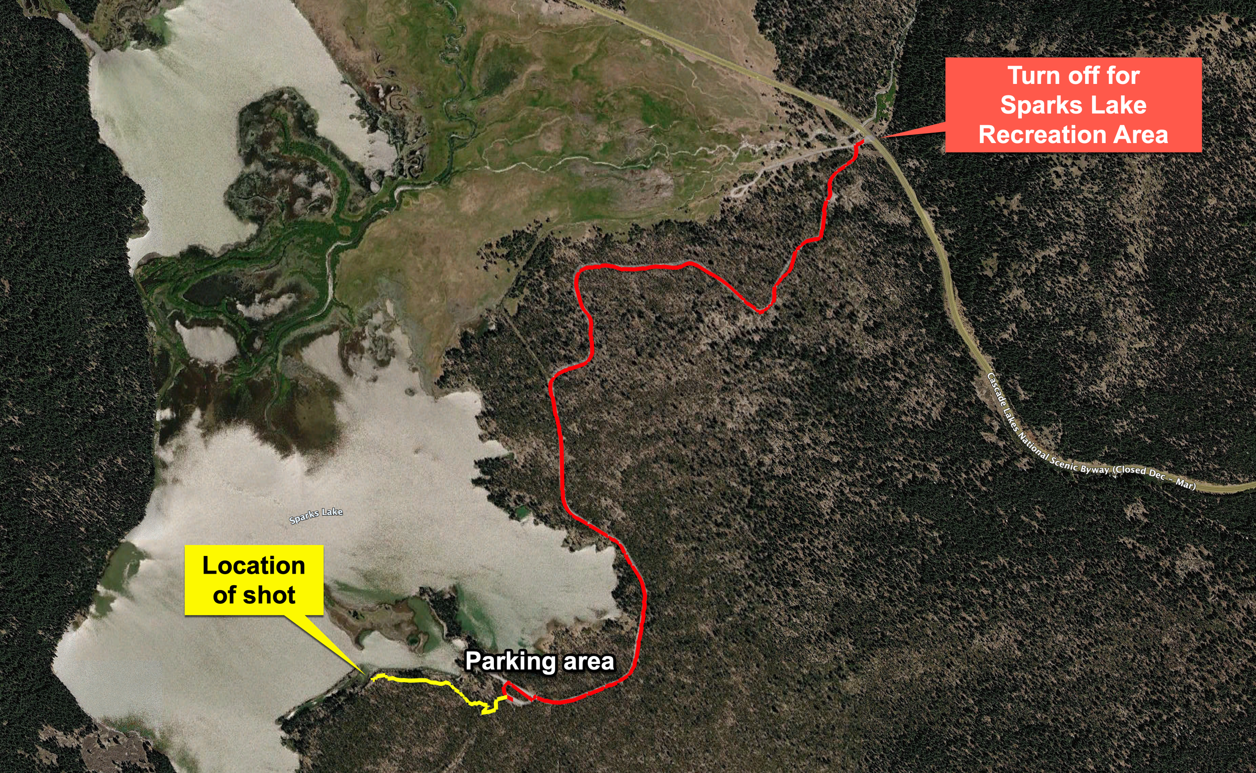
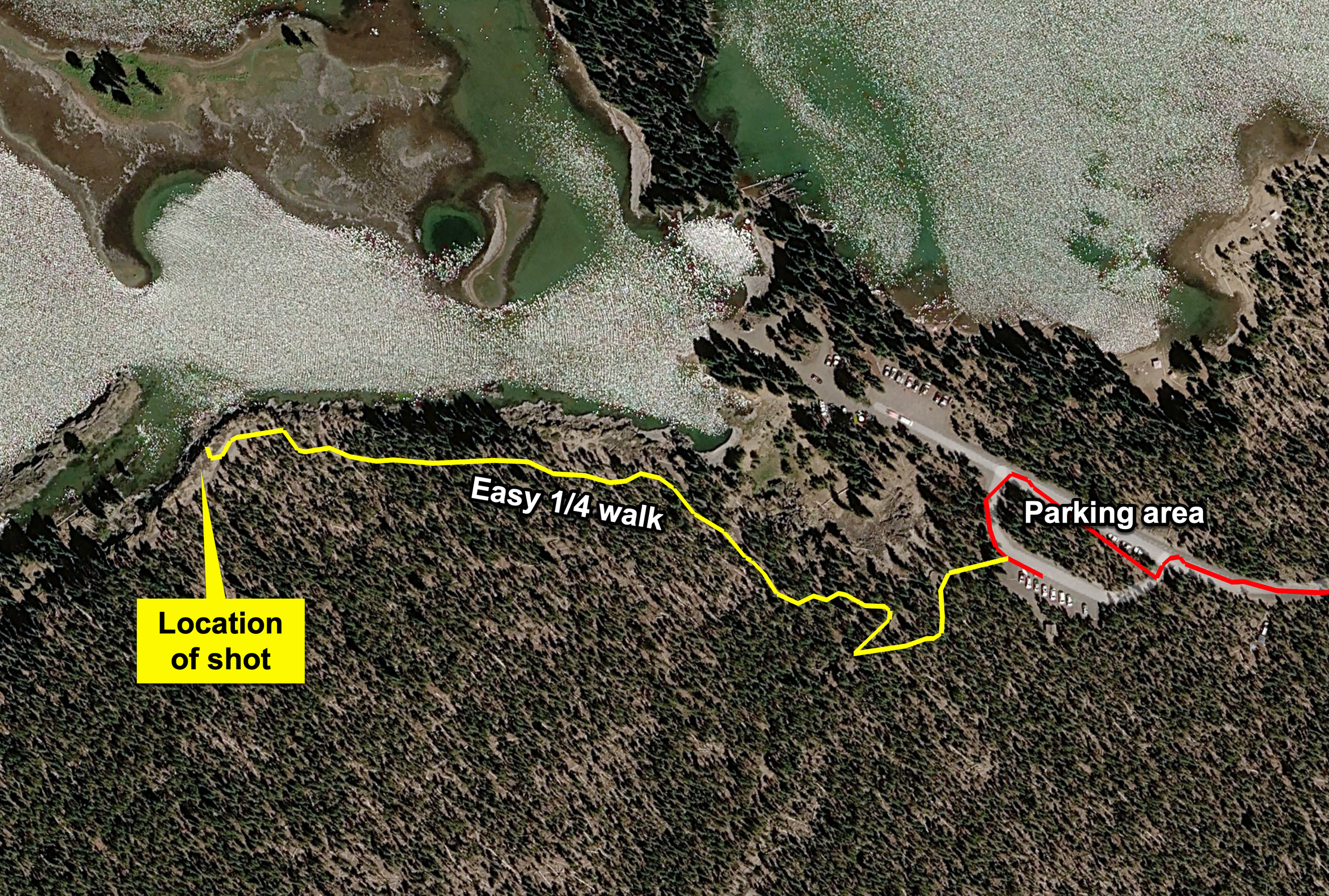
I would rate the difficulty of this trail as a 1 on a scale of 1-5 (with 5 being most difficult). The location of this shot is an easy 1/4 mile walk from the parking area.
GPS Coordinates & Elevation
5,433 ft Elevation
Download KMZ Trail File
Click Here to download the KMZ file for this location.
Photography Tips
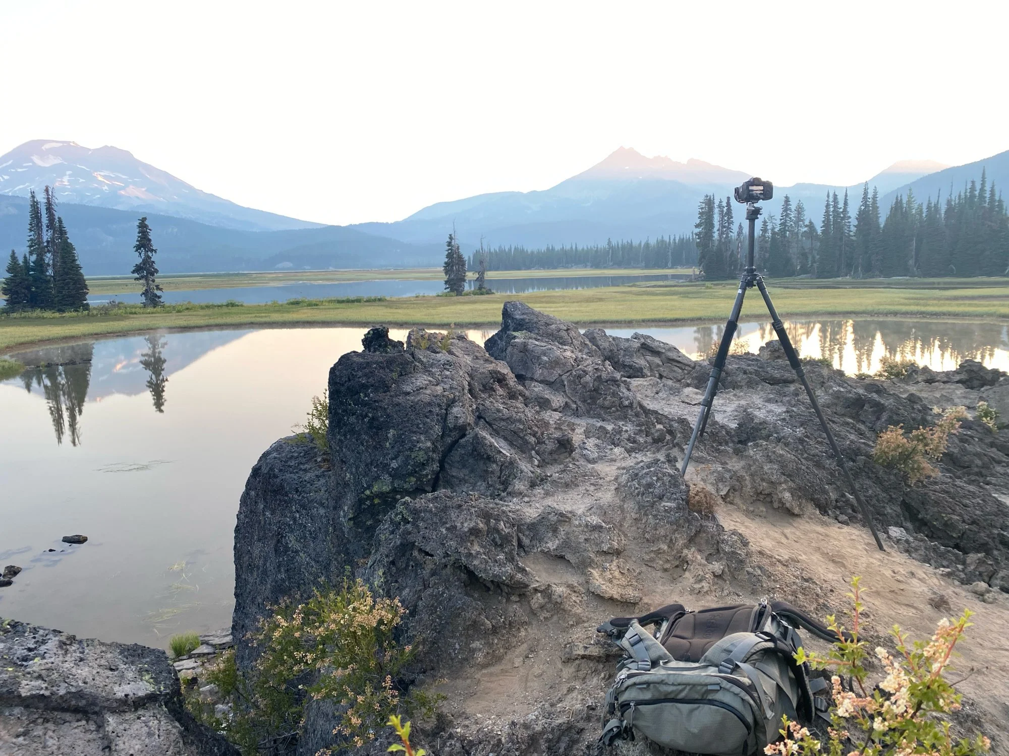
This location offers many excellent views of South Sister, part of the Three Sisters, and Broken Top Mountain, particularly with a stunning early morning reflection. I used the lava rocks in the foreground to enhance the depth of the lake and fill in any empty space. However, there are several vantage points nearby that can also yield great compositions.
The main challenges of photographing this area include the need for a still morning to achieve a mirror-like reflection, as well as suitable cloud cover and the sunrise breaking through to illuminate the scene. Without these elements, you may only have a beautiful location to admire, although you might be fortunate enough to capture some ducks swimming through your shot.
Typically, the sunrise will illuminate the front lava rocks about 15 to 20 minutes after it rises. Therefore, you may need luck with a break in the clouds, or you may have to consider compositing your image to capture the perfect scene.
Directions
CLICK HERE to get driving directions the parking area for Sparks Lake
Starting from Bend, OR, you will drive through a series of roundabouts. Follow the Cascade Lakes Highway (Forest Road 46) for approximately 24 miles until you see a sign for Sparks Lake Recreation Area. Turn left onto Forest Road 4600 to enter the Sparks Lake Recreation Area.
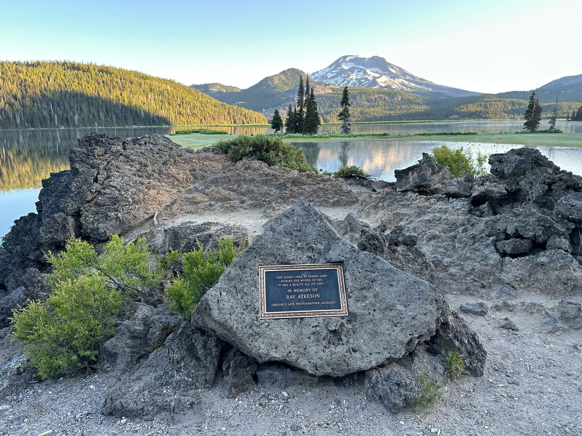
Shortly after turning, take a quick left onto Forest Road 4600-400. If you continue straight, you will arrive at the Soda Creek Campground. Proceed approximately 1.75 miles along this bumpy, potholed dirt road until you reach a small parking area on the left. Park here and take the Ray Atkeson Trailhead, which is about a quarter of a mile from the parking area. You will come to an opening where you will see a sign honoring Ray Atkeson and some lava rocks on the right. The image was taken on these lava rocks.
View In Google earth
EXIF Data
Focal Length – 24 mm
Exposure – 1/10 th sec @ f 8.0
ISO – 100
Date – August 9th
Time – 6:25 AM
Best Time of Day to Shoot
This location is best taken at sunrise.
Best Time of Year
The road to Sparks Lake is usually closed from November to May. If you photograph this location in late fall or early summer, you will have a better chance of capturing snow on the mountains.
Lens(es) Needed
The image above was taken at 24 mm.
Birds-Eye View
Permits
A day-use pass is required to park at Sparks Lake (May–September), costing $5 per day or $30 for an annual Northwest Forest Pass. Passes can be purchased at the site, from Forest Service offices, or from authorized vendors. The area offers boat launches, hiking trails, and is located about 25-50 minutes from Bend.
Direction of the Shot
The shot is taken facing north about 7°.
Equipment Needed
It would be best to have a sturdy tripod in case you need to do an exposure blend or composite your image.
Number of Other Photographers to Expect
Sparks Lake is a very popular location, but at sunrise, you may be the only person at this location.
Weather
Cell Service
I have Version, and had cell service at this location.
Area Guides and Workshops
None