
Pemaquid Point Lighthouse
Pemaquid Point, ME
PEMAQUID POINT LIGHTHOUSE
A BRIEF SUMMARY OF PEMAQUID POINT LIGHTHOUSE
Pemaquid Point Lighthouse is a popular spot on Maine's midcoast for photographers, with the lighthouse set atop a rocky shoreline overlooking Muscongus Bay to the east and the Atlantic Ocean to the south. The brick tower was built in 1835, replacing the original tower, while the keeper's house was built in 1857. This location is unique for photographers in that you can photograph a full 360º around the lighthouse, making it an excellent location for both sunrise and sunset. While it is a popular spot for photographers, because of the many angles available, there is always plenty of room to work.
The lighthouse is perched 79 feet above sea level on a sloping, rocky promontory that marks the western entrance to Muscongus Bay. Because of its height above the water and being set back on the top of the promontory, it is difficult to get crashing waves in photographs, but the dramatic rock and multitude of available angles to photograph from make this a must-see on Maine's coast.
Photos and location summary by Rick Berk

Annual Subscription
Lifetime Membership
DATA POINTS INCLUDED WITH PEMAQUID POINT LIGHTHOUSE SUMMARY
There are a variety of areas to photograph in the park, ranging from very easy to moderate, depending on where you choose to photograph from. On a scale of 1-5, with 5 being hardest, the rocks would be a 2.5, depending on which area of the park you want to work in. The upper area of the park is flat ground with grassy areas while venturing down on the rocks makes things a bit more difficult.
The area near the parking lot, on the same level as the lighthouse, is very easy as it is mostly level, grass-covered ground. From here, you can work three sides of the lighthouse overlooking Muscongus Bay.
There are several paths leading down the rocky slope toward the water. In this area, the trail becomes more moderate. There are no steep drops but a lot of uneven footing where an ankle could be twisted. If you approach the waterline, be aware that rocks may be slick, and footing will be less sure. You should also be aware of the crashing waves. It's easy to be lulled into complacency, but it's best to stay well away from where the waves are crashing.
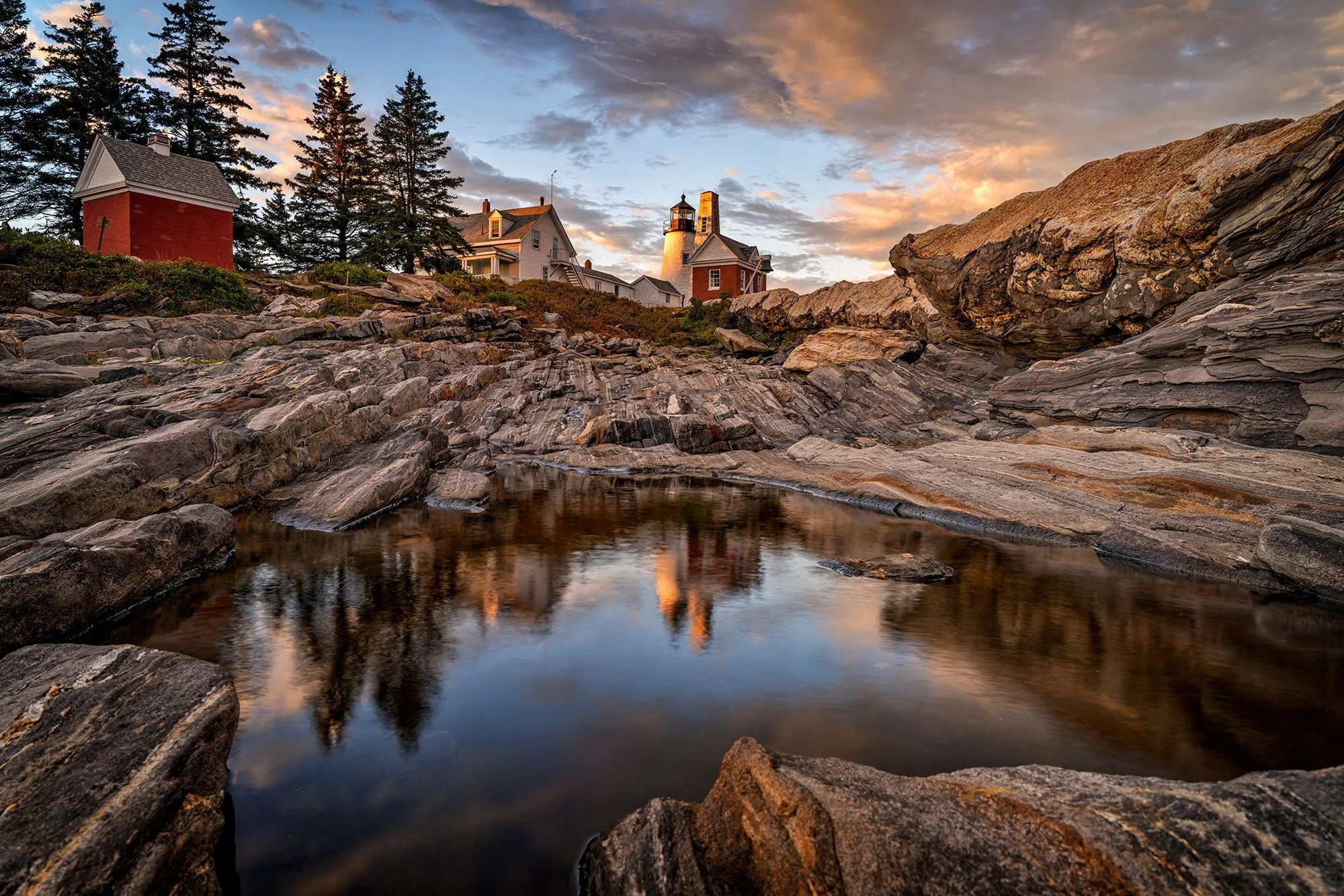
For the image below (photo of the lighthouse reflected in the puddle) you'll want to head down the rocky slope to the west side of the lighthouse. There is one very prominent puddle that makes an excellent foreground. Get very low to the ground, watching for the best position of the reflection. On calmer days, it can appear mirror-like, while on windier days, it may be more blurred. On windy days, a longer shutter speed will help eliminate the ripples.
I find wide-angle lenses to be most useful at Pemaquid Point. Standard length lenses up to 100mm can also be useful.
Several puddles on the rocky slope make excellent reflection elements in photos, and the metamorphic rock's strata also make interesting foregrounds. On the grassy areas, several rocky areas can also be used for foregrounds. During the spring, summer, and early fall, gardens near the parking area add colorful elements to images.
The image above was taken with a 24mm lens
Sea Level Ft. Elevation
Other Resources Available with Membership
Detailed Directions
Best Time of Day to Shoot
Best Time of Year to Shoot
Equipment Needed
Required Permits
KMZ Trail File
Direction of Shot
Google Maps Birds-Eye-View
Number of Photographers to Expect
Cell Service
Current Weather
Lodging & Camping
Area Guides and Workshops
Other Resources
LOCATION SUMMARIES WRITTEN BY PROFESSIONAL PHOTOGRAPHERS


