
Cape Porpoise Fish House
Near Kennebunkport, ME
CAPE PORPOISE REFLECTIO
A BRIEF SUMMARY OF CAPE PORPOISE REFLECTION
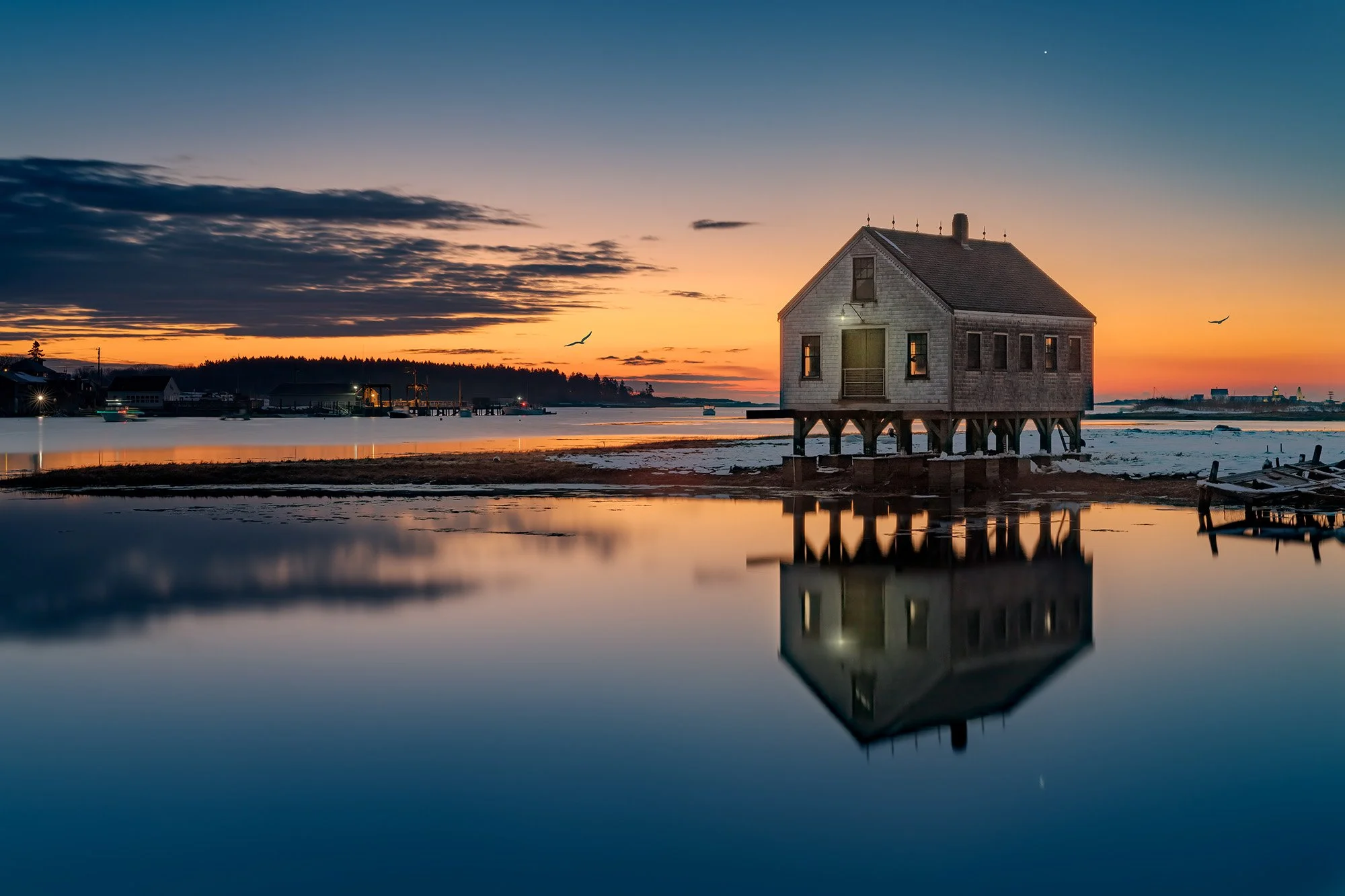
The Cape Porpoise Fish House is a bit of an oddity along the Maine coast. Located in the fishing hamlet of Cape Porpoise, part of Kennebunkport, the current shack was built in 2016, replacing a similar fish house that had stood on the site for decades and collapsed in the early 1990s during a storm.
Since the newer incarnation was erected, it's become a popular location for photographers. So what is it? Much like its original iteration was used as a fish shack by local fishermen bringing in their catch, it is still used today as a workshop for lobstermen working on traps and gear, but also as a place to relax at the end of the day. It stands on the muddy ground near the entrance to Cape Porpoise Harbor, with the municipal pier across the water and the local lobster fleet. While the building is relatively new, it harkens back to simpler times and perfectly captures the feeling of Maine's lobstering roots.
Photos and location summary by Rick Berk

Annual Subscription
Lifetime Membership
DATA POINTS INCLUDED WITH CAPE PORPOISE REFLECTION SUMMARY
The trail is an easy walk along Langsford Road, with various vantage points along the way. The fish house is in a residential neighborhood with waterfront businesses such as Langsford Road Lobster & Fish. Parking along the road is fine, but remember to respect the community's residents and property. There is a muddy path that will lead you to the fish house and the water's edge for a lower vantage point.
This shot was taken slightly zoomed in from a position on the street between two fish houses. The Cape Porpoise Municipal Pier and Goat Island Lighthouse can be seen in the distance.
Zooms such as a 24-70mm are perfect here, as you may want to zoom in to isolate the fish house from a more distant vantage point, but also be wide enough to include surroundings.
The above image was taken at a 53mm focal length.
Sea Level Ft. Elevation
Other Resources Available with Membership
Detailed Directions
Best Time of Day to Shoot
Best Time of Year to Shoot
Equipment Needed
Required Permits
KMZ Trail File
Direction of Shot
Google Maps Birds-Eye-View
Number of Photographers to Expect
Cell Service
Current Weather
Lodging & Camping
Area Guides and Workshops
Other Resources
LOCATION SUMMARIES WRITTEN BY PROFESSIONAL PHOTOGRAPHERS


