
Bennett Bean Bridge
Maine/New Hampshire Border
BENNETT-BEAN BRIDGE
A BRIEF SUMMARY OF BENNETT-BEAN BRIDGE
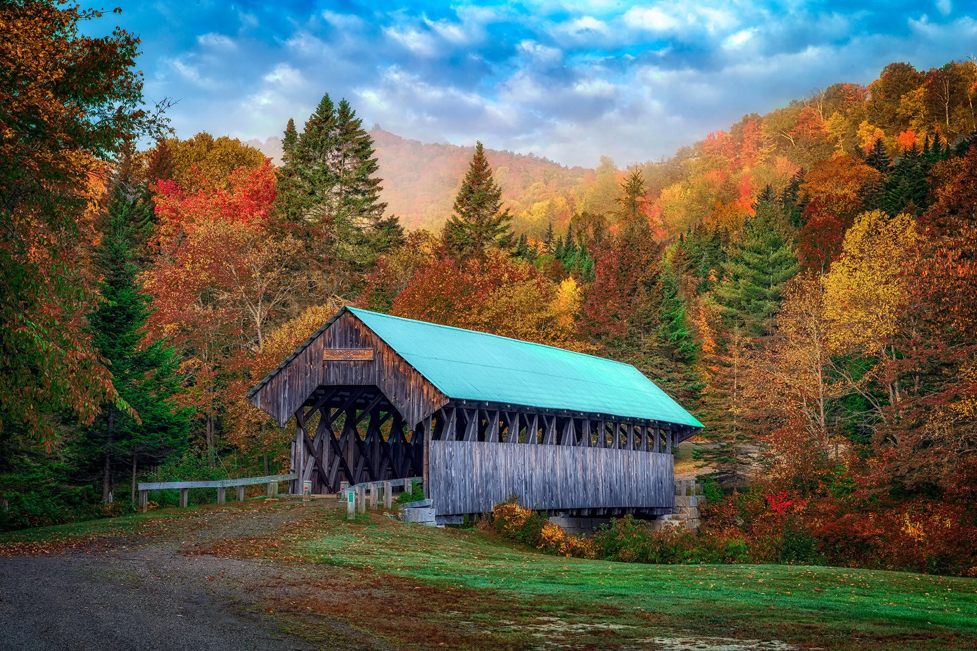
There's nothing so New England as the covered bridges that dot the map around Vermont, New Hampshire, and Maine. One of Maine's older covered bridges, the Bennett Bridge in Errol, Maine is a classic example of a Paddleford Truss design
The bridge was built in 1901 to provide access to Maine Route 16 to a group of small farms in the area. The bridge crosses the Magalloway River at a point where it flows swiftly through a narrow valley. The bridge is 92 feet long and 16 feet 8 inches wide. It was added to the National Register of Historic Places in 1970, and closed to traffic in 1985.
Photos and location summary by Rick Berk

Annual Subscription
Lifetime Membership
DATA POINTS INCLUDED WITH BENNETT-BEAN BRIDGE SUMMARY
The trail is easy. From Maine Route 16, you turn onto Littlehale Road and pull off to the side as you see the bridge come into view. Simply get out of your car and walk around until you find the desired angle.
I walked around quite a bit to find just the angle I was looking for. My first instinct is to go wide, but I found the extended perspective pushed the hills too far back. Using a 24-70mm at 70mm brought the hills closer in to the bridge and emphasized the color. I also used a soft, 2-stop graduated neutral density filter to help control the brightness of the trees, as the bridge itself was still in shadow. This shot was taken around 7am, just after sunrise.
Standard length zoom lenses will work well, such as a 24-70mm. A longer lens used from further away will compress the perspective further and really tuck the bridge in among the trees.
The above shot was taken with a 70mm lens.
1,267 Ft. Elevation
Other Resources Available with Membership
Detailed Directions
Best Time of Day to Shoot
Best Time of Year to Shoot
Equipment Needed
Required Permits
KMZ Trail File
Direction of Shot
Google Maps Birds-Eye-View
Number of Photographers to Expect
Cell Service
Current Weather
Lodging & Camping
Area Guides and Workshops
Other Resources
LOCATION SUMMARIES WRITTEN BY PROFESSIONAL PHOTOGRAPHERS


