
Looking Back
Looking Back
Near Hanksville, UT
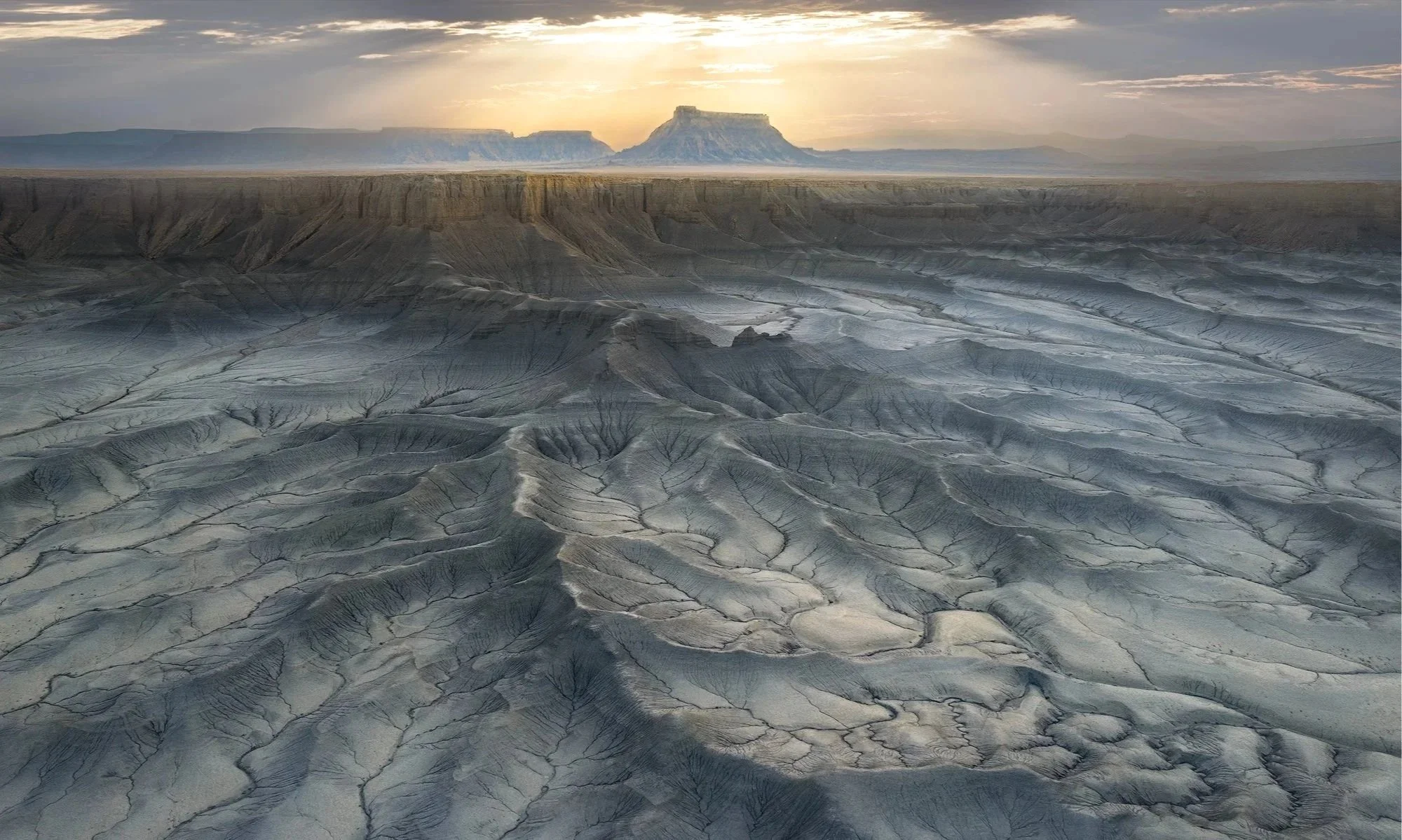
The area surrounding Hanksville features some of Utah's most interesting scenery and unique geographic formations found anywhere in the American Southwest. And the badlands beneath the Moonscape Overlook are a paradise for drone photographers.
During one of my first trips photographing slot canyons, I remember the tour guide continuously reminding us to look all around—up, down, and behind us. Luckily, I remembered this advice and turned the drone around just in time to capture this scene.
Images and location summary by Tim Wier
Trail Difficulty - MODERATE
I would rate the difficulty of this trail as a 2.5 on a scale of 1-5 (with 5 being most difficult). The main road (Coal Mine Rd) is rough in a few spots, and the dirt road that takes you to the Overlook can be a bit bumpy. However, the walk from the parking area to the shot location is an easy 25 yds.
NOTE: The dirt road to this location can be impassable when the ground is wet/muddy.
GPS Coordinates & Elevation
38°27'5.80"N 110°50'16.64"W Launch location
38°27'24.1"N 110°49'40.1"W Location of shot
4,653 Ft. Elevation
Download KMZ Trail File
Click Here to download the KMZ file for this location.
Photography Tips
I usually only photograph with my drone during the time just before sunrise and just after sunset. However, the image above was taken while I was scouting locations for that evening when an unexpected scene unfolded. It's essential to always be ready for the right light.
The areas around Hanksville, particularly the badlands, offer endless opportunities for drone photography. Just explore the area and enjoy the incredible sights it has to offer.
Directions
CLICK HERE to get driving directions to the Moonscape Overlook.
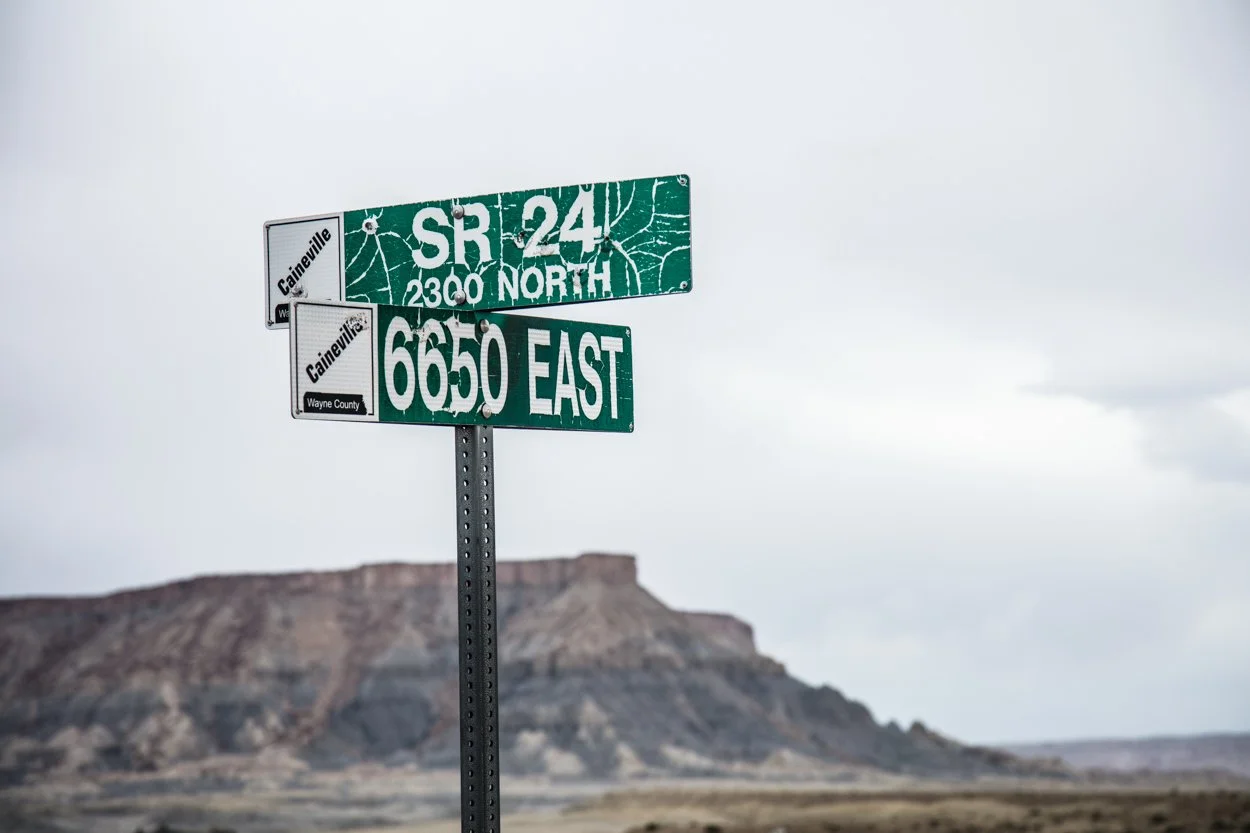
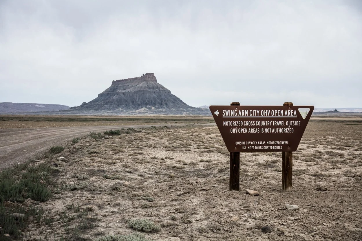
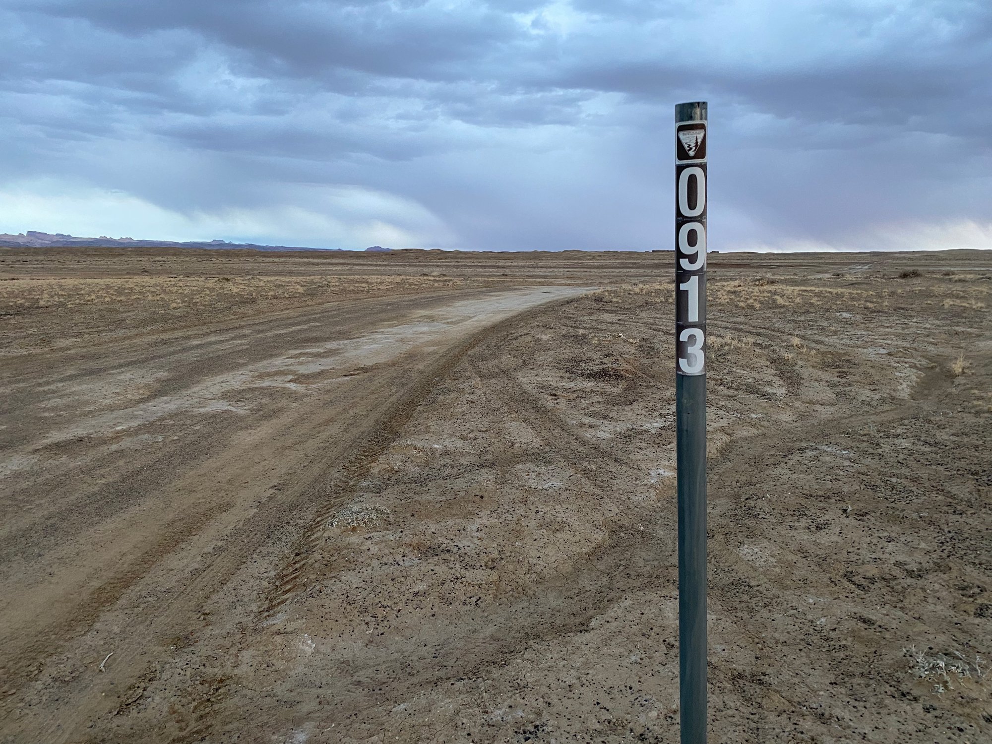
From Hanksville - head west on UT-24 for 10.6 miles until you see a sign for 6650 East (Coal Mine Road). Turn right onto Coal Mine Road and continue for 6.1 miles where you will come to a dirt road labeled BLM 0913 (red line on the map below). Take a right and follow this dirt road east for 2.7 miles until you reach the Overlook of the Badlands. The Overlook is just a short walk from the parking area.
If you plan to shoot sunrise at this location, it’s a good idea to scout it out the day before to find a composition that works for you. Driving to this location for the first time in the middle of the night could be frustrating.
A LITTLE SECRET: There are 3 dirt roads off of Coal Mine Rd that lead toward the Overlook (see the map below). Two of these roads are labeled BLM 0913, and the third is labeled BLM 0931. Most people take the third road (which is marked in red on the map below). I find that the first road (which is marked in yellow) has the least bumps and is the easiest to drive.
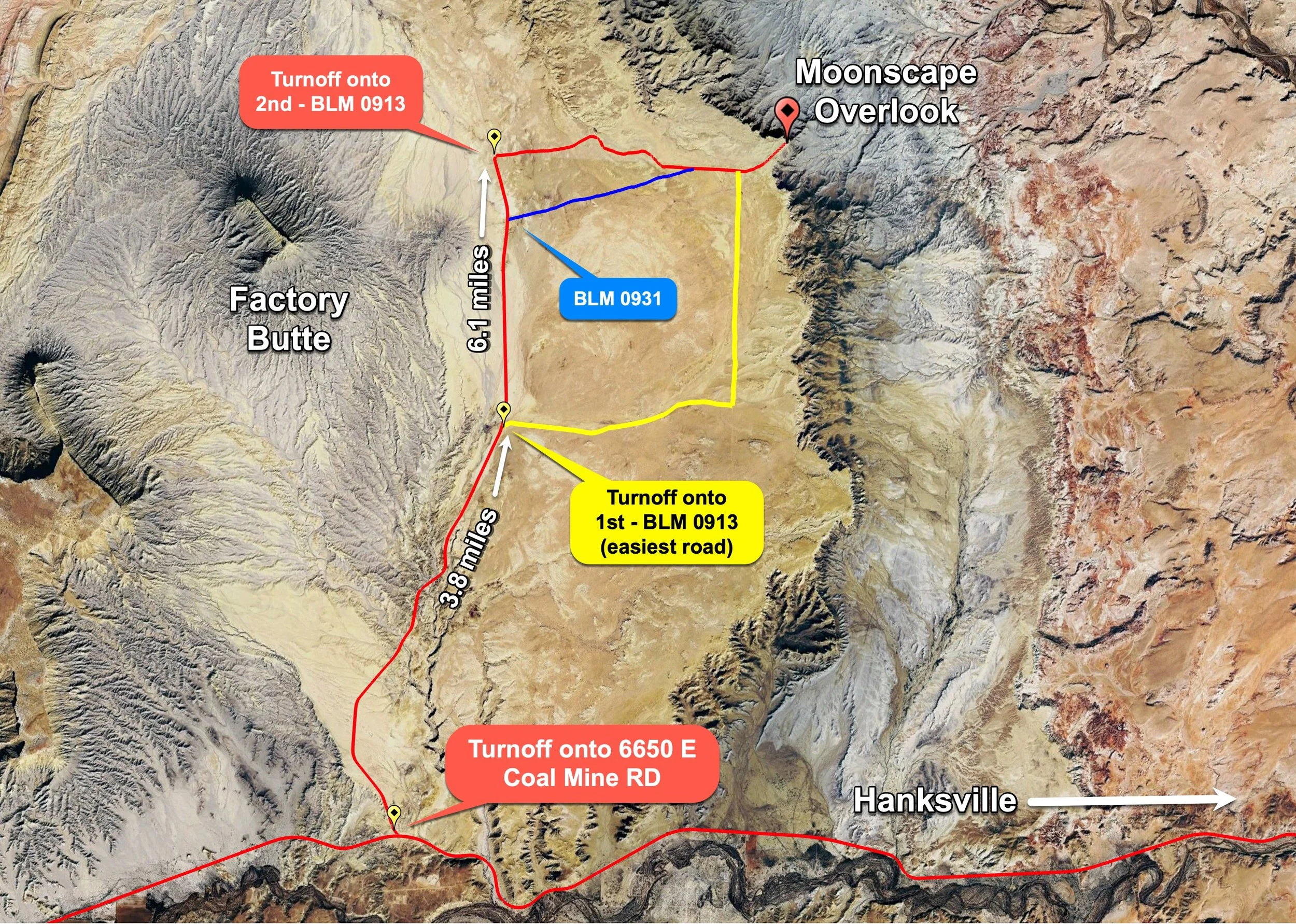
Google Earth

EXIF Data
Focal Length – 24 mm
Exposure – 1/10 sec sec @ f 2.8
ISO – 100
Date – Sept 20th
Time – 6:32 PM
Best Time of Day to Shoot
The best times to photograph the Factory Butte area with a drone are 15-20 minutes BEFORE sunrise and an hour or so BEFORE SUNSET as the valley floor comes into shadow and the patterns explode.
Best Time of Year
You can photograph the Badlands Overlook with a drone any time of year.
Lens(es) Needed
This shot was taken with the wide-angle 24 mm lens on a Mavic 3 Pro.
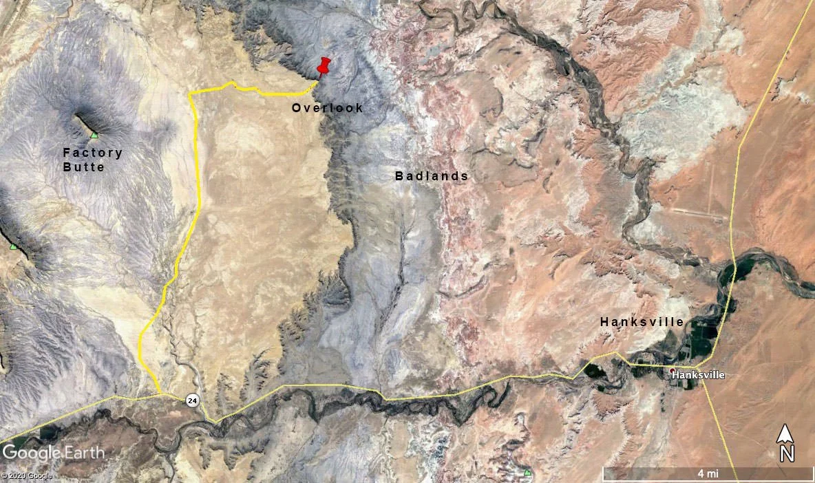
Birds-Eye View From Google Earth Pro
Permits
At this time, no permits are required in the area.
Direction of the Shot
The direction of the shot is west at approximately 270°.
Equipment Needed
A drone with a wide-angle lens.
Number of Other Photographers to Expect
The area surrounding the Moonscape Overlook is a popular destination for tourists, sightseers, photographers, and drone enthusiasts at all times of the day. At sunrise and sunset, it is likely to be crowded.
Weather
The area around Hanksville has a high-desert climate at about 4,800 ft. elevation. Temperatures can vary by up to 30°-40° a day. Spring and fall are nice, but summer can get into the high 100’s.
Cell Service
I have Verizon and the cell service from this location is spotty. A stronger cell signal is available as you approach Hanksville.
Area Guides and Workshops
There are many areas around Hanksville that are wonderful to photograph, but they can only be visited with a high-clearance vehicle. Several outfitters, guides, and tour companies take you to remote places for photography tours or overnight stays.
I have used Melvin Perc at Meridian Tours (954-907-6259) and really enjoy his knowledge of the area and the time he takes to make sure your experience is first-rate (NOTE: I have no relationship with Mel and pay full price when using him for tours).