Factory Butte
FACTORY BUTTE
Near Hanksville, UT
Utah is the most geologically diverse and photographically fertile states in America - with an endless surprise of landscapes, topography, mesa, buttes forest, deserts and vistas. Factory Butte is just such a surprise.
Sandwiched between Capital Reef, Canyonlands and Escalante sets the Factory Butte which is an oddly placed butte in the middle of a lifeless and barren badlands. However, the butte rises about 900ft from the desert floor with mesmerizing ripples and distinctive veins of rock. Under the right lighting conditions can produce many great compositions from this location.
Images and location summary by Tim Wier
Trail Difficulty - MODERATE
I would rate the difficulty of this trail as a 2 on a scale of 1-5 (with 5 being most difficult). The road to this location (Coal Mine Rd) is easy to moderate with a few bumping spots. You can take this image from the the road or the small camping area just east of the road.
GPS Coordinates & Elevation
Google Earth
Download KMZ Trail File
Click Here to download the KMZ file for this location.
Directions
CLICK HERE to get driving directions to Factory Butte.
The closest town is Hanksville, UT which is located in south central part of Utah. The directions are from Hanksville, UT.
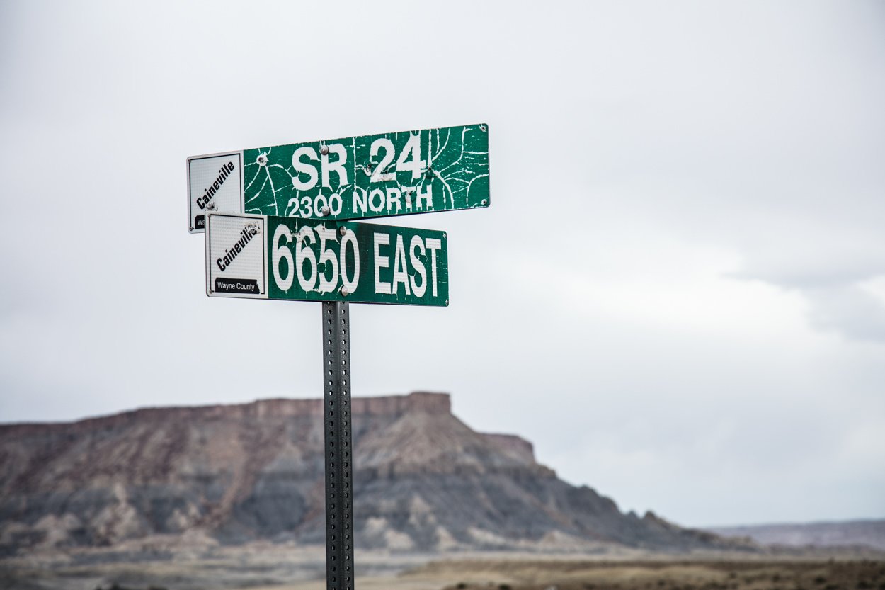
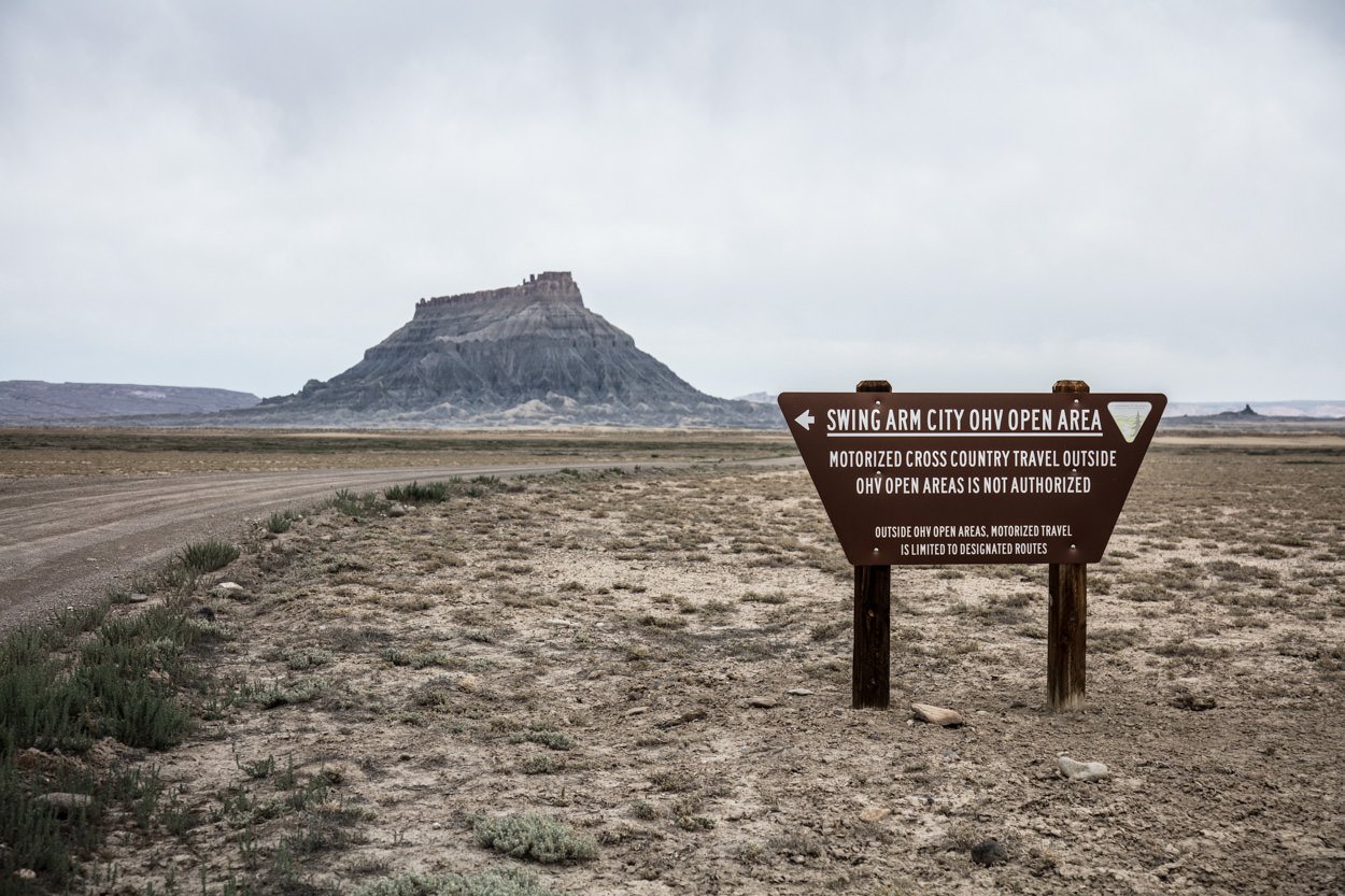
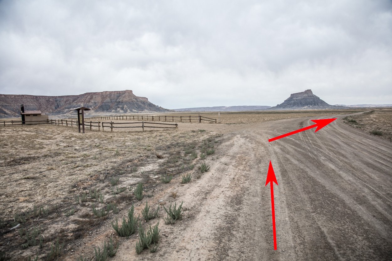
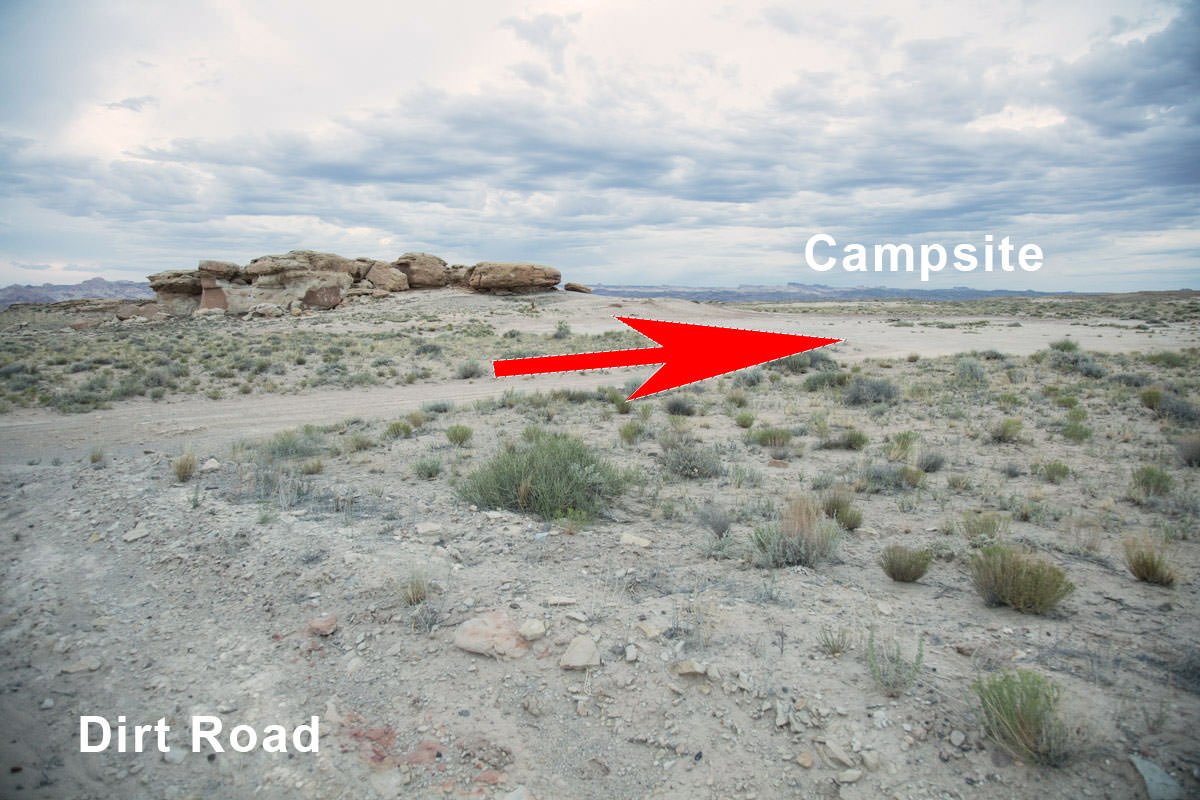
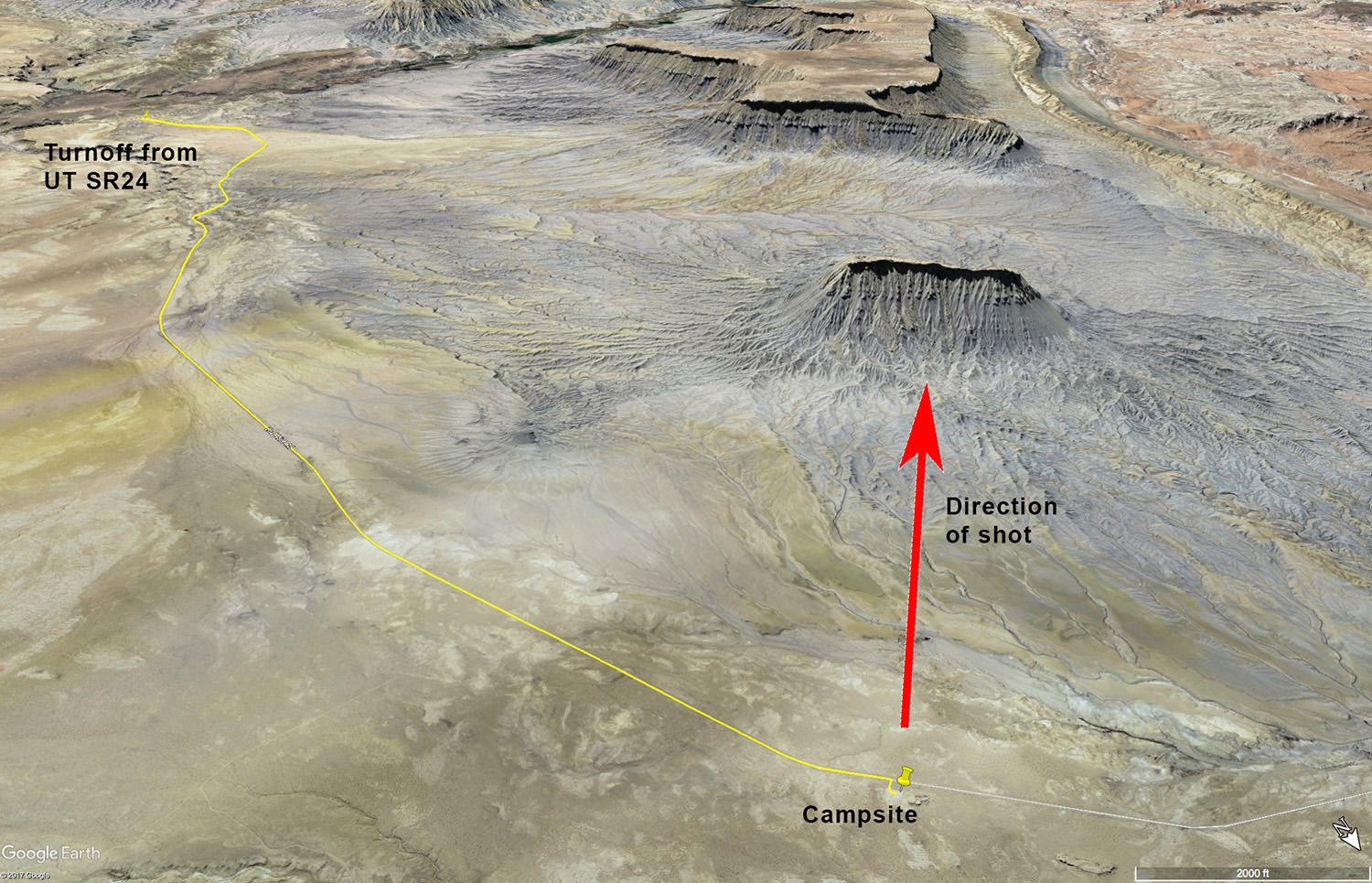
From Hanksville, travel west 10.6 miles on UT-24 until you get to a street sign that says 6650 EAST (this is Coal Mine Rd). Take a right and travel .8 of a mile and you will reach a fork in the road. Stay right at the fork and travel 6.2 miles until you see a small, unmarked parking/camping area next to a rock formation (this is right off of the dirt road that is Coal Mine Rd). The shot above was taken from the parking/camping area about 30 minutes before sunrise.
There are many places to shoot the Factory Butte. My favorite spots are either from the campsite or from an area and is a little further north and a bit closer to the butte. Both will produce a good image. However, they have different angles of the formation (see the two locations on the graphic below). My image above was taken from location #1 (by the campsite) and I believe Alex Noriega’s Funnel Factory image below was taken at or near location #2 (Alt location - 38°27'44.1"N 110°53'43.7"W).
Photography Tips
This is as close to a layup as it get in landscape photography - Easy-pezzy! Arrive before sunrise, set your camera on a sturdy tripod, compose, focus and capture a great shot. Well, maybe not quite that easy. The magic is in the post processing.
For the shot to work, it needs to be taken with indirect light (predawn). The blue color of the butte is what your camera sees before predawn (see raw image below). With correct lighting and careful processing - you can capture a great image from this location.
EXIF Data
Focal Length – 200 mm
Exposure – 16 sec sec @ f 8.0
ISO – 100
Date – Aug 15th
Time – 6:05 am
Best Time of Day to Shoot
Factory Butte is a very unique rock formation with many photographic opportunities. However, the shot above is best at predawn (15 - 30 minutes before sunrise) before any light illuminates the butte Once the sun crest the horizon, the colors/hues of the butte and surrounding areas change substantially.
Best Time of Year
This shot is available all year. However, in the late fall, winter, and early spring as the angle of the sunrise provides better side-light (contrast) for the rock veins. You can still get a good shot in non-winter months - but the sun will rise directly behind you. The chart below shows the sunrise direction for different time of the year.
This shot was taken on Aug 15th.
Lens(es) Needed
There are many ways to shoot the Factory Butte - up closer to the butte with a wide angle lens or back at the road with a longer lens. For me, I prefer a compression shot from the road with a longer lens (135mm to 200mm). The shot above was taken with a 135mm lens and cropped (as this was the longest lens I had on this trip).
Birds-Eye View From Google Earth Pro
Permits
There are no permits required in the area.
Direction of the Shot
The direction of the shot is southwest at 220°.
Equipment Needed
No need for any special photography equipment (other than a tripod).
Number of Other Photographers to Expect
This spot is off of the beaten path for most photographers. However, this location is a trendy spot and at times there will be several other photographers at the location as sunrise / sunset. There is PLENTY of room to handle many of photographers to get this shot.
Weather
The area around Factory Butte is high desert climate at about 5,000 ft. elevation. The temperatures can vary up to 30° - 40° a day. Spring and fall are nice, but summer can get into the high 90s.
Cell Service
I have Verizon and the cell service from this location is spotty. A stronger cell signal is available as you near Hanksville.
Overnight Camping Options
The area around the Factory Butte is badlands, with the closest towns being Hanksville and Caineville, Utah. There is a small camping area just off of the road to this location (not sure if it is sanctioned by BLM or not) with a makeshift fire pit. There are other camping areas and lodgings in both Hanksville and Caineville. There are 2 motels and 2 RV Parks in Hanksville and 1 hotel in Caineville.
Camping - click on the campground below for directions
Duke's Slickrock Campground & RV Park – 275 E Highway 24, Hanksville, UT 84734
Lodging - click on the lodging below for a TripAdvisor review
Muddy Creek Mining Company
(877) 711-3857
280 E 100 N, Hanksville, UT
Whispering Sands Motel
(435) 542-3238
90 South HW 95, UT
Nearby Restaurants
Hanksville is the closest town and there are a few places to eat there. After a morning shoot, I enjoy a good breakfast (biscuits and gravy) at Duke’s Slickrock Grill in Hanksville. They have great food, and nice people run the place. Stan's Burger Shak makes a good hamburger and a hardy shake, and the Outlaw’s Roost makes great tacos.
Nearby Restaurants - click on the restaurant below for yelp review
Duke’s Slickrock Grill
(435) 542-3235
Stan's Burger Shak
(435) 542-3330
Outlaw’s Roost
(435) 542-1763
Area Guides and Workshops
None


