
Dolly Sods Overlook

DOLLY SODS OVERLOOK
Bear Rocks Preserve, Dolly Sods Wilderness, W.Va.
Image by Darron Franta @ www.frantaphotography.com
In the Allegheny Mountains of West Virginia’s Monongahela National Forest, there is a rocky, high-altitude plateau with sweeping vistas and lifeforms normally found much farther north in Canada. Indeed, time stands still high above the Canaan Valley in the unique micro-climate of the Dolly Sods Wilderness Area’s Bear Rocks Preserve.
At 4,123 ft. above sea level this haunting landscape is situated atop the highest plateau east of the Mississippi River. Known locally as "the Sods," this flat, windswept expanse of subalpine heath barrens is characterized by stunted red spruce, ancient sphagnum bogs littered with Huckleberry and Blueberry bushes, and beautiful, forlorn wind-carved boulders.
Photos and location summary by Darron Franta
Trail Difficulty - EASY
I would rate the difficulty of this trail as a 2 on a scale of 1-5 (with 5 being the most difficult). Once you park your car, you will have anywhere from a five to thirty-minute walk, depending upon where you want to set up. Your walk will take you through the heath barrens and berry bushes on well-worn trails that you will need to follow. Due to the narrowness of the trails, I would recommend wearing pants, even in the summer months.
If there has been rain, conditions along trails in the heath barrens and bogs will likely be mushy. Depending on your level of fitness, you can avoid scrambling on top of the large boulders, or you can choose to make your way on top of them. Locations to shoot are everywhere.
GPS Coordinates & Elevation
4,000 Ft. Elevation
Photography Tips
The Bear Rocks Wilderness is a large area and there are numerous locations all along the ridge to shoot from. My advice is to allow yourself time to visit the area the day before you plan to shoot and thoroughly scout the area for compositions that interest you. Compositions can include spruce trees, bushes, rocks, and/or overhangs. If you plan to shoot sunset, make sure you focus on scouting westerly facing compositions (away from the ridge). Pay close attention to the weather forecasts for the area and you should be prepared for dealing with strong wind gusts.
Use The Photographer's Ephemeris for this location. TPE is a very valuable tool for landscape photographers to determine the direction of the sunrise/sunset & moonrise/moonset from any place on earth on any day (past and future).
Directions
CLICK HERE to get driving directions to the parking area for Dolly Sods
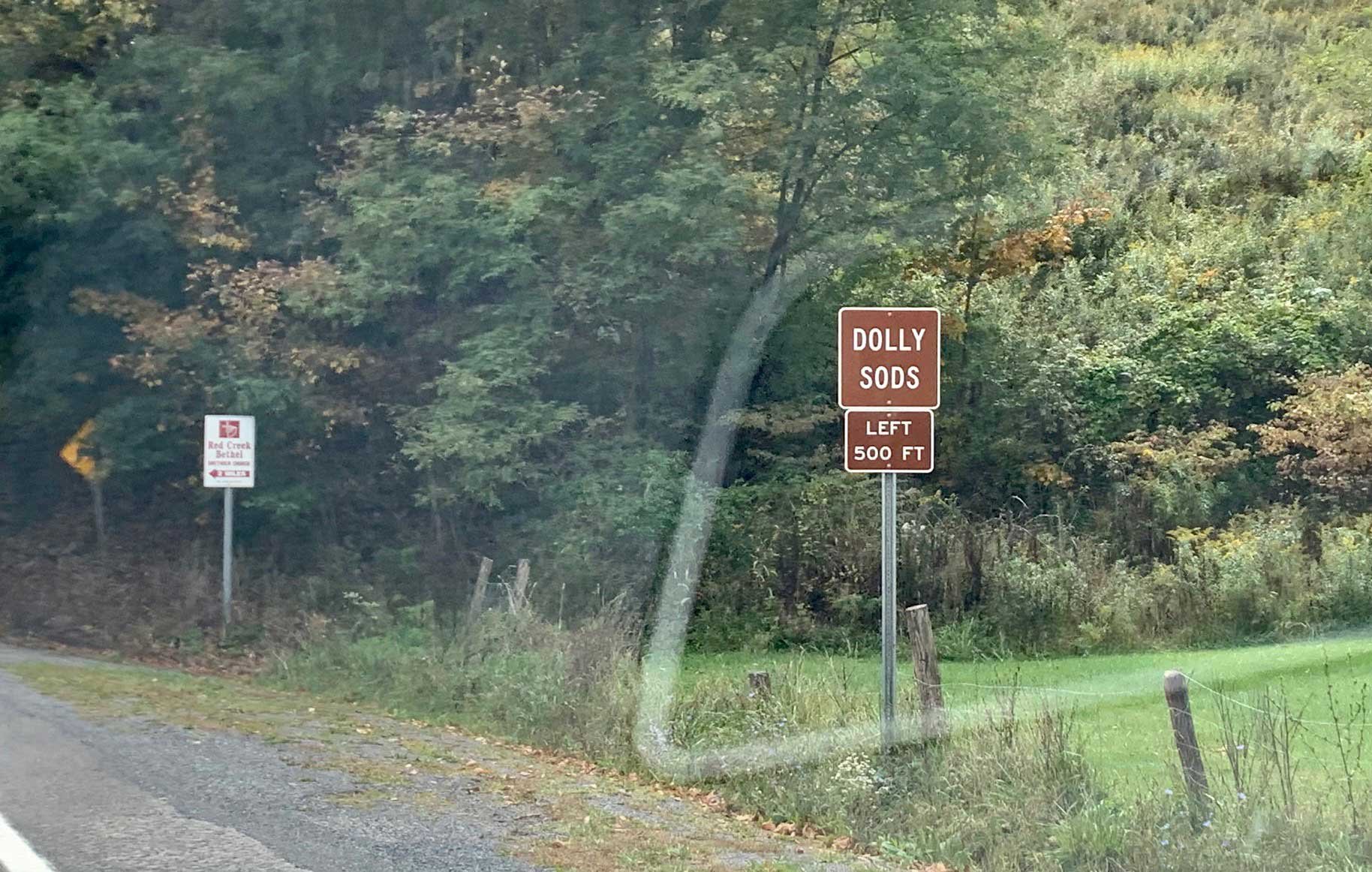
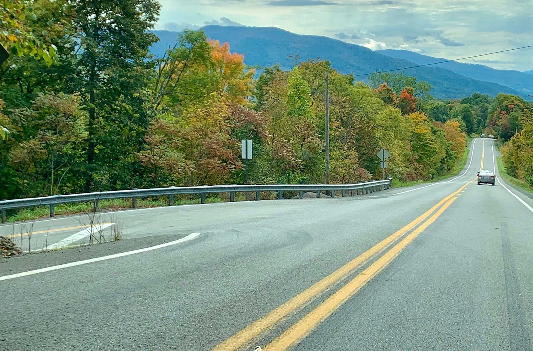
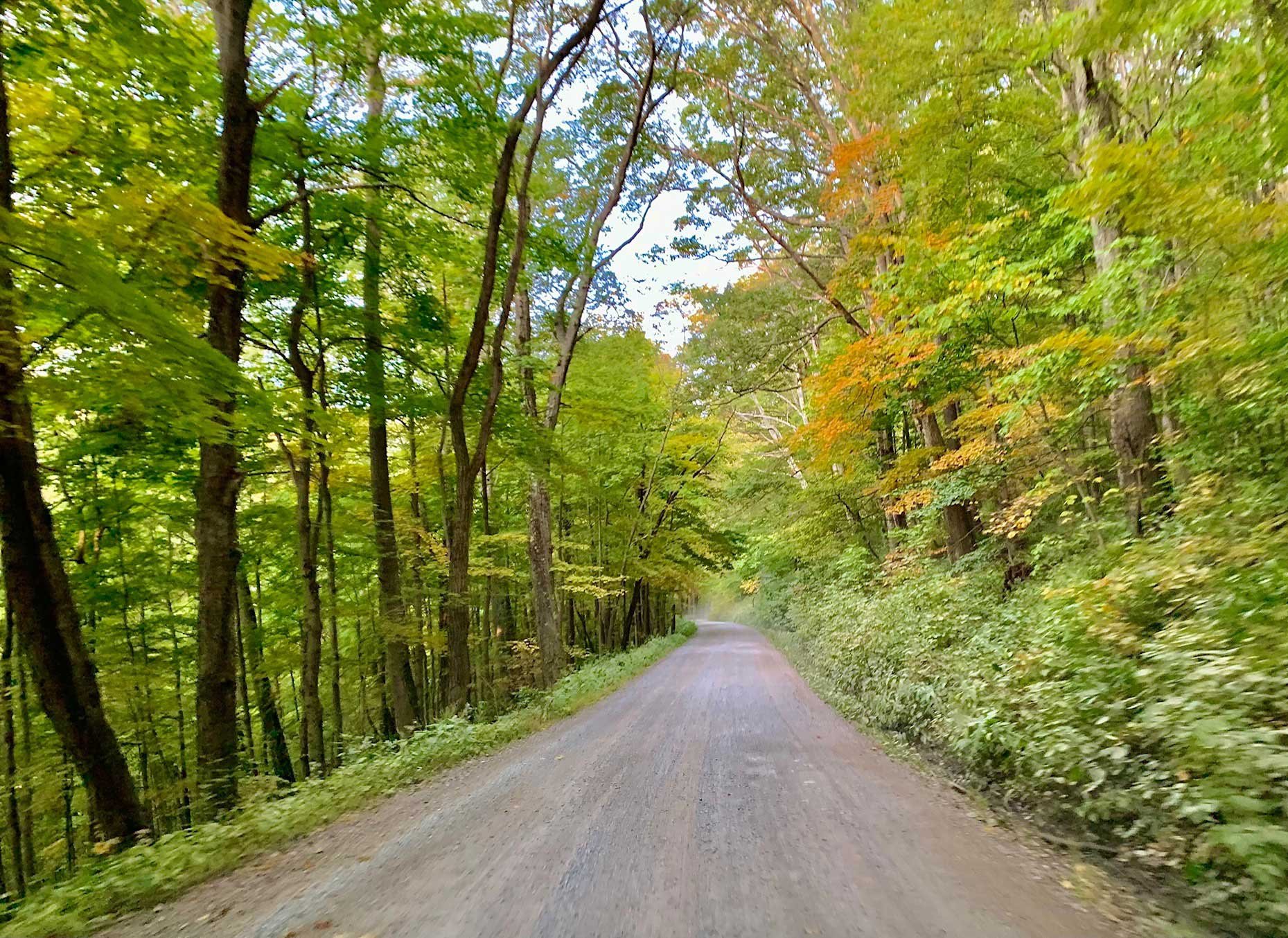
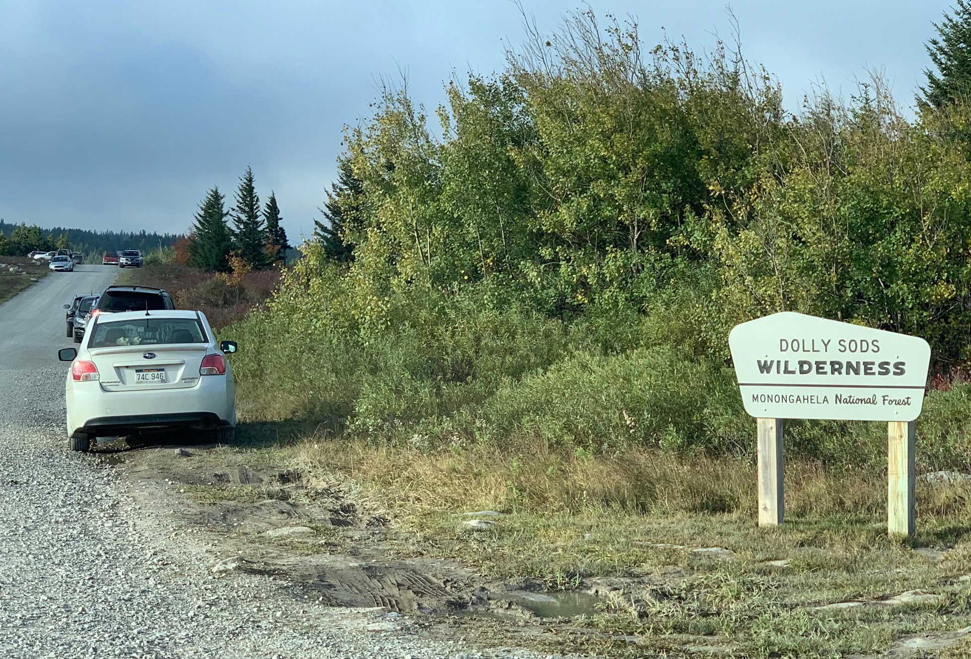
From Davis, W.Va - from where the bridge crosses the Blackwater River in Davis, W. Va., travel 11.1 miles south on Route 32. You will then take a hard, sharp left onto Lanesville Rd. There will be a small brown sign that points to the Dolly Sods Wilderness 500 ft. before the turn. You will stay on this winding road for 5.8 miles until you come to the parking area for the Red Creek Wilderness. At this point, the road passes through an open metal gate and turns to gravel. You will stay on this gravel road (Route 19/75) for 11.1 miles until you come to the Bear Rocks Preserve parking area.
View In Google earth
EXIF Data
Focal Length – 14 mm
Exposure – 60th sec @ f 8.0
ISO – 100
Date – October 4th
Time – sunrise
Best Time of Day to Shoot
This is a great location to spend time exploring and, depending upon the weather, you can shoot at any time of the day. However, this is primarily a sunrise or sunset location. The primary vantage points face east from the exposed ridge, so it naturally provides great sunrise opportunities but there are many compositions to be had shooting west as well.
Best Time of Year
Great photographs can be taken any time of the year, but most believe the best time is in early October when the leaves of the numerous huckleberry and blueberry bushes are bright red and the other foliage in the area has started to take on autumn hues.
The image above was taken on October 4
Lens(es) Needed
This location is primarily an ultra-wide to medium telephoto spot (depending on the composition you are seeking. However, you may want to bring along a longer telephoto lens as well.
The image above was taken with a 14mm lens
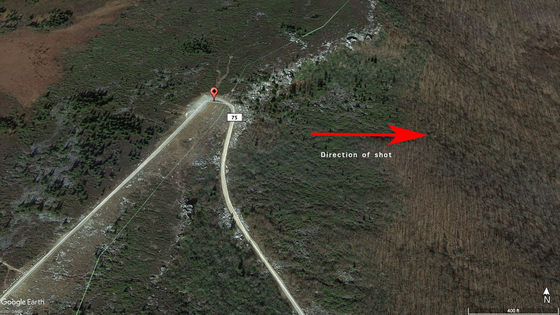
Birds-Eye View
Permits
There are no permits required.
Direction of the Shot
The direction of this shot is almost due east at around 90°.
Equipment Needed
Tripod, Polarizing Filter and/or Graduated Neutral Density Filters
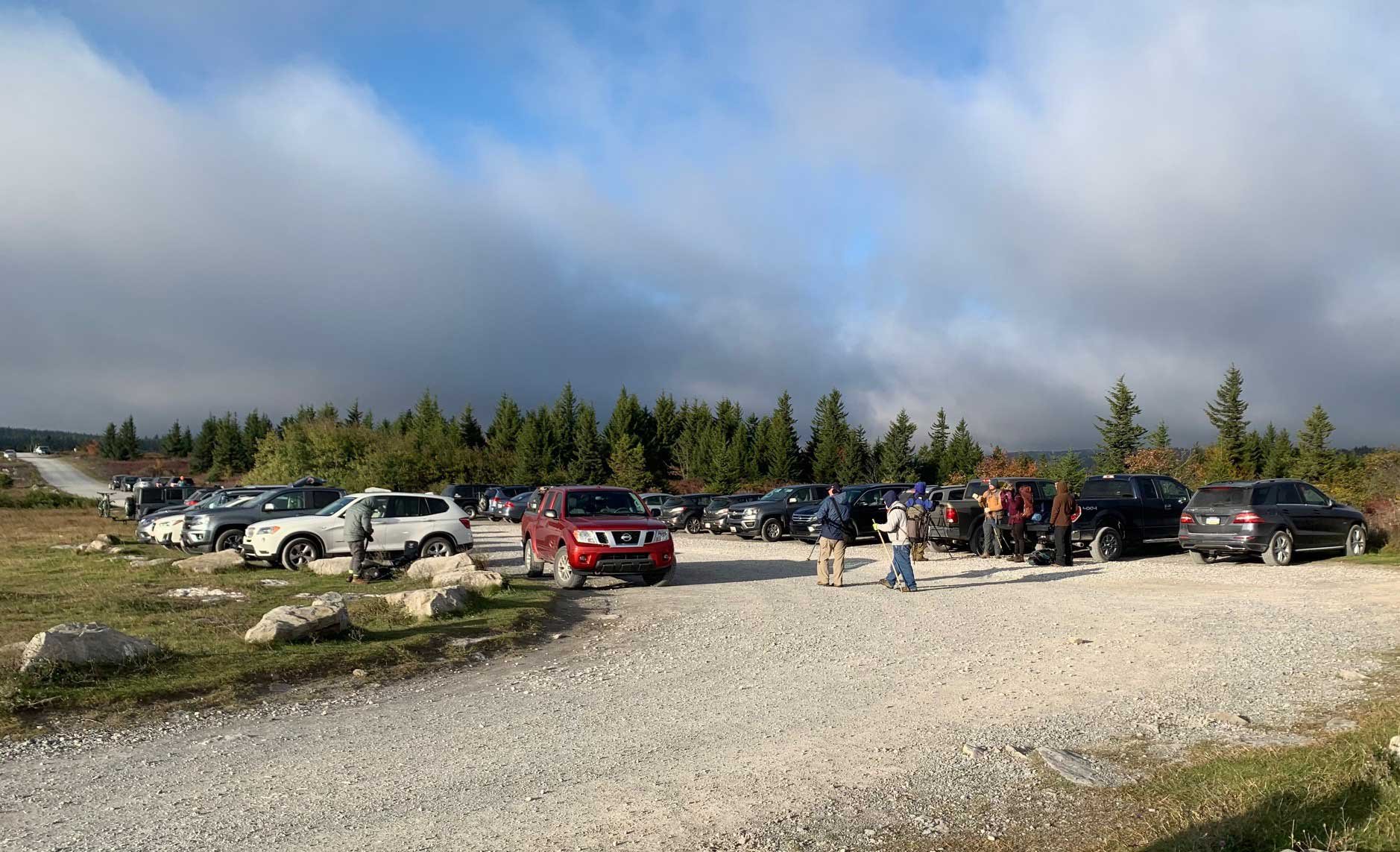
Number of Other Photographers to Expect
In recent years this has become a popular and well-known photography location on the East Coast. Depending upon the day of the week and the time of year, you may be one of only a few photographers or you may be one of several hundred. When I took this photo, which was on a Sunday morning during a peak weekend, there were over a hundred photographers in the area. Maybe double that?
Several workshop classes were being held the morning of this shot. If you have never been to Dolly Sods, I might recommend that your first visit with a workshop as they will usually nail the timing and get you to the better locations. Googling "photography workshops" and "West Virginia highlands" should lead you in the right direction. In my opinion, there are better spots to shoot at than others at the Sods, and the workshops can help you find those. However, this place is large and there are lots of locations to explore. It can accommodate a large number of photographers without too many problems and the biggest problem you may encounter is parking. At busy times, the small parking lot will fill up very quickly, but parking is available on the side of the road you drove in on. If you believe your visit will be during a busy time, plan to arrive early.
Weather
Daily weather can vary greatly with large extremes in temperature occurring quickly. Summers are cool and wet. At over 4,000 feet, the average afternoon maximum is around 70 degrees and the average morning minimum is in the 50s. Thunderstorms are frequent during the warmer months. Winters are typically cold, windy and snowy. Minimum temperatures can drop to -30 degrees. Expect extremely cool/cold temperatures in the shoulder seasons. Regardless of the season, expect a lot of wind. This section of the Allegheny Mountain Range is one of the windiest spots east of the Mississippi. The effect of the winds can be seen in the flag-form red spruce trees; their branches grow mostly on one side (east), away from the prevailing westerly winds.
Cell Service
I use Verizon and cell service up at Dolly Sods is spotty at best. However, once back on the main road and in town, you will have cell service via all carriers.
Lodging & Camping
There are not a ton of lodging opportunities in the area. Here are a few examples of nearby camping and lodging from campgrounds to resorts. There are also some VRBO and Airbnb locations in this area.
Camping - click on the campground below for directions
Red Creek Campground (11 miles)
Blackwater Falls Campground (35 miles)
Black Bear Resort
247 Lodge Drive
Davis, W.Va.
Canaan Valley Resort
230 Main Lodge Road
Davis, W.Va.
Nearby Restaurants
Davis and nearby sister-city, Thomas, are quite small but have a few good offerings for restaurants. I have always enjoyed a meal at Sirianni’s which specializes in hearty Italian fare and unique pizzas. Nearby, Big Belly Deli is a great spot to grab some sandwiches. The Purple Fiddle in Thomas is a wonderful location and they often feature live music on the weekends. Other places you may wish to visit include The Trailhead Coffee Shop and Stumptown Ales.
Click on the restaurant below for Yelp review
474 William Avenue, Davis, W.Va.
(304) 259-5454
390 William Avenue, Davis, W.Va.
(304) 259-5570
96 Hwy 32, Thomas, W.Va
(304) 463-4040
Area Guides and Workshops
None