
Sparks Lake
Central Oregon
Sparks Lake
A BRIEF SUMMARY OF SPARKS LAKE
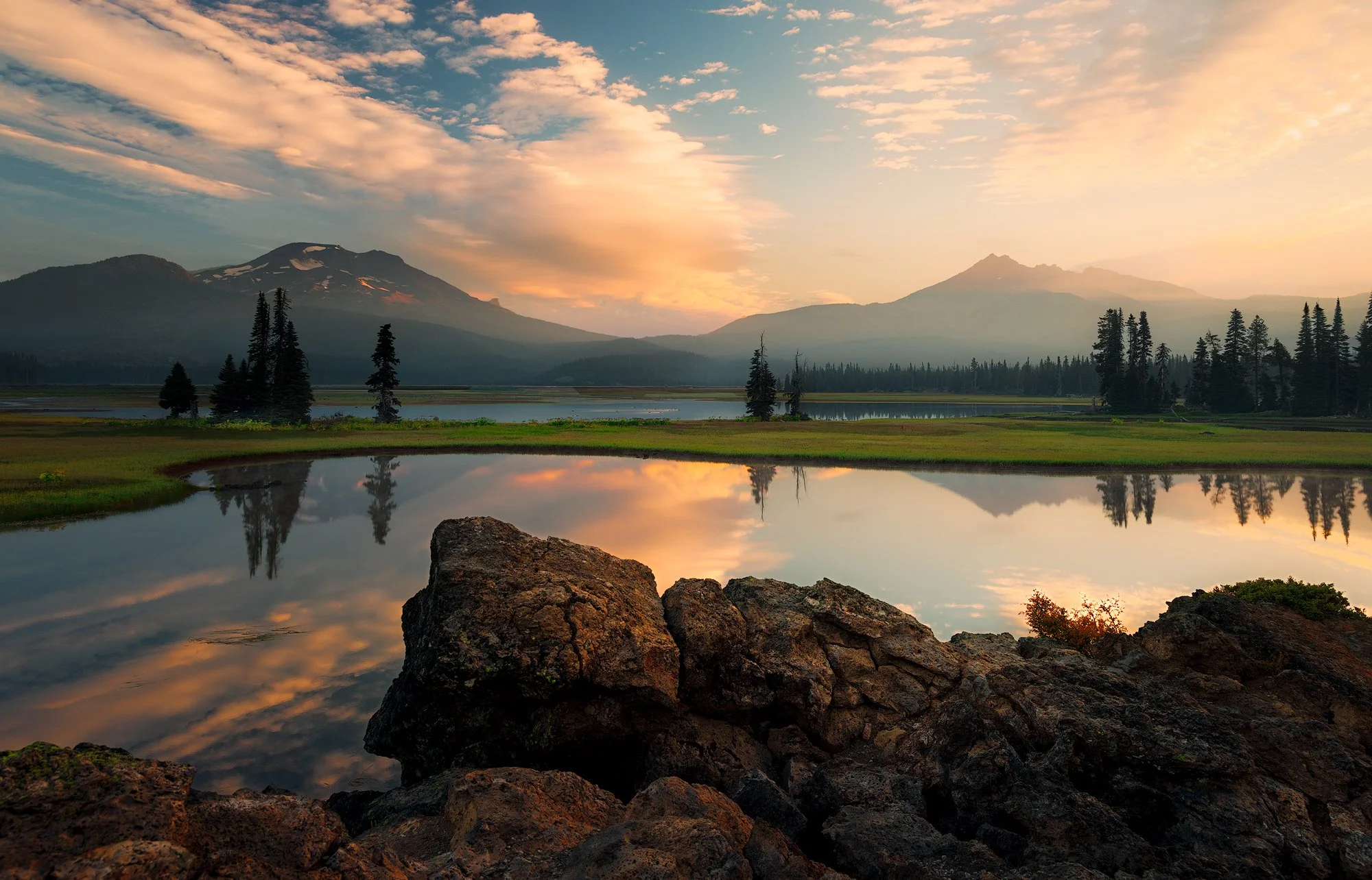
Oregon, with its hundreds of stunning waterfalls and pristine lakes, is a paradise for outdoor enthusiasts and photographers alike. One of my favorite locations to visit and photograph is Sparks Lake, situated in the central Cascade Range. Standing here at sunrise can be truly magical.
Typically, it's just you and a few ducks witnessing the dawn of a new day, with the calm waters reflecting the sunrise and the distant views of the South Sister and Broken Top mountains. Just be sure not to be late, as the sun waits for no one.
Images and location summary by Tim Wier
Annual Subscription
Lifetime Membership
DATA POINTS INCLUDED WITH SPARKS LAKE SUMMARY
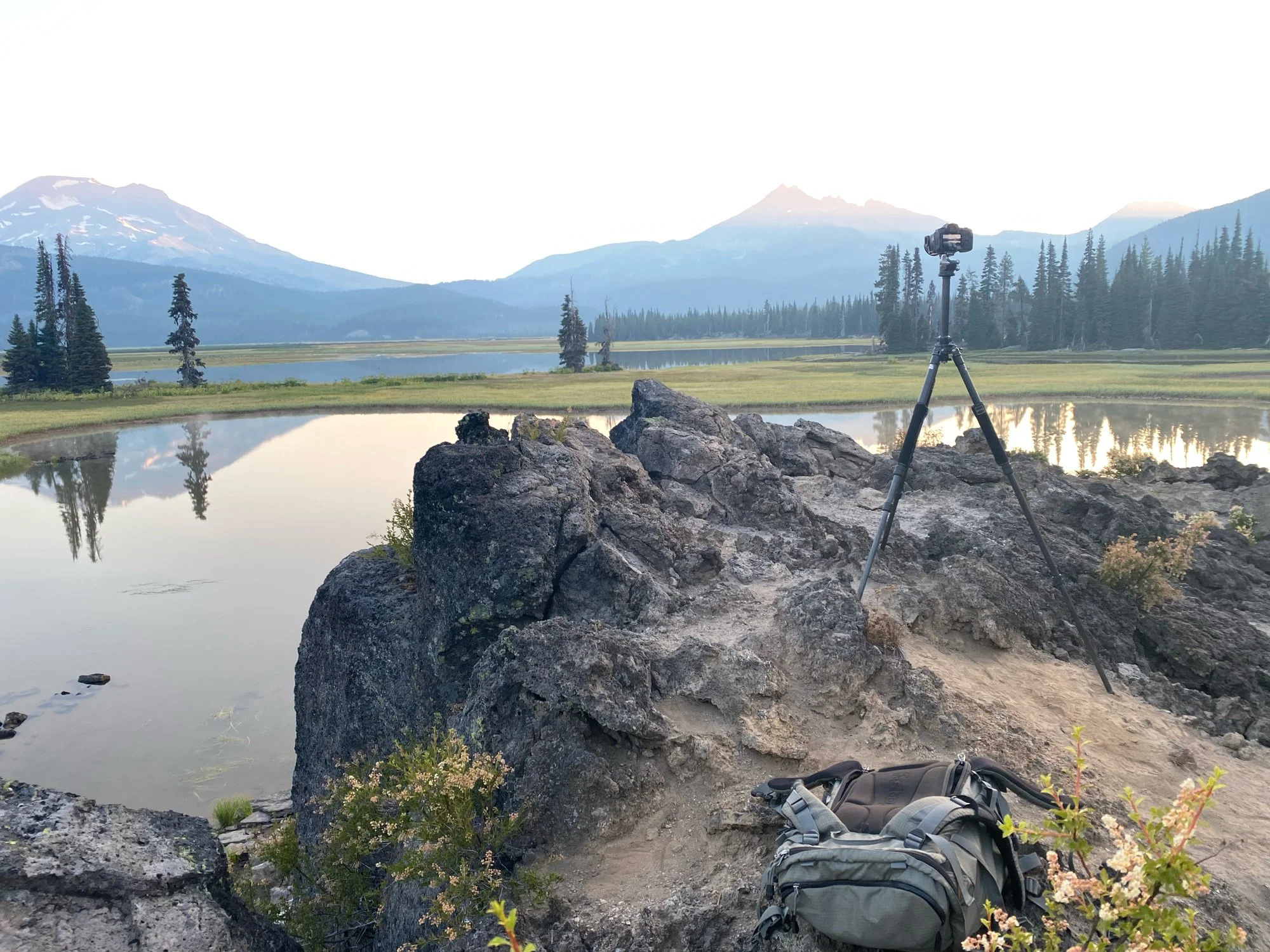
I would rate the difficulty of this trail as a 1 on a scale of 1-5 (with 5 being most difficult). The location of this shot is an easy 1/4 mile walk from the parking area.
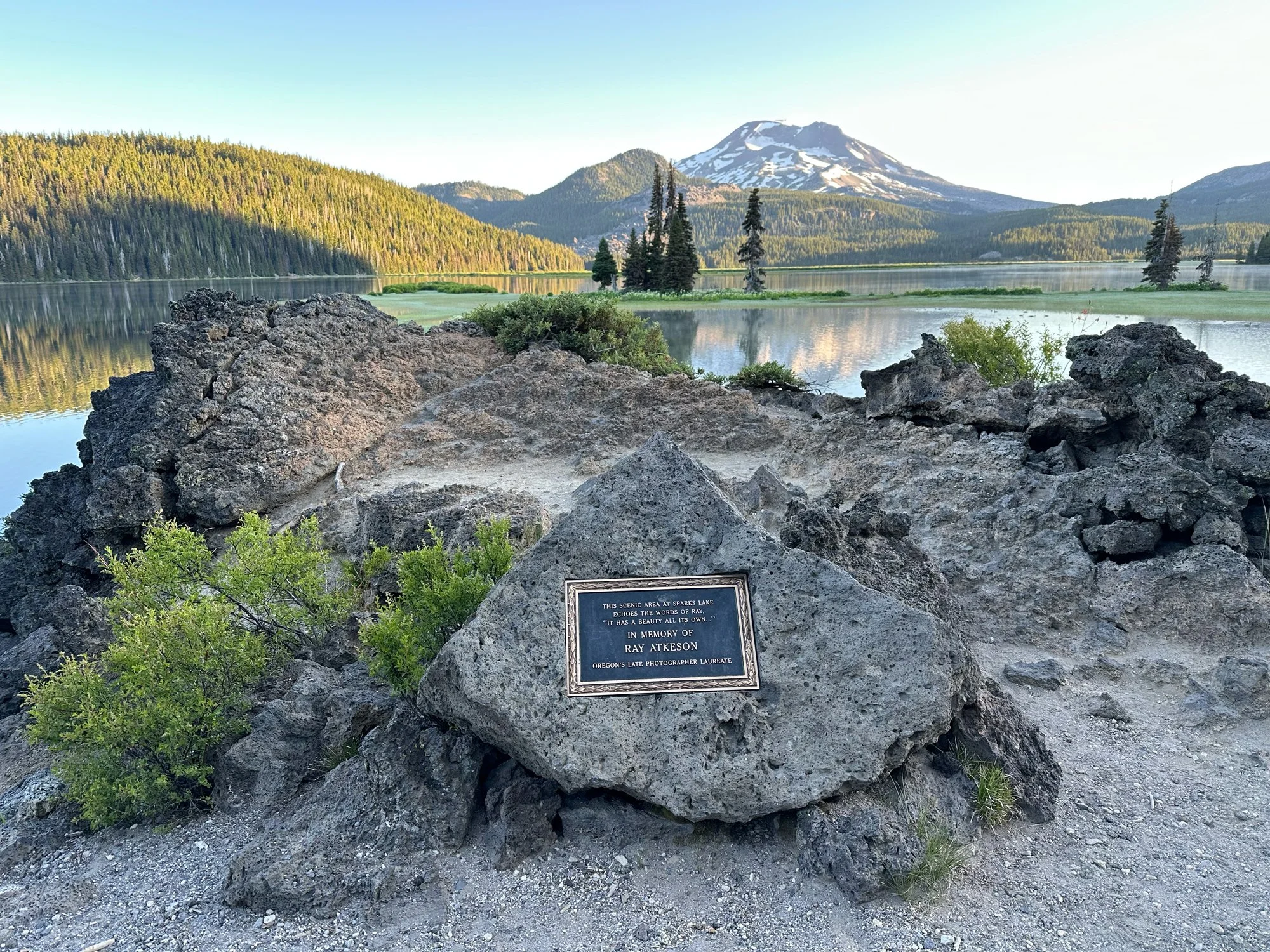
This location offers many excellent views of South Sister, part of the Three Sisters, and Broken Top Mountain, particularly with a stunning early morning reflection. I used the lava rocks in the foreground to enhance the depth of the lake and fill in any empty space. However, there are several vantage points nearby that can also yield great compositions.
The main challenges of photographing this area include the need for a still morning to achieve a mirror-like reflection, as well as suitable cloud cover and the sunrise breaking through to illuminate the scene. Without these elements, you may only have a beautiful location to admire, although you might be fortunate enough to capture some ducks swimming through your shot.
Typically, the sunrise will illuminate the front lava rocks about 15 to 20 minutes after it rises. Therefore, you may need luck with a break in the clouds, or you may have to consider compositing your image to capture the perfect scene.
The image above was taken at 24 mm.
5,433 Ft. Elevation
Other Resources Available with Membership
KMZ Trail File
Directions
Best Time of Day to Shoot
Best Time of Year to Shoot
Equipment Needed
Permits Required
Direction of Shot
Google Maps Birds-Eye-View
Number of Photographers to Expect
Cell Service
Overnight Lodging/Camping
Nearby Restaurants
Area Guides and Workshops
Other Resources
LOCATION SUMMARIES WRITTEN BY PROFESSIONAL PHOTOGRAPHERS


