
Lower Lewis Falls
Gifford Pinchot National ForesT
LOWER LEWIS FALLS
A BRIEF SUMMARY OF LOWER LEWIS FALLS
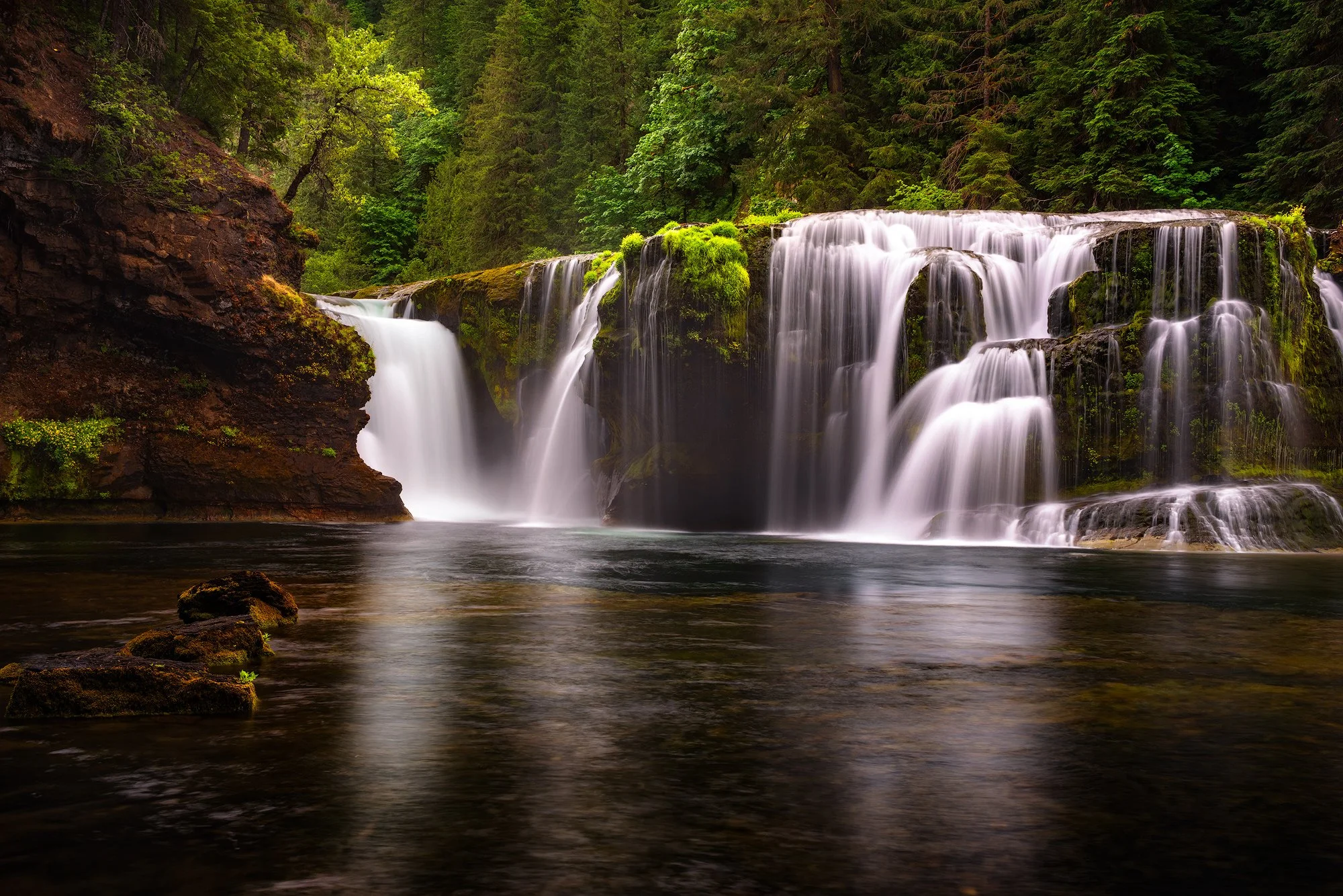
The Pacific Northwest is home to hundreds of stunning waterfalls, and nestled within the dense and picturesque Gifford Pinchot National Forest, you can discover one of the most beautiful: Lower Lewis Falls.
This remarkable set of waterfalls features multiple cascades and breathtaking views, attracting hikers, fishermen, tubers, kayakers, and photographers who are eager to enjoy this outdoor paradise. The falls are located next to a peaceful and relaxing campground, making it a perfect escape from the busyness of everyday life.
Photographers looking to capture this picturesque scene must navigate a challenging trail down to the water and maintain their balance as they wade through ankle-deep water. Once they arrive, they are greeted by an incredible sight.Photographers looking to capture this picturesque scene must navigate a challenging trail down to the water and maintain their balance as they wade through ankle-deep water. Once they arrive, they are greeted by an incredible sight.
Images and location summary by Tim Wier
Annual Subscription
Lifetime Membership
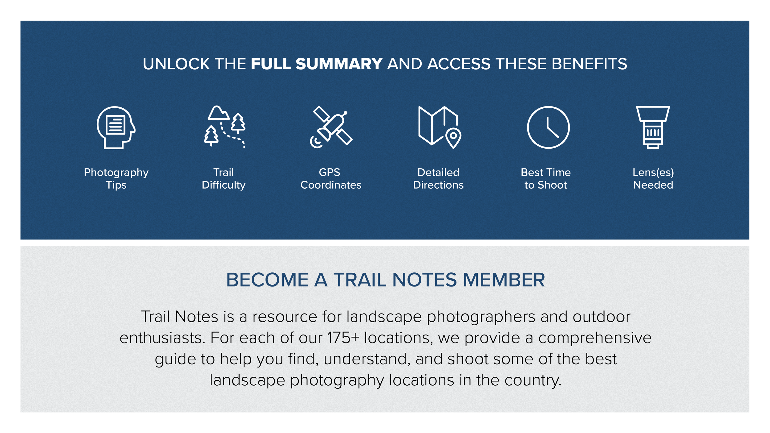
DATA POINTS INCLUDED WITH LOWER LEWIS FALLS SUMMARY


I rate the difficulty of this trail as a 3.5 on a scale of 1-5 (with 5 being most difficult). To get to the location of this shot, you will need to hike down to the water below the falls. This is not a difficult hike, but there are some challenges to consider.
To reach the water, you will have to descend about 10 to 15 feet from the end of the trail. This requires level 3 hiking skills, which may involve using your hands and knees, sliding on your butt, and possibly utilizing a climber's rope. There are several spots to access the water, and I found two of them that include a climbing rope for assistance. If you follow the provided KMZ file, you will find a trail that allows you to use tree roots to gradually and safely descend to the water.
Once you are in the water, be cautious: the rocks are very slick, and it is easy to slip and hurt yourself. After reaching the water, you will need to walk through ankle-deep water for about 30 to 40 yards. While you might stay close to the edge to keep your boots dry, I recommend walking through the water instead, as the rocks are extremely slippery. Please be careful as you make your way to the location of this shot. If you have muck boots, wearing them will help keep your feet dry.
This place is simply stunning!
Once you get to the shot's location, take in the wonderful view and consider the many composition possibilities before deciding where to set up your tripod, as you will be standing in ankle-to-knee-high water. During my visits to this spot, I've found that there is usually little to no current in the river (below the falls), especially if you stay close to the bank. The full width of the falls spans about 10 to 20 yards. However, on my last visit, I noticed several unphotogenic logs on the right side of the falls. The image above shows the left-hand side.
To capture great photographs, it’s best to visit when there is no direct light on the falls or the surrounding area. This is typically during the early morning, late afternoon (around sunset), or on a cloudy day.
After you have found your composition, I recommend using a neutral density (ND) filter that allows for a shutter speed of 1 to 10 seconds. You can achieve a smooth, creamy effect on the water from the falls with just a 1-second exposure. However, for the foreground water, a 5 to 10 second exposure will work better. Keep in mind that this longer exposure may also capture movement in the leaves of nearby trees, so you might need to composite your shot. Enjoy your time in this beautiful location, and don't hesitate to explore and try different compositions!
Depending on your perspective and composition, either a wide-angle or a standard lens can be suitable.
The image above was taken at 40 mm.
1,454 Ft. Elevation
Other Resources Available with Membership
KMZ Trail File
Directions
Best Time of Day to Shoot
Best Time of Year to Shoot
Equipment Needed
Permits Required
Direction of Shot
Google Maps Birds-Eye-View
Number of Photographers to Expect
Cell Service
Overnight Lodging/Camping
Nearby Restaurants
Area Guides and Workshops
Other Resources
LOCATION SUMMARIES WRITTEN BY PROFESSIONAL PHOTOGRAPHERS


