
Abiqua Falls

Near Scotts Mills, OR
ABIQUA FALLS
A BRIEF SUMMARY OF ABIQUA FALLS
One of the most scenic waterfalls in Oregon, Abiqua Falls is a 92 foot waterfall nestled in cliffs of red tinted columnar basalt, tumbling into a large pool at the base of the falls. A pebbly beach with boulders, moss, ferns and old growth forest at the top of the cliff walls, and the outflow of Abiqua Creek offer numerous photographic compositions.
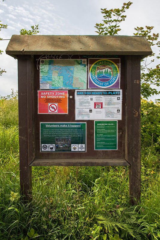
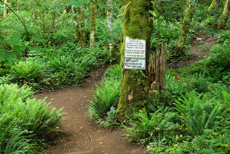
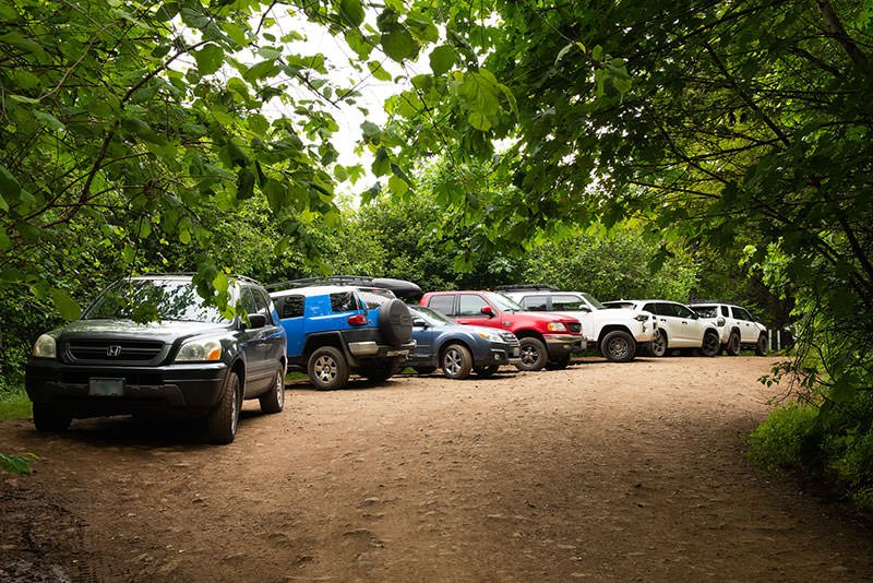
The falls are 33 miles east of Salem, out of the small town of Scotts Mills, in the foothills of the Oregon Cascades. The area receives about 70 inches of rain a year, and is lush and green year around. The falls are on private property owned by Mt. Angel Abbey, but the area is open to the public. Most of the road to the trailhead is paved. However, the last two mile stretch is a gravel and dirt with large potholes, exposed rock, and ruts. High clearance, 4WD vehicles only are recommended for this section. At the end of the road is a steel gate, and a small wide area that will fit about a half dozen vehicles.
Photos and location summary by Patrick Campbell

Annual Subscription
Lifetime Membership
DATA POINTS INCLUDED WITH ABIQUA FALLS SUMMARY
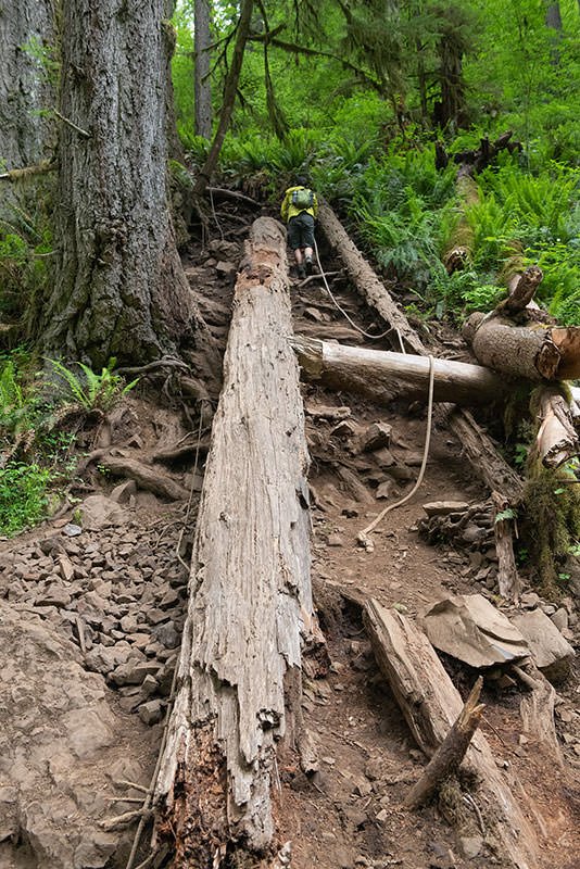
I would rate the difficulty of the trail to this specific location as a 4 on a scale of 1-5 (with 5 being most difficult). The trail down to the falls from the end of the road is only about 0.9 mile each way, with about a 300 ft elevation loss/gain. It is unmarked, and near the road are some false trails that led to a cliff. The true trail is well travelled, but very steep in places, particularly the last section, which has about a 70 per cent grade. On this last section are two sets of ropes that are parallel to the trail. After a recent rain the trail will be very muddy and very slippery. When you reach the creek, you will have to do some rock hopping upstream to get to the falls. For some compositions you will want to wade to the far side of the shallow creek, so bring water shoes, waterproof boots, or waders.
For those without a high clearance 4WD vehicle, you can park farther up the road, and add an additional 1/2 to 2 miles each way and up to another 1100 feet of elevation loss/gain.
As this location has become more well known and more popular, I recommend visiting on a week day, and as early in the day as possible, especially in the summer. It is rare to have the place entirely to yourself.
Wide-angle to short telephoto. 16mm is more than wide enough to capture the waterfall and surrounding bowl. I have also used 16-35mm and 24-70mm zooms to photograph the falls.
The image above was shot at 24mm.
896 Ft. Elevation
Other Resources Available with Membership
KMZ Trail File
Directions
Best Time of Day to Shoot
Best Time of Year to Shoot
Equipment Needed
Permits Required
Direction of Shot
Google Maps Birds-Eye-View
Number of Photographers to Expect
Cell Service
Overnight Lodging/Camping
Nearby Restaurants
Area Guides and Workshops
Other Resources
LOCATION SUMMARIES WRITTEN BY PROFESSIONAL PHOTOGRAPHERS


