
Teton Reflection
Grand tetons, NP
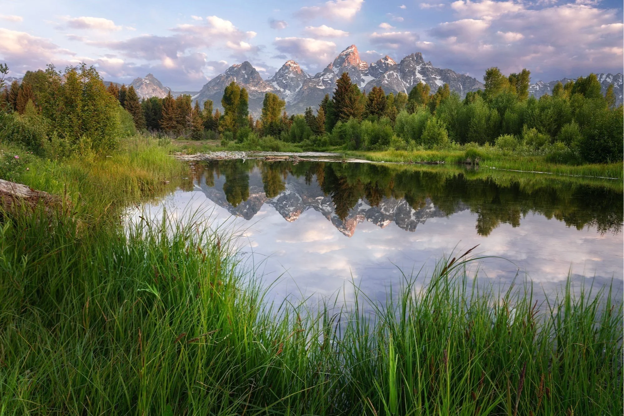
Teton Reflection
A BRIEF SUMMARY OF TETON REFLECTION
The areas around Jackson Hole offer many great views of the magnificent Teton Mountains. And many of the iconic locations draw hundreds of visitors at sunrise each day, which can be overwhelming and challenging to photograph.
Sometimes the road less traveled can still offer a wonderful photographic opportunity without fighting the crowds. I offer this peaceful and equally magnificent alternative to the very famous Schwabacher’s Landing. I have been to this location several times at sunrise and have rarely seen other people there.
And yes, I bring bear spray.
Images and location summary by Tim Wier

Annual Subscription
Lifetime Membership
DATA POINTS INCLUDED WITH TETON REFLECTION SUMMARY
I rate the difficulty of this trail as 1.5 on a scale of 1-5 (with 5 being most difficult). It’s an easy 1/4 mile walk from the parking area near just south of Schwabacher’s Landing. The hike to this location is on a well-defined trail along the tributary leading west from the parking area.
This shot is fairly straightforward - arrive several minutes before sunrise, find your composition, and wait for the light to paint this beautiful scene.
For the image above, I set my composition to frame the main mountain peak with the V shape formed by the grass in the foreground (this same formation may not be present when you are at this location). I chose to wait for the tallest peak to begin to illuminate (with a pink glow) and then composited it with the same shot a few minutes later when the foreground was in light.
There are several ways to photograph from this spot. I chose to shoot with a wide-angle lens to include the small grass near the water, which helps frame the shot. You can also zoom in a bit to capture the beaver pond and mountain peaks.
6,653 ft Elevation
Other Resources Available with Membership
KMZ Trail File
Directions
Best Time of Day to Shoot
Best Time of Year to Shoot
Equipment Needed
Permits Required
Direction of Shot
Google Maps Birds-Eye-View
Number of Photographers to Expect
Cell Service
Overnight Lodging/Camping
Nearby Restaurants
Area Guides and Workshops
Other Resources
LOCATION SUMMARIES WRITTEN BY PROFESSIONAL PHOTOGRAPHERS


