
The Tarn
Acadia National Park, ME
THE TARN
A BRIEF SUMMARY OF THE TARN
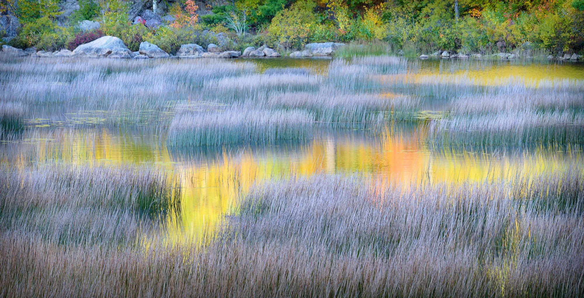
The Tarn lies in a steep valley between two peaks — Mt. Dorr, the third tallest peak on the island, lies to the west and the knob of Huguenot Head to the east. The Tarn is probably one of Acadia’s more under-appreciated ponds due to its smaller stature.
Many people overlook it because it’s not as well-known as some of Acadia’s larger bodies of water, such as Jordan Pond, Long Pond, and Eagle Lake. Yet, I believe it is one of its most picturesque. If you arrive at the right time, when the sun is providing picturesque reflections, you'll be rewarded with a beautiful view and likely agree with my assessment.
Photos and location summary by Darron Franta

Annual Subscription
Lifetime Membership
DATA POINTS INCLUDED WITH THE TARN SUMMARY
This trail is a 1 on a scale of 1-5 (with 5 being the most difficult). The shooting location is a walk of 100 yards or less after a six-minute drive from downtown Bar Harbor.
As mentioned, this is a morning shot, but not necessarily sunrise. The best approach, in my estimation, is to wait for the sun's direct light to clear Huguenot Knob and light the side of Dorr Mt., which is covered with beautiful color-bearing trees. Depending upon the time of year, this will usually occur mid-morning. Shooting westward, Mt. Dorr's trees will provide beautiful reflections amidst the lily pads and water grasses that dance on the shallow body of water.
When photographing The Tarn Short - you can use lenses ranging from wide-angle to telephoto (24-70 and 70-200).
The image above was shot @ 150mm
101 Ft. Elevation
Other Resources Available with Membership
Detailed Directions
Best Time of Day to Shoot
Best Time of Year to Shoot
Equipment Needed
Required Permits
KMZ Trail File
Direction of Shot
Google Maps Birds-Eye-View
Number of Photographers to Expect
Cell Service
Current Weather
Lodging & Camping
Area Guides and Workshops
Other Resources
LOCATION SUMMARIES WRITTEN BY PROFESSIONAL PHOTOGRAPHERS


