
Meadow on Country Rd #7

Near Ridgway, CO
MEADOW ON COUNTY RD #7
A BRIEF SUMMARY OF MEADOW ON COUNTY RD #7
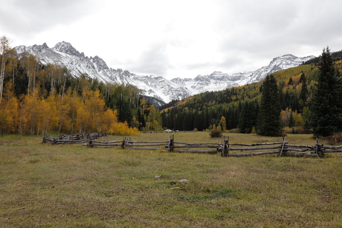
Colorado is a wonderful place for landscape photography. The open range combined with snow capped mountains and the magnificent colors and hues that appear each fall produce a land of opportunity for a photographer and someone just wanting to enjoy the great outdoors. This location captures much of that feeling in a single image.
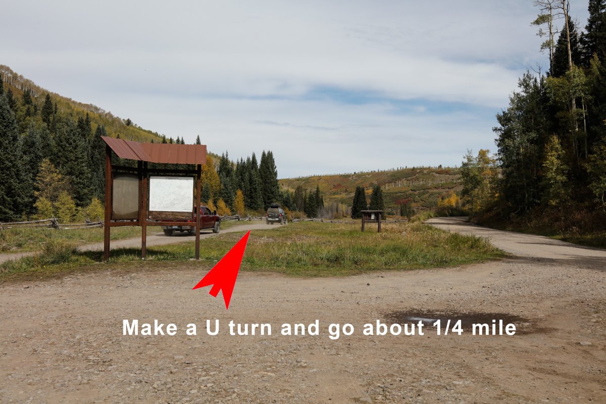
You can capture plenty of great Colorado landscapes just by driving the 3 county roads known as County Rd #5, County Rd #7, and County Rd #9 outside Ridgway, CO. Each of the 3 dirt roads cuts through some of the most beautiful land Colorado has to offer. This image was taken at the end of County Rd #7 just after it passes through the Double RL Ranch and turns back into public land. The little valley with split rail fences and golden Aspens lining the hills makes for a great photographic opportunity.
Images and location summary by Tim Wier

Annual Subscription
Lifetime Membership
DATA POINTS INCLUDED WITH MEADOW ON COUNTY RD #7 SUMMARY
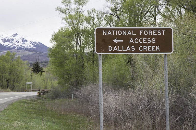
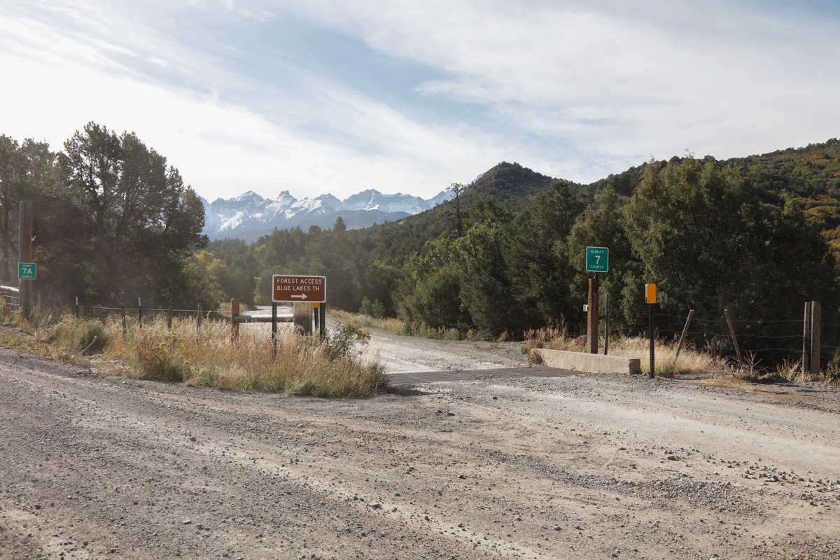
I would rate the difficulty of this trail between 3 and 5 on a scale of 1-5 (with 5 being most difficult). The 7.7 mile drive on the dirt road that is CR7 can be bumpy and rough in some places and should be traveled only with a 4-wheeel drive vehicle.
If the road is muddy, don’t attempt to drive it, as you are almost guaranteed to get stuck and it is an 8 mile walk back to Ridgway.
Please note, the dirt road that is county road CR9 is public property and can be used for taking pictures and traveling through the ranchland. However, the land on either side of the dirt road is private property, and the owner, Ralph Lauren (Double RL Ranch), takes this seriously. I have been reminded of this by ranch hands many times.
The shot is pretty straight forward. Try to use a rock or other object to anchor the image.
The shot above was taken with a 24mm lens.
9,126 Ft. Elevation
Other Resources Available with Membership
KMZ Trail File
Directions
Best Time of Day to Shoot
Best Time of Year to Shoot
Equipment Needed
Permits Required
Direction of Shot
Google Maps Birds-Eye-View
Number of Photographers to Expect
Cell Service
Overnight Lodging/Camping
Nearby Restaurants
Area Guides and Workshops
Other Resources
LOCATION SUMMARIES WRITTEN BY PROFESSIONAL PHOTOGRAPHERS


