
House on the Range

Near Ridgway, CO
HOUSE ON THE RANGE
A BRIEF SUMMARY OF HOUSE ON THE RANGE
Just west of Ridgeway are three great dirt roads that take you through some of the most beautiful ranch lands in southwest Colorado. County road 5, 7 and 9 are public access roads that run through the majestic 16,000 acre Double RL Ranch (owned by Ralph Lauren) up to the Uncompahgre Plateau.
This spot takes you back to an earlier time, when the Colorado ranges were wild, open and free.
Images and location summary by Tim Wier

Annual Subscription
Lifetime Membership
DATA POINTS INCLUDED WITH HOUSE ON THE RANGE SUMMARY
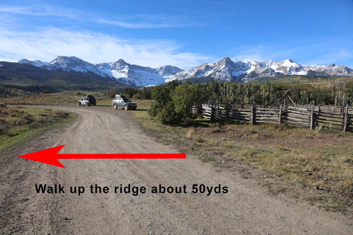
I would rate the difficulty of this trail between 3 on a scale of 1-5 (with 5 being most difficult). The drive is for 4.1 miles on a narrow dirt road (with several bumps and holes) winding through the Colorado countryside. Upon your arrival at the location the shot is an easy 50ft walk off the road.
Important to note: There are a few places on the road which narrow to one lane. There is one place in particular (at exactly 2 miles from CO HW62) where you will making an uphill blind S curve in a very narrow section with tall bushes obstructing your view. If there is another vehicle coming, it may cause a head-on collision. It is best to be very cautious at this point and greatly reduce your speed on the turns. I would suggest traveling this road with a 4-wheel drive vehicle.
If the road is wet or muddy, don’t attempt to drive the road as you are almost guaranteed to get stuck and it is a 12 mile walk back to Ridgway.
Please note, the dirt road that is county road CR9 is public property and can be used for taking pictures and traveling through the ranchland. However, the land on either side of the dirt road is private property and the owner, Ralph Lauren (Double RL Ranch), takes this seriously. I have been reminded of this by ranch hands many times.
This is mainly a straight forward shot, but there are different views based on where you stand along the road. I would suggest scouting the location well before sunset to find your...
For me, this shot is more of a compression of the ranch house, the Aspens and the mountains. For this reason I would suggest a 35-50mm lens. The shot above was done as a 3 horizontal pano stitch with a 75mm lens to capture as much detail as possible.
8,645 Ft. Elevation
Other Resources Available with Membership
KMZ Trail File
Directions
Best Time of Day to Shoot
Best Time of Year to Shoot
Equipment Needed
Permits Required
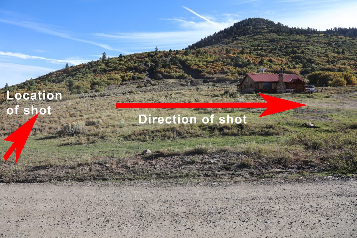
Direction of Shot
Google Maps Birds-Eye-View
Number of Photographers to Expect
Cell Service
Overnight Lodging/Camping
Nearby Restaurants
Area Guides and Workshops
Other Resources
LOCATION SUMMARIES WRITTEN BY PROFESSIONAL PHOTOGRAPHERS


