
Anvil Mountain Sunset
Near Ophir, CO
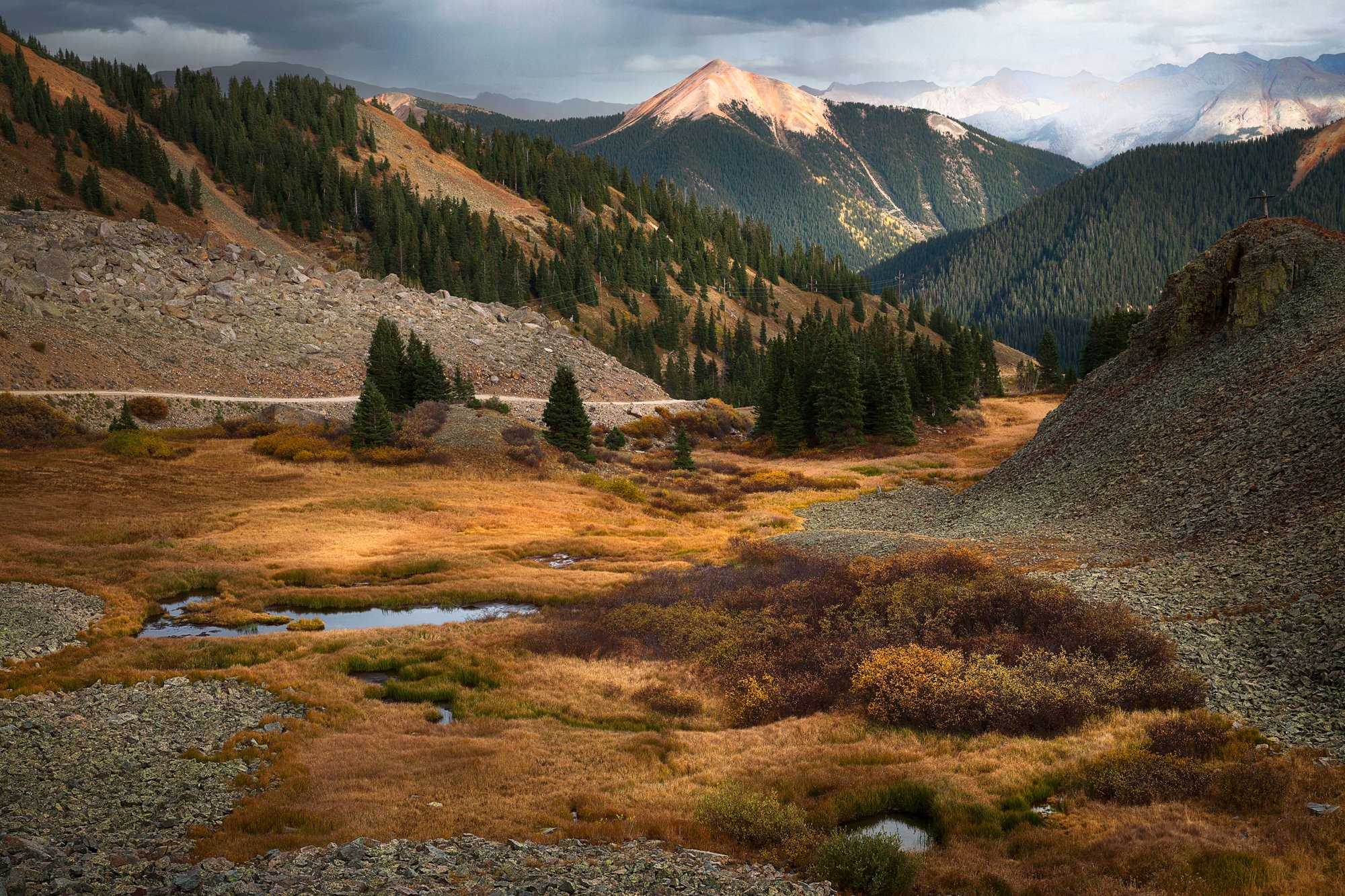
SUNSET OVER ANVIL MOUNTAIN
A BRIEF SUMMARY OF SUNSET OVER ANVIL MOUNTAIN
The Ophir Pass has many fantastic views from both the east and west sides of the summit. This shot was taken near the summit on the east side and if facing toward the Anvil Mountain in the late afternoon.
There are many other great photography opportunities on the east side as well.
Images and location summary by Tim Wier

Annual Subscription
Lifetime Membership
DATA POINTS INCLUDED WITH SUNSET OVER ANVIL MOUNTAIN SUMMARY
I would rate the difficulty of this trail 3 on a scale of 1-5 (with 5 being the most difficult). The location of the shot is directly from the road (Ophir Pass). However, getting to the location required driving up to the summit of the Ophir Pass. You can get to the summit by driving east from the small community of Ophir or west by driving US HW 550 (Million Dollar Highway). Either direction requires a 4x4 vehicle. The drive from US 550 is much easier as the road is a well-maintained forest road.
The Ophir Pass is a single-lane dirt/rocky/shale road that is not for the faint of heart!!! It is non-technical and does not have rocks or boulders to climb over - however, it just has some places with deadly drop-offs and challenging inclines. If you have a good 4x4 vehicle with good 4x4 driving skills, the road to the summit from the west is not overly taxing. However, even with a 4x4 vehicle - if you are not an experienced off-road driver, this location may not be for you.
This specific spot attracted me because of the red or pink glow on the Anvil Mountain late in the afternoon. However, there are many other great places to photograph on the Ophir Pass late in the afternoon. Spend some time on the pass (both the east and west sides of the summit), and you will be amazed by the beautiful scenes in the fall.
The above image was taken at 60mm.
11,780 Ft. Elevation
Other Resources Available with Membership
KMZ Trail File
Directions
Best Time of Day to Shoot
Best Time of Year to Shoot
Equipment Needed
Permits Required
Direction of Shot
Google Maps Birds-Eye-View
Number of Photographers to Expect
Cell Service
Overnight Lodging/Camping
Nearby Restaurants
Area Guides and Workshops
Other Resources
LOCATION SUMMARIES WRITTEN BY PROFESSIONAL PHOTOGRAPHERS


