
Brink Of The Lower Falls

Yellowstone NP
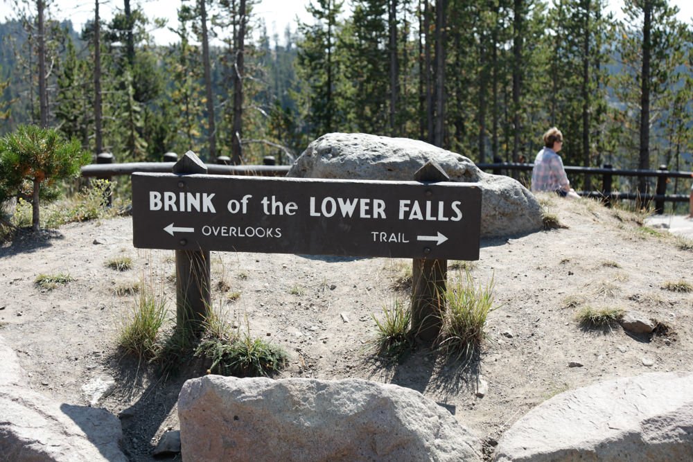
BRINK OF THE LOWER FALLS
A BRIEF SUMMARY OF BRINK OF THE LOWER FALLS
Brink Of The Lower Falls offers one of the very best views of the enormous power of the Yellowstone River. The Brink of the Lower Falls places you right on top of the massive 300ft drop off to the canyon below. The hike to this spot is not easy, with a pretty serious elevation gain over a ¼ of a mile. But when you reach this spot, you can capture some unique images of The Grand Canyon of the Yellowstone.
From the viewpoint at the bottom of the trail, you can capture the exact opposite view that you get from Artist Point on the south rim. Around mid-day, you normally get a nice rainbow that forms looking east. If you walk back up the switchback and look down on the falls, you can also get some nice abstracts of the powerful flow from the falls. All in all, this hike is well worth the visit; but again, it is not easy.
Images and location summary by Tim Wier

Annual Subscription
Lifetime Membership
DATA POINTS INCLUDED WITH BRINK OF THE LOWER FALLS SUMMARY
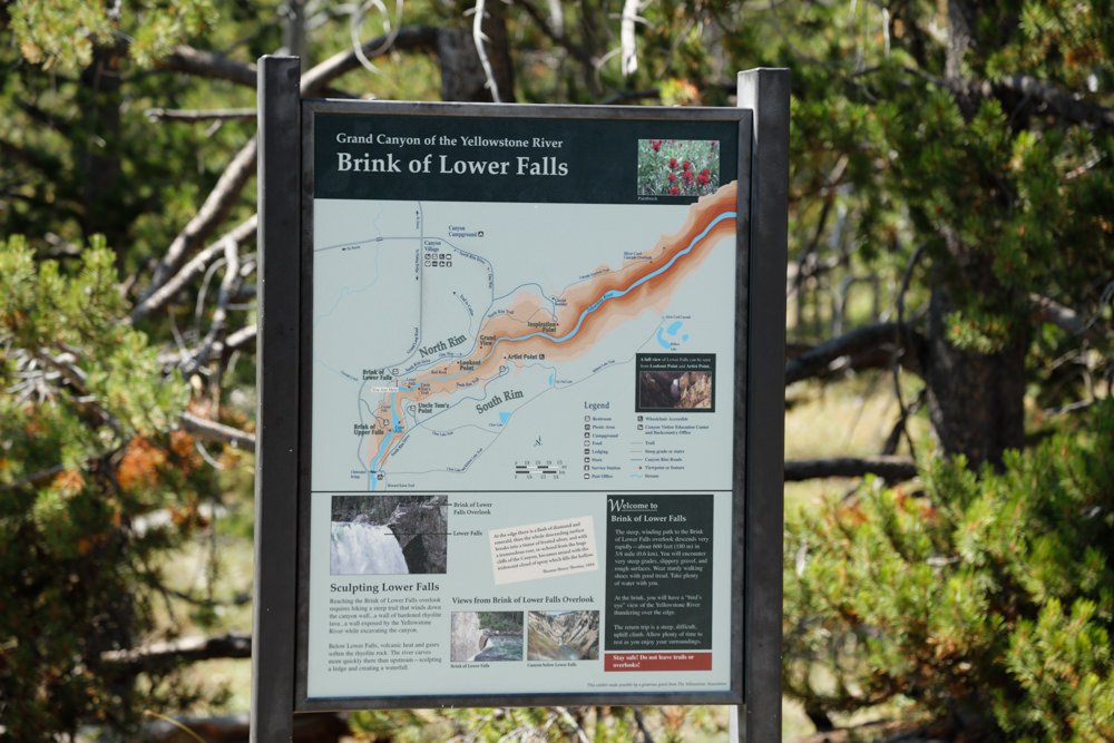
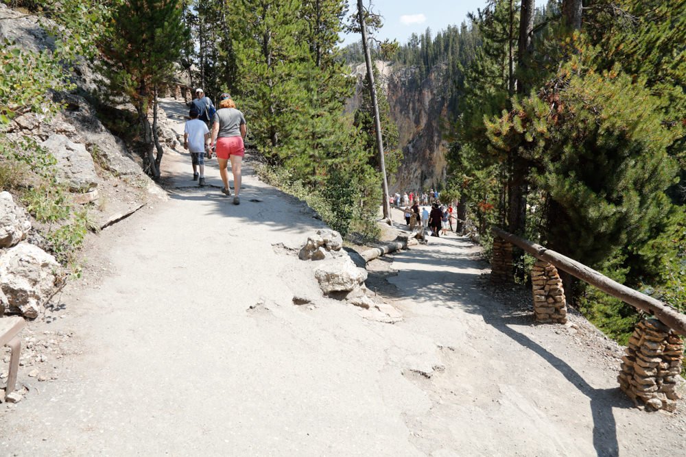
I would rate the difficulty of this trail as a 3 on a scale of 1-5 (with 5 being most difficult). The hike to the Brink of the Lower Falls is a dirt/paved trail that is 0.4 miles each way (0.8 miles round trip) consisting of about 8-10 switchbacks. The elevation gain is significant (300ft each way) and is not for everyone. The hike back up can be tiring if you don’t hike much.
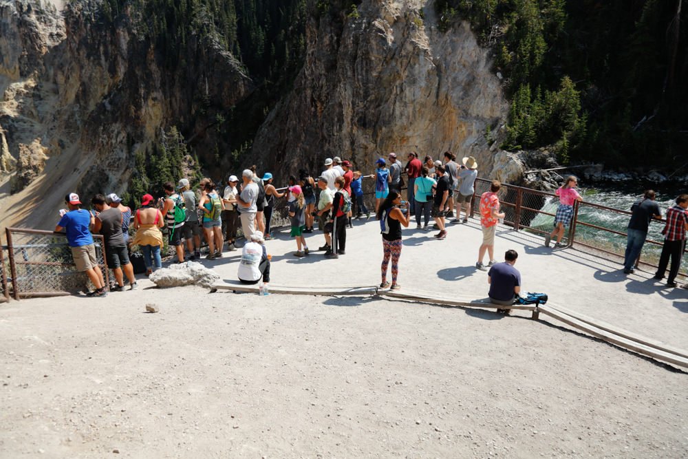
The shot is fairly straightforward. Just be careful not to tumble in, as there is no return.
In the afternoon, the mist from the falls will produce a rainbow when shooting out toward the canyon. This is a nice option to include in your shot.
The image above was shot with a 20mm lens.
4,298 Ft. Elevation
Other Resources Available with Membership
KMZ Trail File
Directions
Best Time of Day to Shoot
Best Time of Year to Shoot
Equipment Needed
Permits Required
Direction of Shot
Google Maps Birds-Eye-View
Number of Photographers to Expect
Cell Service
Overnight Lodging/Camping
Nearby Restaurants
Area Guides and Workshops
Other Resources
LOCATION SUMMARIES WRITTEN BY PROFESSIONAL PHOTOGRAPHERS


