
The Lollypop

The Lollipop
Vermilion Cliffs, AZ
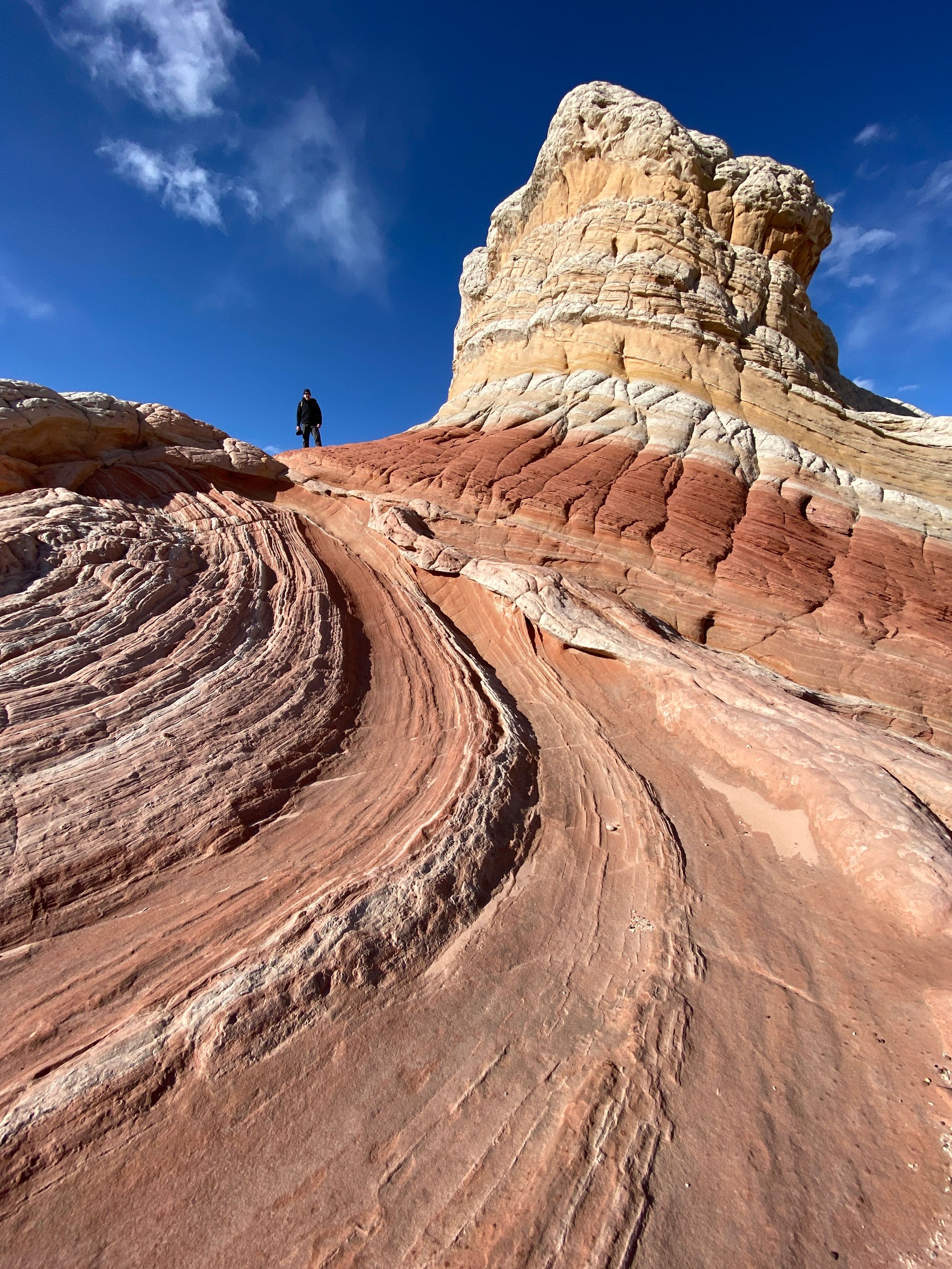
The Lollipop (also called the Swirl) is just one of the many exciting formations found at The White Pocket in the Vermilion Cliffs National Monument in northern Arizona. This formation's unique shape and colors seem to change as you view it from different angles and lighting conditions.
For a photographer, the White Pocket provides some of the most intriguing sandstone shapes found anywhere in the American Southwest. But like most unique places, this one is very hard to get to and is only accessible if you come well-prepared and committed.
Some formations at the White Pockets are delicate and could be damaged if subject to a large number of hikers - I would ask that when you visit, please do your best to preserve all aspects of this location for future visitors and always try to leave it in better shape than when you found it.
Images and location summary by Tim Wier
Trail Difficulty - HARD to EXTREME
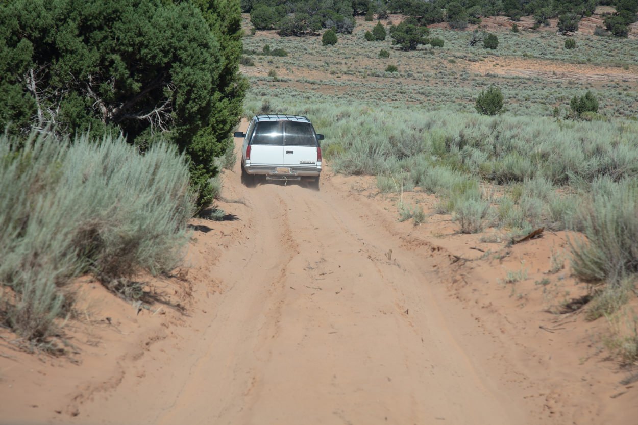
I rate the difficulty of this trail as a 5 on a scale of 1-5 (with 5 being most difficult). The drive to the White Pocket is 36 miles, and it takes about 2 1/2 hours to get there (from US89). The majority of the long drive is on ranch-style dirt roads. However, the last 5 miles are made up of DEEP SAND and rock sections. A 4x4 vehicle with good ground clearance and off-road tires is a must. If you get stuck, it is very difficult to dig yourself out, and the extraction cost can run up to $1,000.
Even if you have a high-clearance, 4-wheel drive vehicle, I suggest letting air out of your tires down to 15-20 lbs of pressure. This allows your tires to expand and gives them more traction in deep sand. For this reason, you will need a portable air compressor for the ride home.
TAKE THE DRIVE SERIOUS! If you are driving a street version (rental) SUV with 2-wheel drive and think you can make it to the White Pocket – think again because you stand a strong chance of getting stuck! White Pocket is deep in the Arizona desert and is 60 miles from the nearest community. There are no trees, shade, water, or cell service.
GPS Coordinates & Elevation
5,844 Ft. Elevation
Download KMZ Trail File
Click Here to download the KMZ file for this location.
Photography Tips
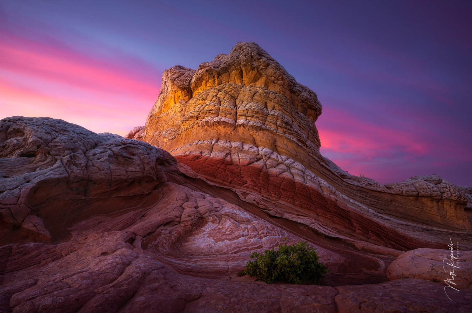
You can photograph this formation in the late afternoon (just before sunset or early morning (just before sunrise). The image above was taken toward the end of the day when the sun was just above the horizon (about 20 minutes before the stated sunset time).
The colorful rock formation changes perspective and colors as you walk around. Try different angles, lenses, and positions to find your favorite composition. Try not to get too close, as the face of the rock can begin to overwhelm the scene.
The White Pocket is a unique place and offers some of the most intriguing abstracts of any location in the American Southwest. However, this is not a place you drive up to and wait for the best light. You will need to scout around to find the different compositions that interest you. The White Pocket area is only about 1/4 mile long by 1/2 mile wide (and the primary photography area is only about 200 yds by 400 yds). Still, you could easily spend several hours just walking around looking for different compositions to photograph. I suggest arriving 3-5 hours before sunset to give yourself plenty of time to scout.
You must know where you want to shoot as the sunset (or sunrise) approaches - as the light goes very quickly, and it does take time to walk from one composition to the other. So for scouting, I suggest walking around during the day with your camera and taking pictures from different locations - while marking your spot with either a GPS or visual. Then return to your vehicle and find which compositions you like best. Then, as late afternoon approaches, position yourself to capture your best composition under the best light.
Directions
CLICK HERE to get driving directions to White Pocket.
You can reach White Pocket from either the north US Hwy 89 (the road from Kanab, UT, to Page, AZ) or the south via US Hwy 89a (from Jacobs Lake). The most common route is from the north (US Hwy 89).
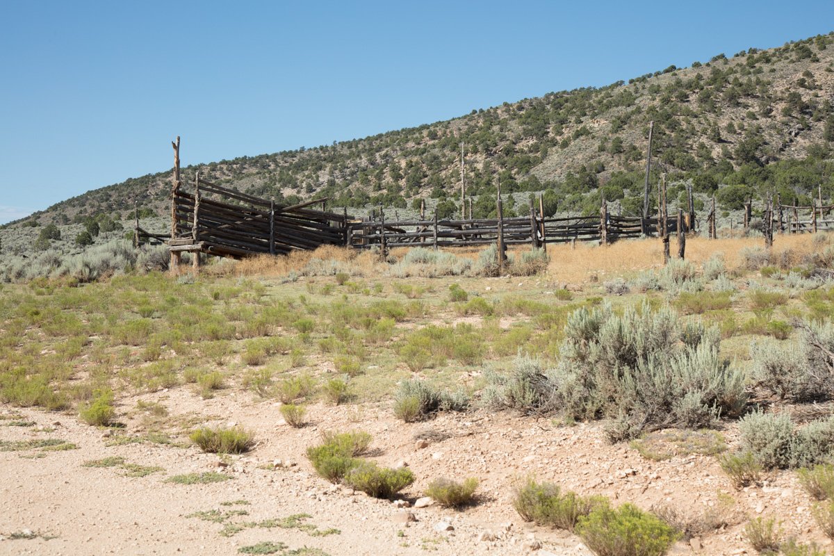
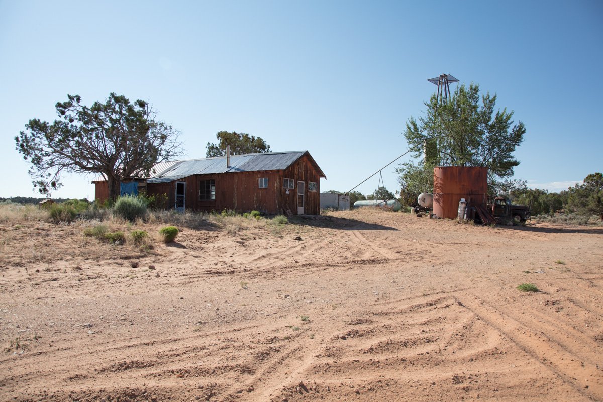
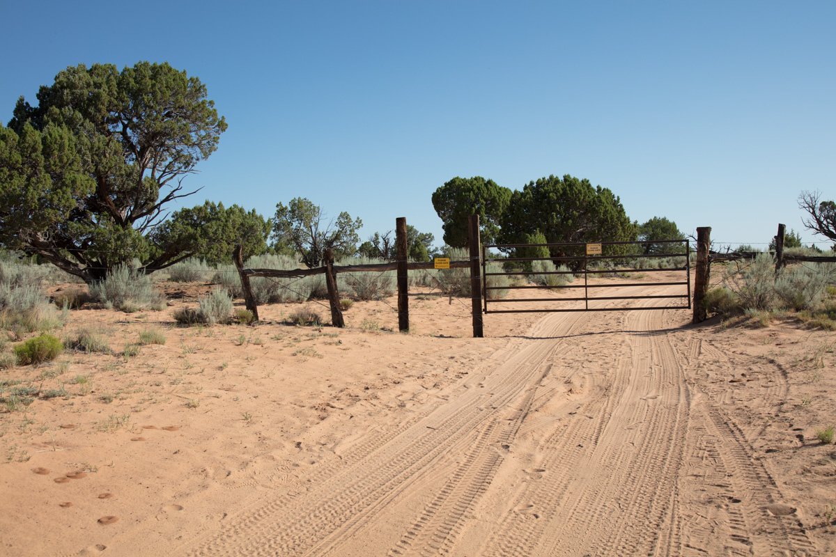
From US Hwy 89 - take House Rock Rd for 20.3 miles until you come to a dirt road called Pine Tree Rd / BLM 1017 (you will see an old cattle fence on the right - see below). Take a left and drive 6.1 miles until you see an old ranch house and water tank. Take a left at the old ranch house and travel for 3.9 miles, where you will see a split in the dirt road. Veer left and travel about 1/2 miles, and you will come to a ranch gate.
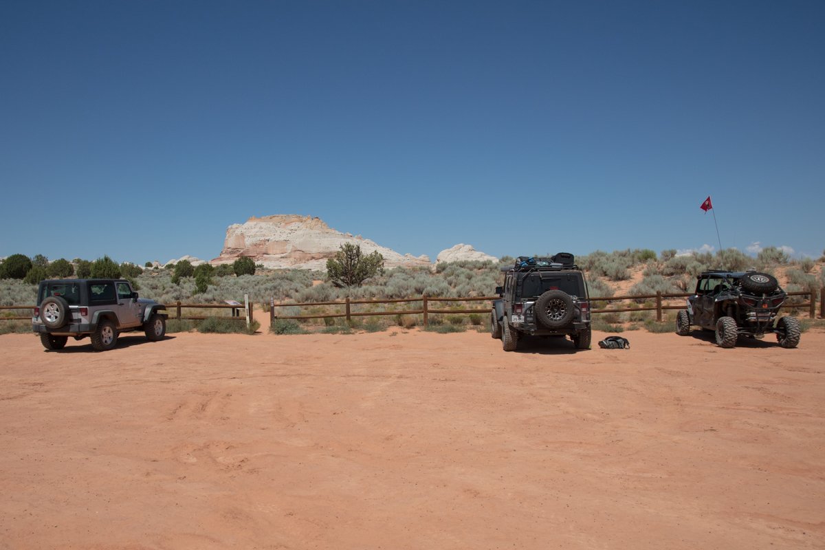
Open the ranch gate (make sure you close it once you pass through it) and travel another 5 miles until you see the White Pocket parking area. The last couple of miles get pretty gnarly WITH SOME PRETTY DEEP SAND, and unless you have a 4-wheel drive, you stand a good chance of getting stuck.
You have arrived!!
WHILE AT WHITE POCKET - ensure you are always aware of where you are. Even though the White Pocket area is not very large (roughly 300 yards x 800 yards), it is VERY EASY to get disoriented and lose your place when walking around on the rocks. Make sure you either bring a GPS and mark the spot of the parking area or, at minimum, look around and take note of markers to help find your way back. It is not a place you want to get lost after the sun goes down..
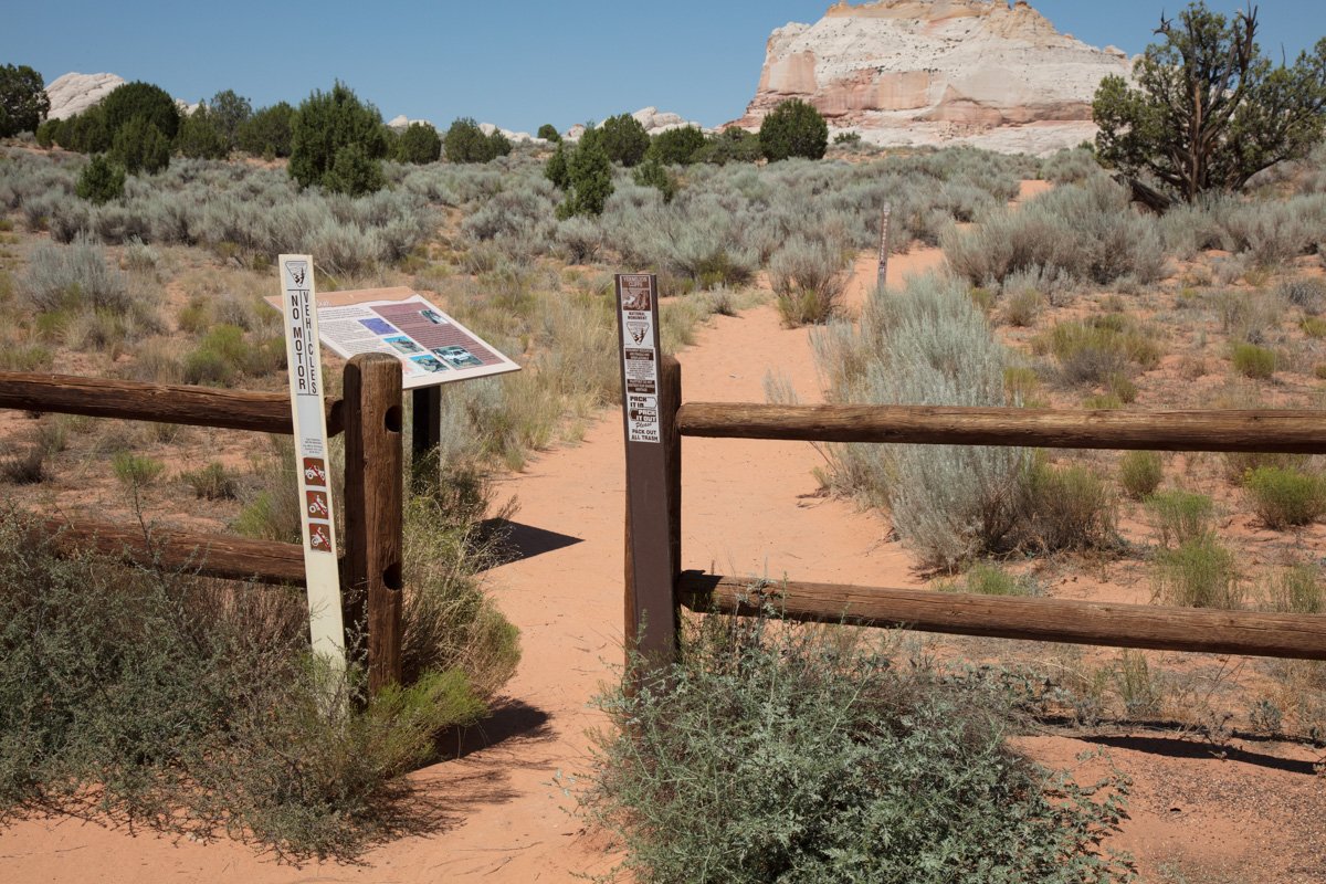
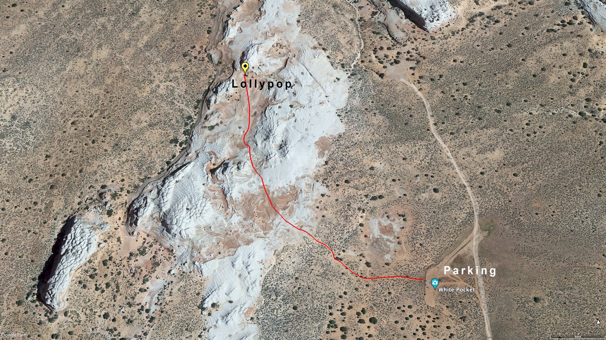
To get to the Lollipop formation - hike from the parking area through the opening in the fence and take the trail until you hit the rock formations (100 yards or so). Once you hit the rock formations, veer center-right and walk through the two prominent rock hills. Once you walk through the two main rock hills, keep walking center right. You will see the formation toward the back right. The exact GPS is 36°57'34.9 "N 111°53'50.2 "W.
Google Earth
EXIF Data
Focal Length – 16 mm
Exposure – 1/15 sec @ f 8.0
ISO – 100
Date – April 12th
Time – 6:41 pm
Other Images From This Location
Best Time of Day to Shoot
Photographing the White Pocket is all about the abstract formations and the light. For this reason, White Pocket is best photographed in the late afternoon/sunset/dusk or dawn/sunrise/early morning, and some of the best colors are found during the 30 minutes before sunrise and 30 minutes after sunset. You can also get photographs on a cloudy or overcast day.
For sunrise, get up early and be ready to shoot well before the sun comes up!!! Once the sun hits the rock formations, the shots get blown out.
The Lollipop image above was taken about 20 minutes before SUNSET. This allowed the sun to get near the horizon and provide soft, warm light. This location can also be taken at SUNRISE (before the sun crests the horizon and blows out the shot) - but SUNSET is the preferred time.
Best Time of Year
For this SPECIFIC LOCATION - the best times to shoot at SUNSET is in the spring and fall. In the winter months, the SUNSET is almost directly on the face of the rock formation. During the summer, the SUNSET is more toward the back left of the rock formation.
Lens(es) Needed
This rock formation changes shapes and compositions as you walk around it. I used a 16mm lens to accentuate the curves and unique facing of the rock.
Birds-Eye View From Google Earth Pro
Permits
No permits are required at the time of this writing (January 2025).
Direction of the Shot
The direction of this shot is north at 0°.
Equipment Needed
The White Pocket is deep in the middle of the Arizona desert and is miles and miles and miles from the nearest community. There are no trees, little shade, water, or cell service. With this in mind, you must bring a compass, sunscreen, a hat, a long-sleeve shirt, a jacket, plenty of water (with electrolytes), food, snacks, energy bars, and a full gas tank.
From a photography equipment standpoint, you need a sturdy tripod and a polarizer. Also, make sure you have a headlamp or flashlight so you can find your way to and from your vehicle.
Number of Other Photographers to Expect
The drive to White Pocket is difficult. It is only accessible in a high-clearance 4-wheel drive vehicle and is way off the beaten path for most photographers. However, it is a very unique place that draws quite a few visitors during the tourist season. Depending on the time of year, you can expect to see between 0 and 30 tourists and/or photographers at White Pocket.
Having company at White Pocket IS NOT bad as there are countless photographic opportunities and plenty of room to go around.
Weather
The Vermilion Cliffs is a high desert climate where temperatures can vary up to 40° in a day. Spring and fall are nice, but summer can get into the 100s. The monsoon season (in late summer) can bring violent but brief thunderstorms, which can be great for photography.
It is very important to know the weather if you are driving south on House Rock Valley Road (from US89). On the drive from US89, the road crosses the Coyote Wash for about 500-700yds. This wash would be very dangerous to be in during a flash flood and would be completely impassable after heavy rain.
If you are cut off after a flood you can drive south on House Rock Valley Road until you reach US89A which can take you to either west to the north rim or east to Page, AZ.
Cell Service
I use Verizon and could not get cell service at White Pocket. If you get lost, you might get cell service by climbing one of the large hills in the area. AT&T seem to have better coverage at White Pocket.
Area Guides and Workshops
Many tour guides and outfitters in the Kanab and Paria area offer all-inclusive tours to Coyote Buttes South. If you do not have a high-clearance 4x4 vehicle or are not experienced in driving in deep sand, I recommend hiring one of these expert guides or outfitters.
I have used Paria Outpost & Outfitters in the past and was completely satisfied with their service, knowledge, and accommodations.