
False Kiva

THE FALSE KIVA
Caynonlands National Park, UT
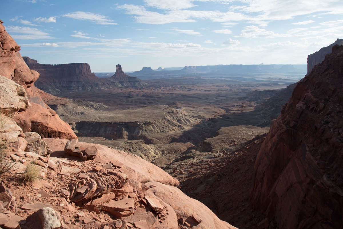
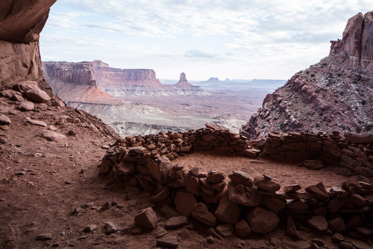
The False Kiva is one of the most intriguing locations for landscape photographers in the American Southwest. This mysterious place provides a spectacular once-in-a-lifetime view from inside a potential Anasazi alcove overlooking the Green River canyon and its jaw-dropping horizon. This mesmerizing setting is timeless, peaceful, breathtaking, amazing, and otherworldly.
Each time I visit here, I always ask myself, “How did this happen?” What are the chances of this perfectly shaped alcove, placed in the middle of nowhere, overlooking one of the most stunning vistas in the entire southwest? The Kiva is a ring of stacked rocks about 15 feet in diameter. The “False” part implies it is not a real Kiva (which was a ceremonial worship place for the Anasazi Indians).
Unfortunately, someone vandalized the False Kiva in Summer 2018 with an open fire and graffiti on the red rock walls. Because of this, the National Parks Service has prohibited access to the alcove that includes the False Kiva. Currently, you can hike to the area but enter the alcove where the False Kiva is in.
The False Kiva is a small and fragile location, but receives many visitors each year. I would ask that when you visit, please do your best to preserve all aspects of this location for future visitors and always try to leave it in better shape than when you found it.
Images and location summary by Tim Wier
Trail Difficulty - DIFFICULT
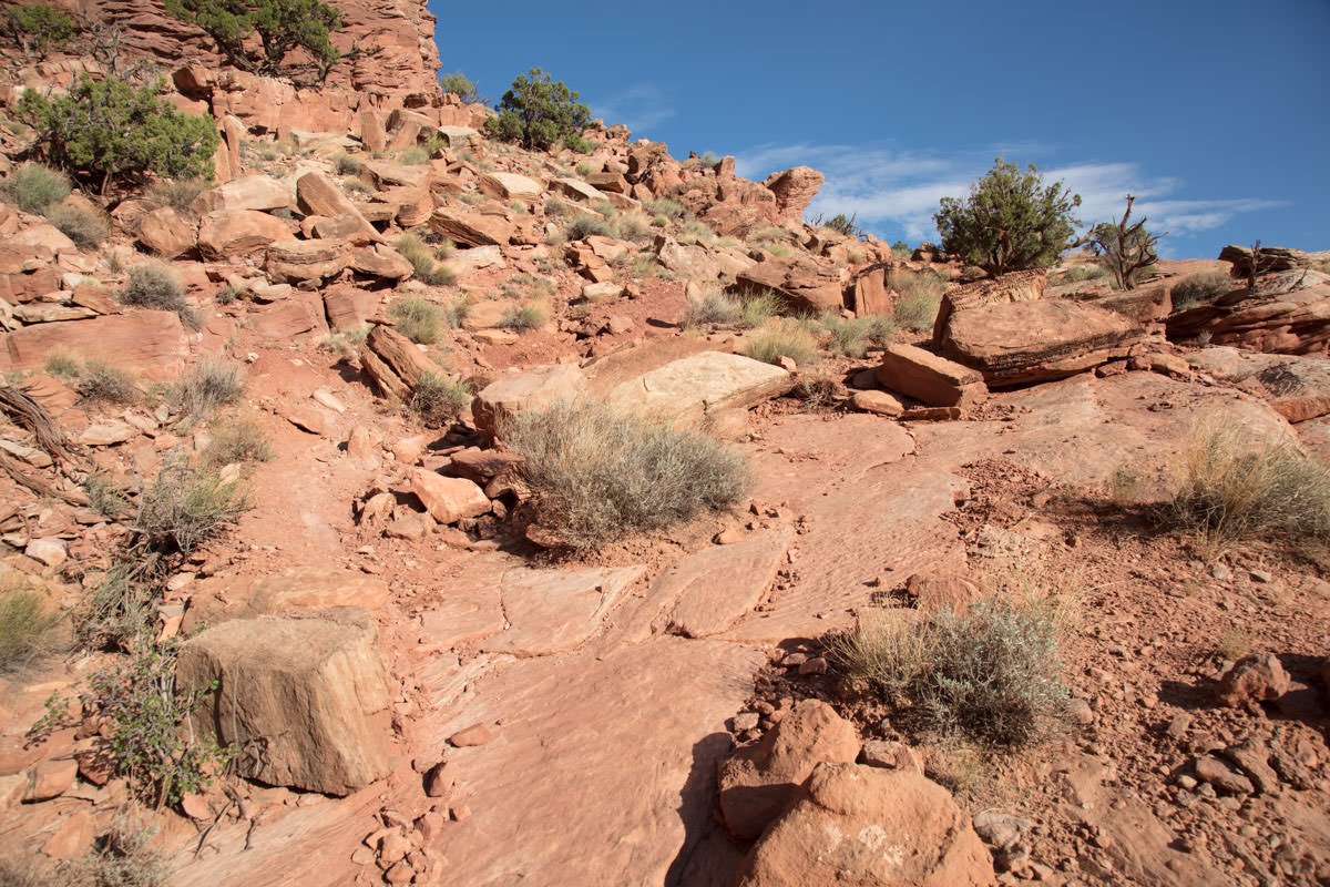
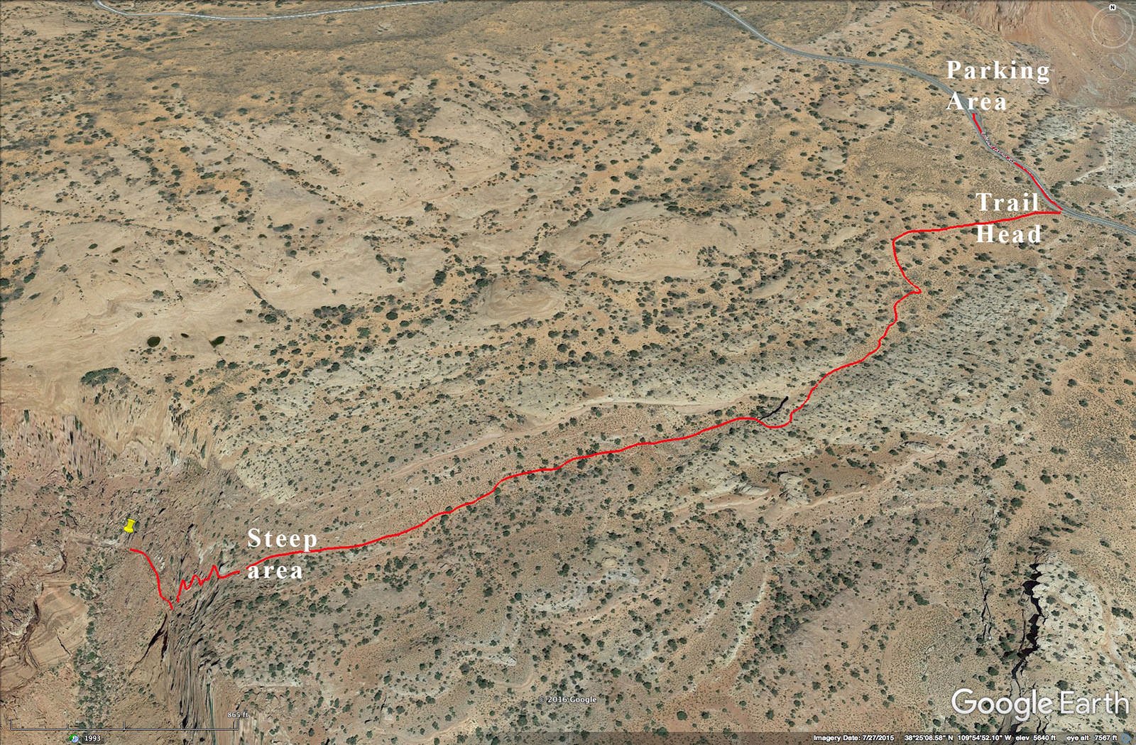
I would rate the difficulty of this trail as a 4 on a scale of 1-5 (with 5 being most difficult). The hike to the False Kiva is approximately ¾ miles each way and takes about 45 minuets. Even though the trail is not very long, it is not easy to follow and parts of the trail are steep and rocky.
At times the trail vanishes, but is marked sporadically along the way with rock cairns. The middle of the hike goes through a rocky wash and the latter part of the hike has a steep downhill slope with lots of loose rocks and tough spots. The final leg of the hike runs along a tight rocky shelf. To get to the False Kiva, you have to climb a steep dirt trail to the alcove. This hike is doable, but not for everybody.
GPS Coordinates & Elevation
5,138 ft. Elevation
Google Earth
Download KMZ Trail File
Click Here to download the KMZ file for this location.
Directions
CLICK HERE to get driving directions to the False Kiva parking area.
Please note: you will lose your cell service once you get deep into the Canyonlands.
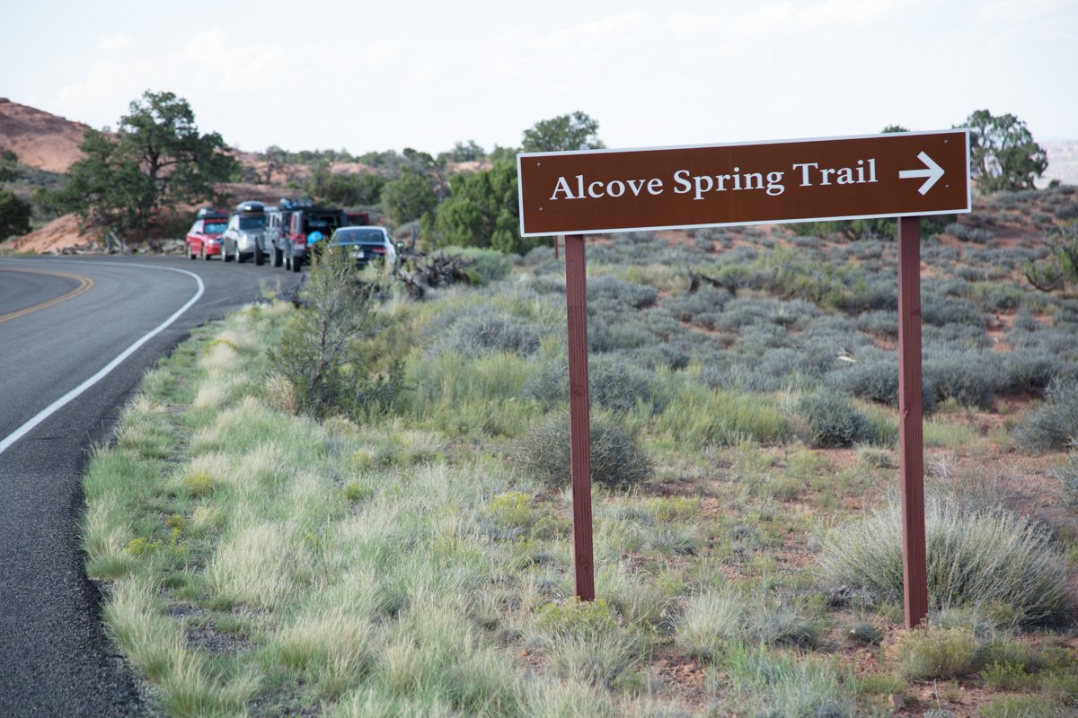
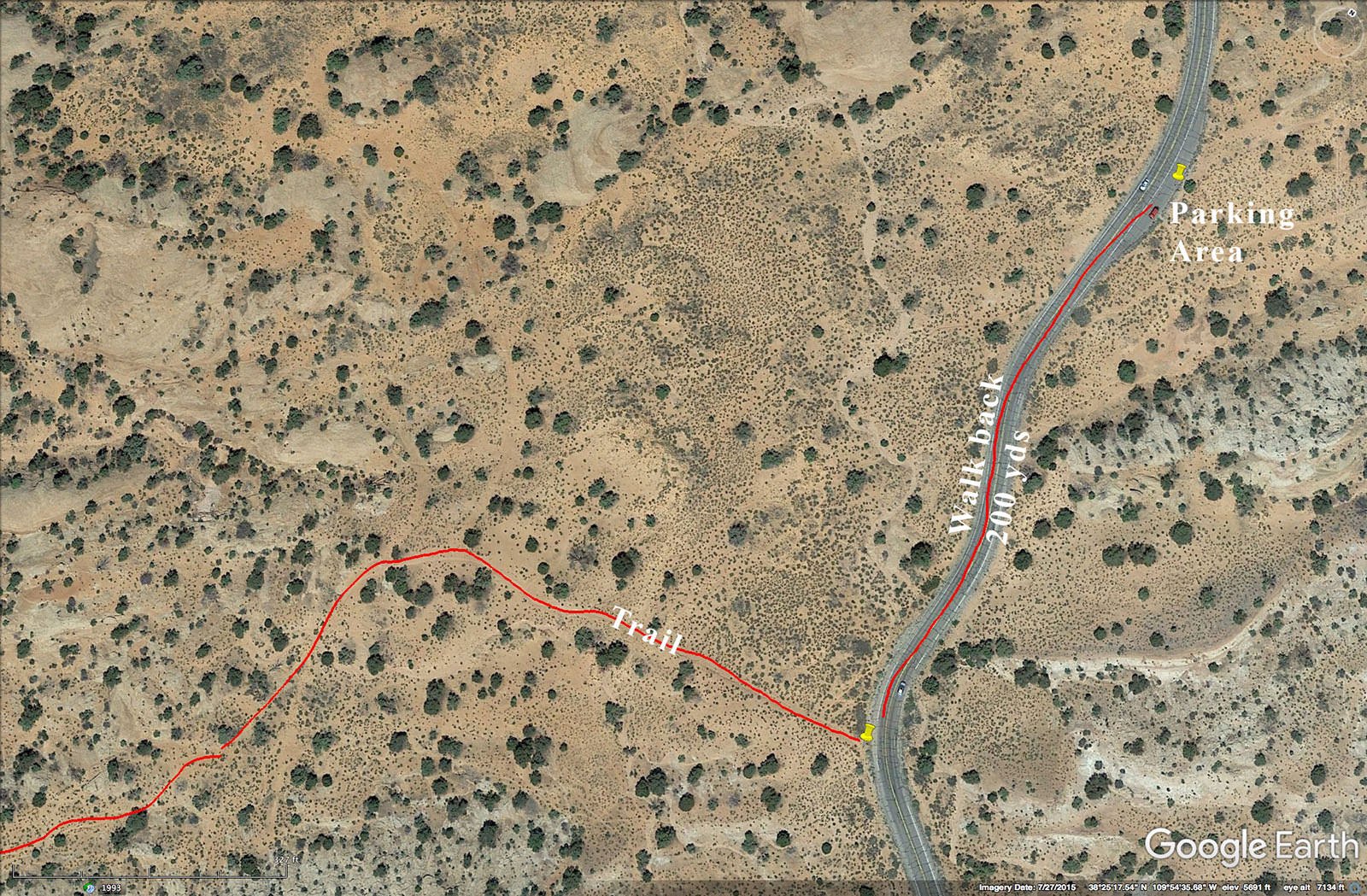
The directions are from Moab, UT.: From Moab, travel northwest on US-191for 11 miles until you reach the entrance to the Canyonlands National Park. At this point, take a left on UT-313 and drive west and then south 27.7 miles until you reach a right turn at Upheaval Dome Rd. Travel 3.6 miles on Upheaval Dome Rd. until you see a small pullout on the right (holds about 5-6 cars). The pull out is about 100yds. past a sign for “Alcove Spring Trail.” This is parking lot for the False Kiva trailhead.
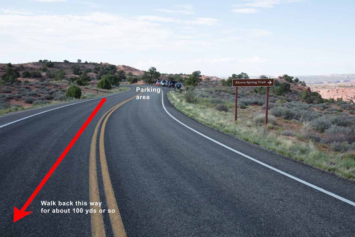
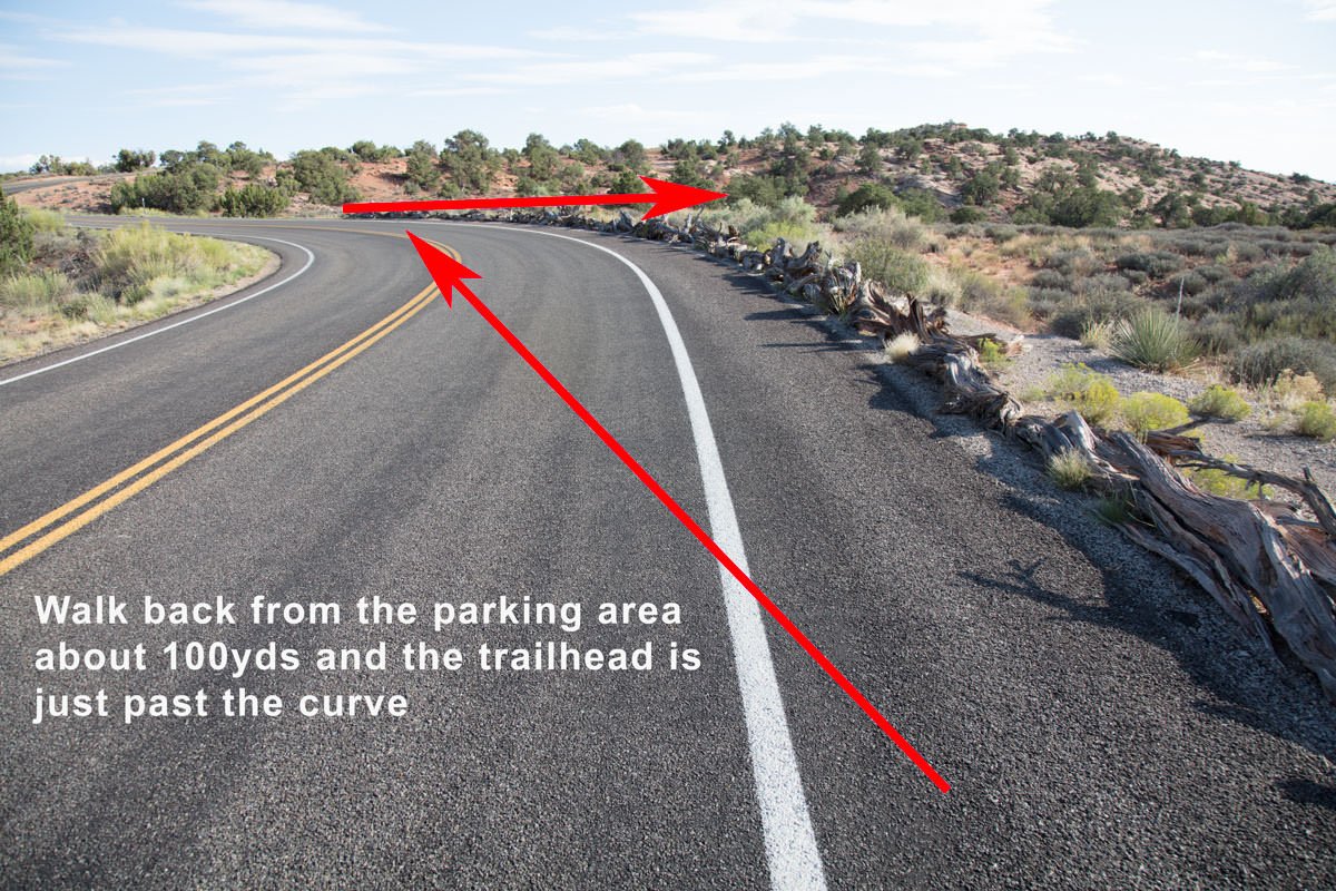
From the parking lot, walk back the way you came for about 100yds. Just past the curve on the right side of the road is a series of stacked wood rails along the curve. At the end of the curve you will see an unmarked dirt trail heading south.
The entry point for the unmarked trail to False Kiva (38°25'15.77"N 109°54'30.98"W). If you have a GPS, mark this spot for the return journey. If you don’t have a GPS, look around and remember what your surroundings look like.
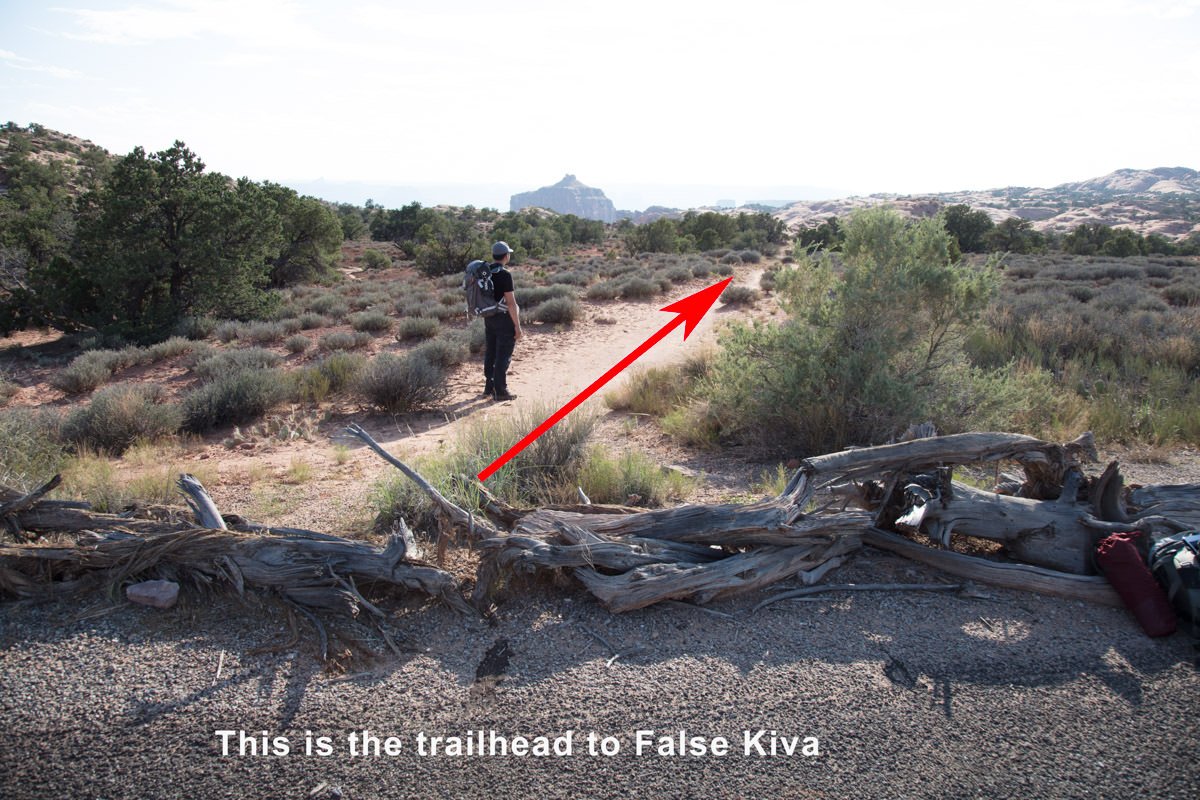
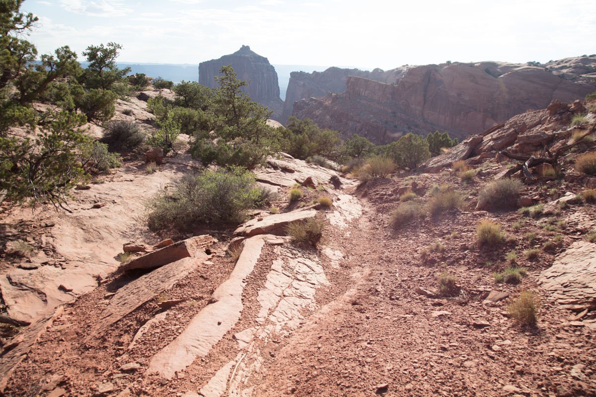
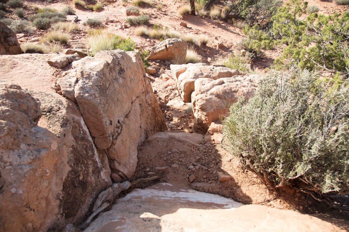
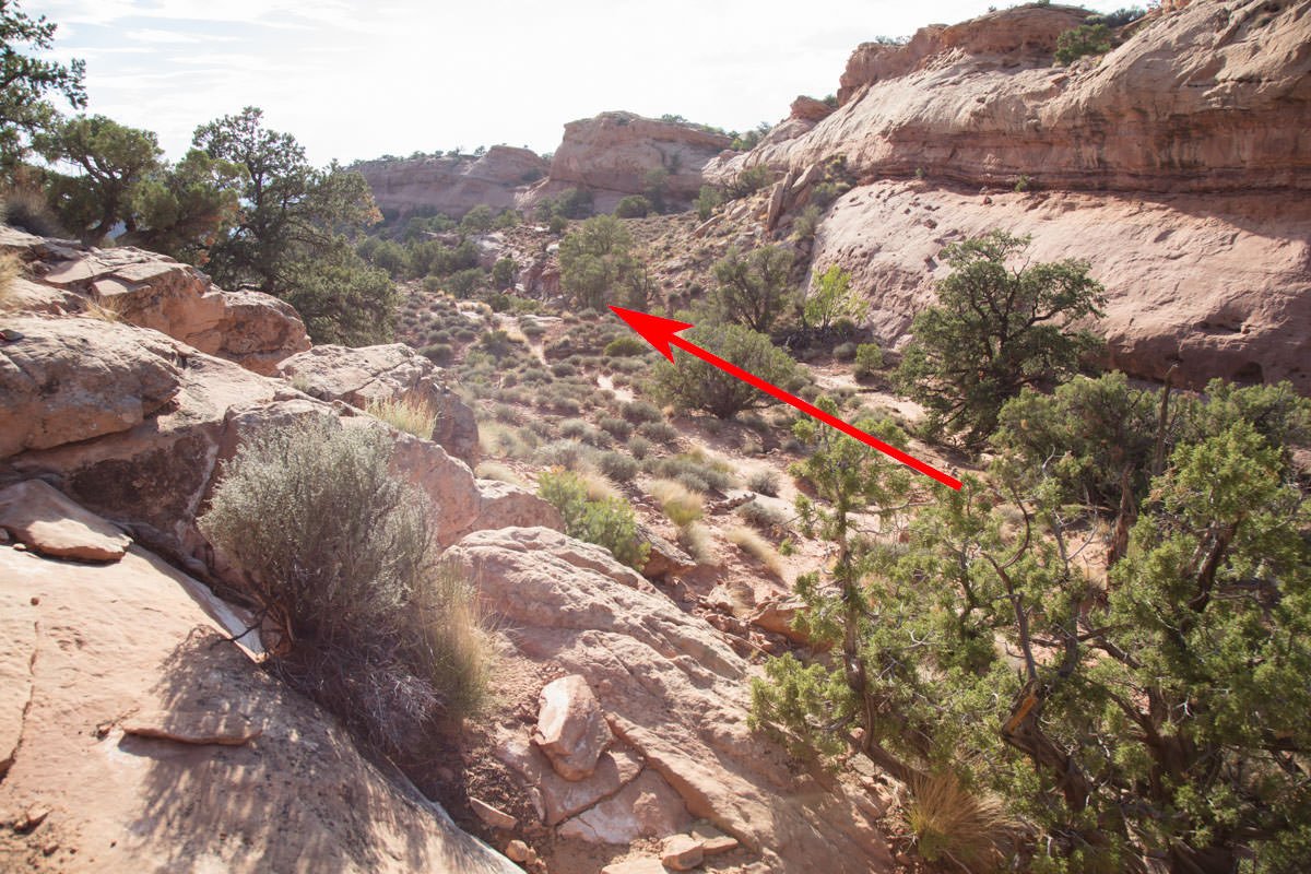
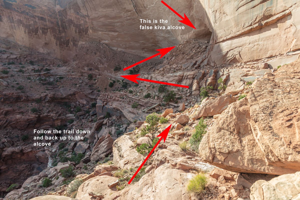
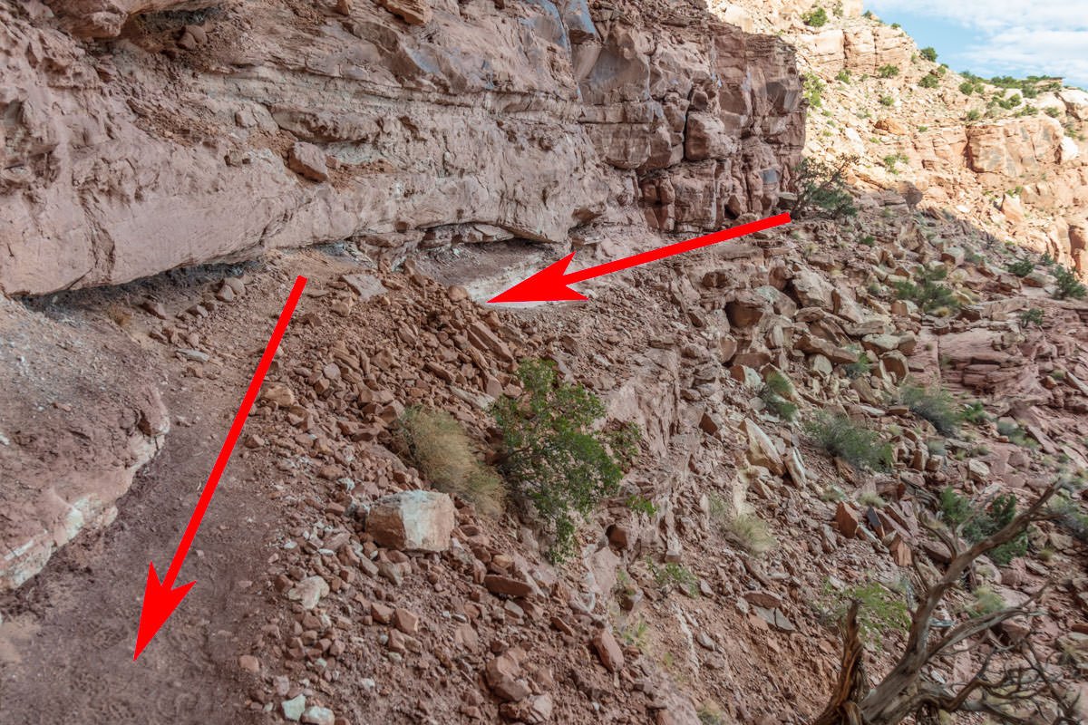
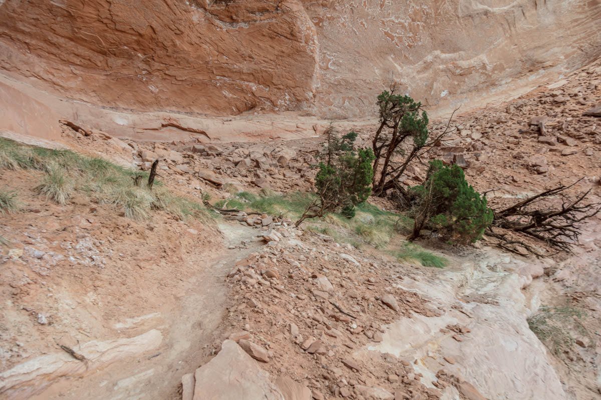
The trail to the False Kiva is not well marked and at places seems to disappear. Continue on what appears to be the dirt trail (if you get to a place you can’t see a trail look around for rock cairns, as they are placed along the trail) for about 0.3 mile. To your right, you will see a drop down into a wash / ravine (again look for the rock cairns to lead the way). Once you are in the ravine, continue toward the butte with the pointed top. At the end of the ravine, you will see the trail heading down a fairly steep rocky path toward a large red wall with an alcove.
You are almost there. Carefully follow the trail along the cliff until you are at the bottom of the red wall. Then take the final trail to the alcove that is the False Kiva.
VERY IMPORTANT: It takes at least 45 minutes to hike back to the parking lot. Make sure you allow time to get back before dark. Remember, you are deep in the Canyonlands and there are no city lights within 35 miles. When the suns goes down, you can’t see your hand in front of your face.
Photography Tips
After the difficult hike to get to the False Kiva, capturing a good image here can also be challenging for the following reasons:
The alcove is fairly small (50ft. across x 20ft. deep) with the small kiva in the center (about 10ft. from the back wall).
There is a protected archaeological area on the left side of the alcove that takes up about a quarter of the space.
During the day, the dynamic range between the inside of the alcove and the distant mesa is extreme.
Most likely there will be foot prints all around the alcove/kiva. Unless you want these footprints in your image, you will need to brush them away (with shirt, hat or small broom).
The shot above was taken in the late afternoon (just before sunset). I waited for the late afternoon because I wanted the long shadows in the distance and I wanted the red glow on the left-side butte.
Unless you shoot this late in the afternoon, you will most likely need to blend or composite your image.
EXIF Data
Focal Length – 24 mm
Exposure – 45 th sec @ f 8.0
ISO – 100
Date – Sept 26th
Time – 7:26 pm
Best Time of Day to Shoot
Because of the direction of the sun, the best time would be in the late afternoon or close to sunset. This is when the sun is lower in the horizon, which creates long shadows and softly illuminates the red mesas in the distance. The shot above was taken about 10 minuets before sunset, just before the sun dropped behind the hills to the east.
Best Time of Year
The best time would be from April to October. In the winter months, the sun would set in front of the alcove, and the mesas and buttes would be partially silhouetted. The shot above was taken on September 5th.
Lens(es) Needed
I have seen many images from this location. Most photographers try to go as wide as possible (11-21mm) to capture the whole alcove. I took a different approach and used a 24mm lens for this shot.
Birds-Eye View From Google Earth Pro
Permits
The False Kiva is in the Caynonlands National Park, and an entrance fee (good for 7 days) is required ($35). It can be purchased at the visitors’ station.
Direction of the Shot
The direction of the shot is mainly south @ 190°.
Equipment Needed
In addition to a tripod, I would suggest bringing a small broom (as you will need to sweep away footprints on the floor) and a GPS to mark your return path. Getting lost in this area is easy and dangerous.
Number of Other Photographers to Expect
For many years, this location was a secret spot that required special knowledge from a park ranger to reach. Recently, it has become a very popular attraction for tourists and photographers. Depending on what time of year and what time of the day, you can share this small space with up to 10 people, or you can be all alone.
Weather
False Kiva is in the Island in the Sky District, which is a high desert climate where temperatures can change up to 50° a day. Spring and fall are nice, but summer can get into the 100s. The monsoon season (in late summer) brings violent but brief thunderstorms, which often cause flash floods.
Cell Service
I use Verizon, and there is NO cell service at this location. Cell service is spotty in the Canyonlands Park and is not a strong signal until you get back to Moab.
Overnight Camping Options
The False Kiva is deep in a remote section of the Canyonlands National Park and the nearest town is Moab (50 miles). Moab is a nice town and has an abundance of lodging.
The closest campsite to False Kiva is the Willow Flat Campground (3.5 miles east) by the Green River Overlook. This little campground has 12 sites and is available year-round on a first-come, first-served basis. Sites are $15 per night.
There is also a campsite at the Dead Horse State park (24 miles east and then north). The Dead Horse campground has 20 sites (17 standard partial hookups and 3 yurt). Sites are $15 per night.
Nearby camping and lodging
Camping - click on the campground below for directions
Willow Flat Campground (3.5 miles east by the Green River Overlook)
Kayenta Campground (24 mile north Dead Horse Point)
Horsethief Campsite (19 miles north back toward Moab just past turnoff to Dead Horse Point State Park)
Cowboy Campsite (18 miles north back toward Moab just past turnoff to Dead Horse Point State Park)
Lodging - click on the lodging below for a TripAdvisor review
Red Cliffs Lodge
(435) 259-2002
Mile Post 14 Hwy 128, Moab, UT
INCA Inn and Motel
(435) 259-7261
570 N Main St, Moab, UT
Gonzo Inn
(435) 259-2515
100 W 200 S, Moab, UT
Nearby Restaurants
There are no restaurants or lodges in the park. Moab, UT, is the nearest town (50 miles) and has a nice choice of restaurants. There are several good places to eat in Moab.
Nearby Restaurants - click on the restaurant below for yelp review
Desert Bistro
(435) 259-0756
36 S 100 W, Moab, UT
Twisted Sista's Cafe
(435) 355-0088
11 E 100 N, Moab, UT
Area Guides and Workshops
None