

Panther Creek Falls
Southern Washington
Panther Creek Falls provides a wonderful multi-stream waterfall shot with vivid colors, unique rock shapes, and cascading water flows. The main waterfall actually takes a sharp turn before dropping to a pool at the base of the falls. Then an adjoining falls sends a new veil of water down the other side of the gorge.
The experience of first seeing Panther Falls after the stressful hike down to the base of the falls is breathtaking. For a photographer, this serene location offer endless compositional opportunities.
Trail Difficulty - MODERATE
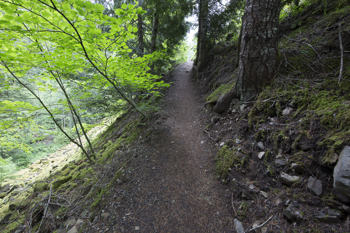
I would rate the difficulty of this trail as a 3 on a scale of 1-5 (with 5 being most difficult). The hike to the viewing area and is only a short walk from the parking lot (200-300 yards). The hike to the base of the falls is a bit more difficult, but with caution you can get to the creek without too much difficulty.
For those that had been to Panther Creek Falls in the past know the hike down to the creek used to be a serious event. Now, there is a new maintained path down to the creek with a newly constructed viewing stand. - a welcomed site!! The new trail is found by walking down toward the viewing area and then veering to the left.
ATTENTION: a Trail Notes subscriber noted that when they visited in the Fall of 2021, the bottom of the trail toward the creek (below the lower platform) has a sign that indicates the trail is currently “Closed for Restoration”. We are not sure how long the the bottom of the trail will be closed.
Download KMZ Trail File
Click Here to download the KMZ file for this location.
GPS Coordinates & Elevation
1,878ft Elevation
Google Maps Birds-Eye-View


Click link above to view location in Google Earth
Directions
CLICK HERE to get driving directions the Panther Creek Falls trailhead/parking lot.
The closest town to Panther Creek Falls is Stevenson, WA (17.2 miles south).
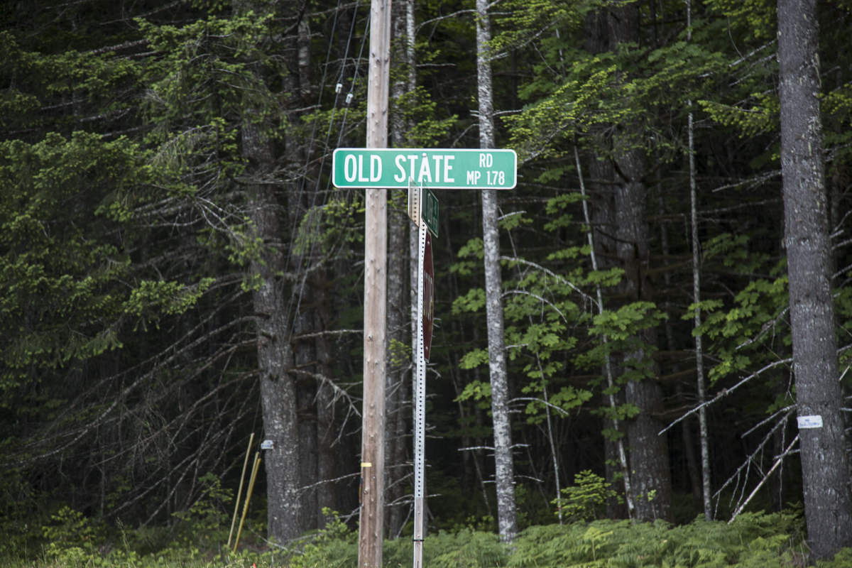
From Stevenson, WA, drive approx. 3 miles east on WA-14 and take a LEFT at the turn-off toward Carson, WA (Wind River HWY). From the stop sign in Carson, travel north 4.8 miles and look for a small road called Old State Rd. (this is a small sign and is easy to miss). Take a right on Old State Rd. and travel only about 300 ft., then take a left (north) on Panther Creek Rd. / NF-65. Mark you odometer at this point.


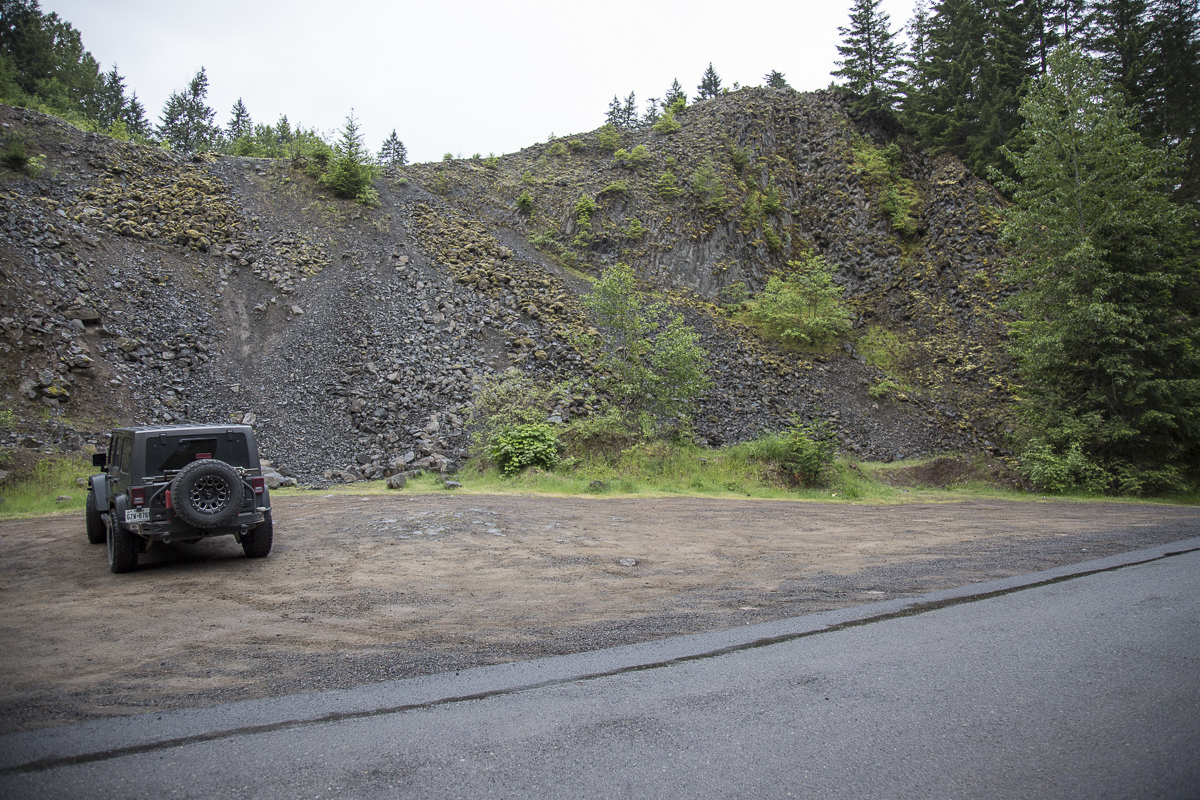
Travel 7.2 miles on Panther Creek Rd. (which turns into NF-65). You will be traveling on a winding, narrow 2-lane paved road through thick trees with some elevation gain toward the end. At the 7.2 mile mark, you will see a moderately sized parking area on the right that holds 5-10 cars.
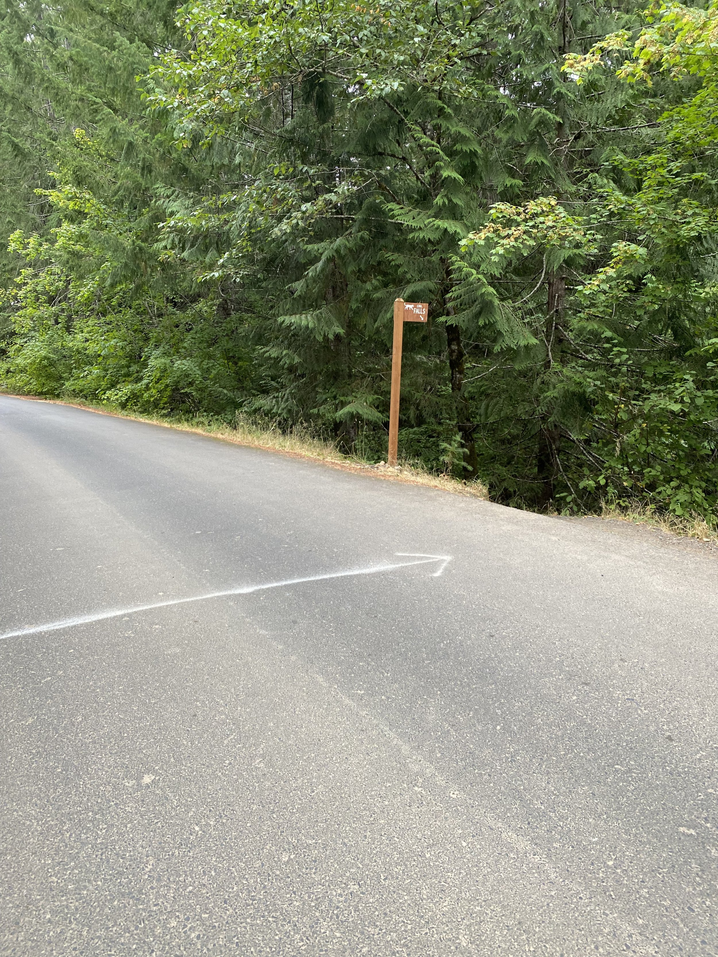
To confirm you are a Panther Creek Falls, walk across the paved road toward the sound of running water and you will see “PCF” spray painted in BLUE on the road just in front of a small opening through some trees / shrubs. There is also a small wooden sign that says Panther Creek Falls nailed to a tree above the opening. This is easily missed, as the sign is brown and stands high on the tree where your eye is not looking.
Two different spots to shoot the falls
There are 2 different locations to view the falls: 1) the tourist viewing spot, and 2) the photographic spot. The tourist viewing spot is directly above the photographic spot. I suggest going to the tourist spot first and then move to the photography location.
Getting to the Tourist Viewing Location
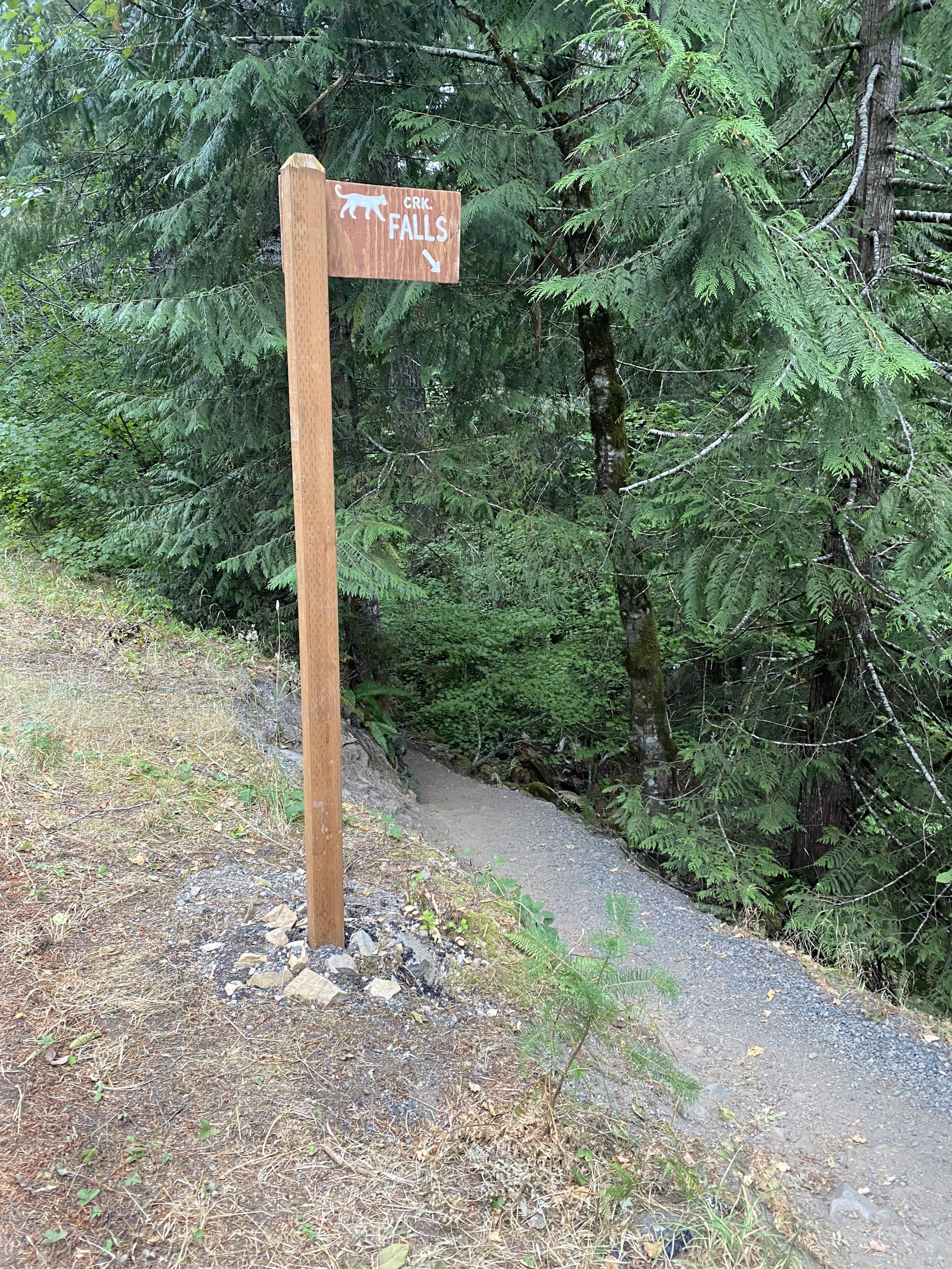
The path to the tourist spot an easy hike, but not very easy to find. The trailhead is directly across from the parking area and someone spray painted BLUE on the paved road in front of the trail opening. There is also a small wooden sign nailed to a tree about 8 feet above the road. The sign is easy to miss, as it is weathered and blends in with the tree.
From the trailhead, it is an easy hike of about 100-200 yards through the small opening in the brush down to the tourist viewing platform directly in front of the falls.
Standing on the tourist-viewing platform, if you look down to the base of the falls you will see where the real photographic opportunity is. Problem is, it is a steep drop straight down. You’ve got to figure out how to get there (see below).
Getting to the Photographic Location
From the path to the tourist viewing platform veer left and following the maintained path that meanders through the woods down to the new viewing area down by the creek.
Now you are at one of the most beautiful places in Washington — where time stands still and all the effort of getting here is forgotten.
Best Time of Day to Shoot
The best time to shoot is either on an overcast day or early morning (as the sun will be behind the trees). Very late afternoon would work too, but is not preferred.
Best Time of Year to Shoot
Spring, summer and fall are all good times to shoot these magnificent falls. However, late fall would be the best as with colors in the background make the scene really pop.
What Lens(es) Do You Need
The photographic area is narrow, small and tall – so to capture the whole falls from below you need an extremely wide angle lens (11-16mm). An alternative would be to do a vertical pano stitch with a 24mm lens or wider. A perspective control lens would also be a benefit as you are pointing up to get the top of the falls.
Permits
There are no permits required.
Direction of the Shot
The direction of the shot is north by northwest @ 330°.
Special Nuances of Shot
As mentioned, the area around the falls is small and requires an extremely wide angle lens to capture the entire falls from the creek. Most times of the year the spray from the falls can create problems with water on your lens. Be prepared to shield your camera / lens, and consider bringing towels or micro cloths to dry your camera / lens.
Special Equipment Needed
You will need a tripod, a polarizer, and a neutral density (ND) filter to reduce your shutter speed to ½ second or longer to create the silky water flow on the falls.
As mentioned, the force of the rushing falls will produce a ton of mist, which will end up on your lens and camera. Be prepared to shield your camera / lens with an umbrella, hat, or other item. Bring a rain sleeve for your camera and lots of micro and lens cloths to wipe down your equipment.
Number of Other Photographers to Expect
Depending on the time of year, you may expect between 0 and 5 other photographers. I have been to this spot several times and most of the time I am the only one there. However, I did go one time and there was a 5-person workshop. You will know how many other people to expect by how many cars are in the small parking area. The late spring and fall are the busiest times (the road is normally closed in winter). The location is fairly small, so if there are other photographers there you will just have to wait your turn.
Weather
It rains a great deal in this part of the country. If it is raining, the trail down to the creek becomes EXTREMELY SLICK and dangerous. I would suggest bringing a 50ft. rope to tie to a tree in the steep part of the trail.
Cell Service
I have Verizon and my cell service lasted to the turnoff onto Old State Rd. from Wind River Rd. There is no cell service at all on the 7 mile drive to Panther Creek Falls.
Overnight Lodging/Camping
The closest town is Carson, WA (9 miles), which has limited places to stay. The next larger towns are Stevenson, WA (17 miles south and west) and Cascade Locks, OR (21 miles south and west across to Oregon).
The closest camping is at Panther Creek campground (4.5 miles south on Panther Creek Rd./NF-65). It is a nice facility, but is closed in the winter & early spring. Other camping spots are the Eagle Creek campground (23 miles south and then west) or Ainsworth State Park (29 miles south and then west). Eagle Creek campground is small (16 sites), does not have RV hookups, and fills up quickly. Ainsworth State Park is a tradition campground with about 40 RV hookups and tent sites.
Nearby camping and lodging
Camping - click on the campground below for directions
Panther Creek campground – 4.5 miles south
Eagle Creek campground – 23 miles south and then west (currently closed due to Eagle Creek fire)
Ainsworth State Park – 29 miles south and then west (currently closed due to Eagle Creek fire)
Lodging - click on the lodging below for a TripAdvisor review
Skamania Lodge
(866) 571-0605
1131 SW Skamania Lodge Way, Stevenson, WA
Columbia Gorge Riverside Lodge
(509) 427-5650
3200 SW Cascade Ave, Stevenson, WA
Best Western Plus Columbia River Inn
(509) 427-7700
735 Wa Na Pa St, Cascade Locks, OR
Nearby Restaurants
Stevenson, WA, is a nice little town with some nice places to eat. I have had many a good meal and cold beer at the Big River Grill directly across for the Stevenson Elementary School. It is nice place with good food and friendly folks. Also Joe’s El Rio Mexican Café across the street has very nice people, pretty good Mexican food, and great margaritas.
Cascade Locks, OR, is also a nice little community. My favorite place to eat is the Cascade Locks Ale House. They have GREAT pizza with a good selection of local brews.
Nearby Restaurants - click on the restaurant below for yelp review
Big River Grills
(509) 427-4888
192 2nd St, Stevenson, WA
El Rio Mexican Cafe
(509) 427-4479
193 2nd St, Stevenson, WA
Cascade Locks Ale House
(541) 374-9310
500 NW Wanapa St, Cascade Locks, OR
(971) 231-4599
515 NW Portage Rd, Cascade Locks, OR
Laundry Mat
There is a self-service laundry mat attached to A&J Market in Stevenson, WA.
Eastwind Laundry at 225 2nd St., Stevenson, WA
Other Photography Opportunities Around
Airport Options
The closet airport is in Portland, OR. Portland International airport (PDX) services most of the major airlines in the US.
Area Guides and Workshops
If you were looking for a GREAT photography guide for Pacific Northwest (Oregon and Washington areas) - I can highly recommend Mark Metternich. I have taken workshops with Mark in the past and he has been hosting workshops in the Pacific Northwest for many years.
Mark knows all the VERY best places to take you and just the right time to be there - to help you get the shot. He is a great photographer, an expert at photoshop, an excellent guide/instructor and a super nice guy.
Mark Metternich
www.markmetternich.com
Mark@MarkMetternich.com
Other Resources
The Photographer's Ephemeris is a very valuable tool for landscape photographers to determine the direction of the sunrise/sunset & moonrise/moonset from any place on earth on any day (past and future). Click here to take you to The Photographer's Ephemeris for this location.