
East Of Eden
Near Eden, ME
EAST OF EDEN
A BRIEF SUMMARY OF EAST OF EDEN
Acadia National Park is called the Crown Jewel of the North Atlantic Coast and if you have been there, you understand why. This unique national park/island is filled with wonderful photographic locations, including an endless coastline, timeless lighthouses, and amazing fall colors.
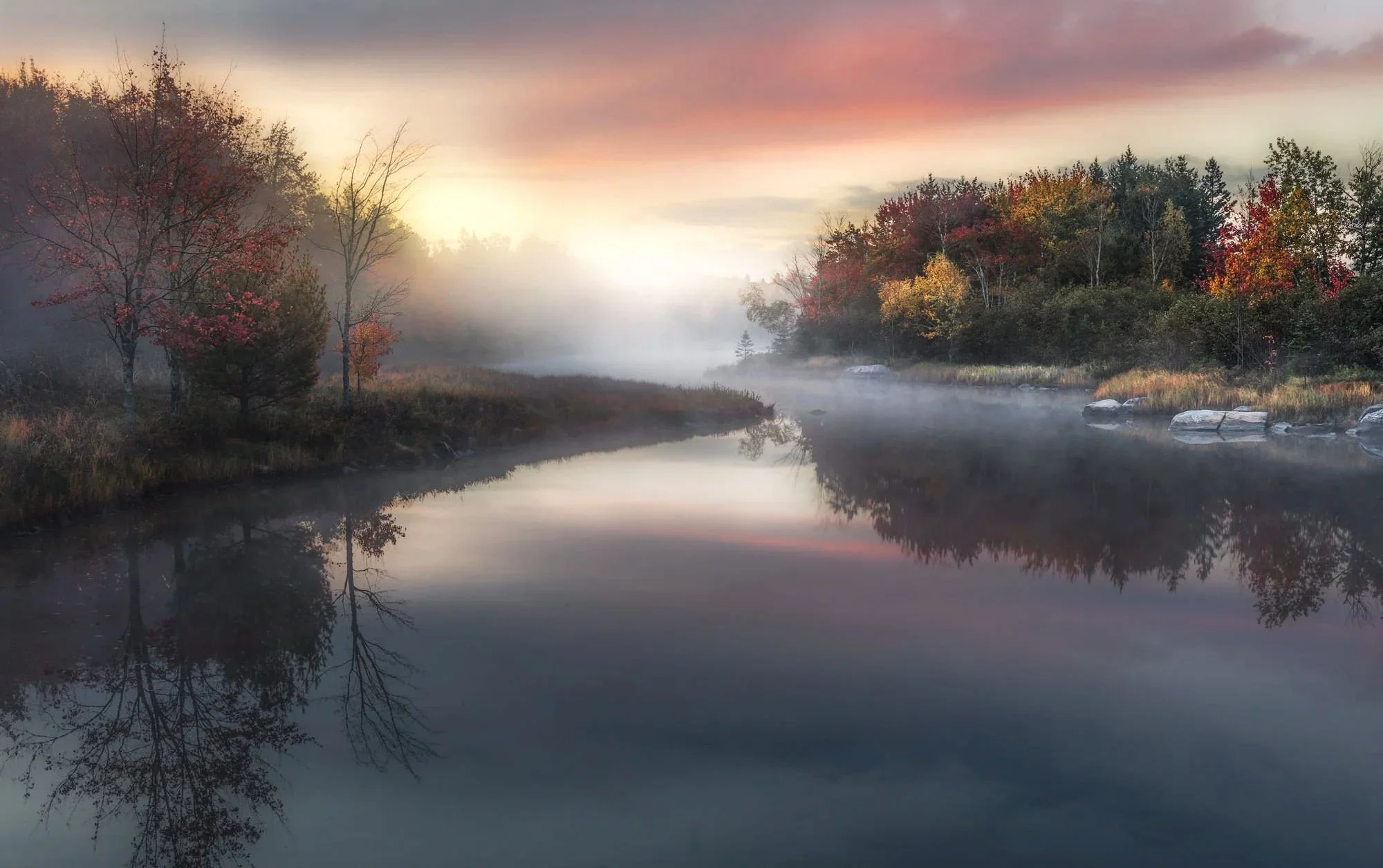
Just after arriving on the island, on your way to Bar Harbor, you are greeted with this quaint spot (right off the side of the road). There’s a tributary off of the Eastern Bay and under the right conditions, this location turns from a pretty little scene into a magical moment.
If you are looking for a great place to visit for fall colors, Acadia NP - including Bar Harbor and the surrounding communities, are perfect places to relax, enjoy and photograph to your heart’s content.
Images and location summary by Tim Wier

Annual Subscription
Lifetime Membership
DATA POINTS INCLUDED WITH EAST OF EDEN SUMMARY
I would rate the difficulty of this trail a 1 on a scale of 1-5 (with 5 being most difficult). There is a small pullout (viewing area) just past this location on the east side. The location of the shot is an easy 100 ft walk from the pullout - but you might have to push through some bushes to get this shot.
There are many different views, perspectives and, angles from this little pullout near Eden, ME. If you move 10 yards to the east or west, the perspective changes and the “S” of this little tributary either widens or contracts. I visited this location the day before and shot from several different spots, but ended up choosing this view. If you catch the good fall colors and nice light, there are many opportunities to get a nice shot.
This location is full of many interesting angles and views and can be photographed anywhere from a wide-angle to short telephoto. I chose this composition - which was shot at 35mm.
Sea Level Ft. Elevation
Other Resources Available with Membership
Detailed Directions
Best Time of Day to Shoot
Best Time of Year to Shoot
Equipment Needed
Required Permits
KMZ Trail File
Direction of Shot
Google Maps Birds-Eye-View
Number of Photographers to Expect
Cell Service
Current Weather
Lodging & Camping
Area Guides and Workshops
Other Resources
LOCATION SUMMARIES WRITTEN BY PROFESSIONAL PHOTOGRAPHERS


