
Bass Harbor Marsh
Acadia National Park
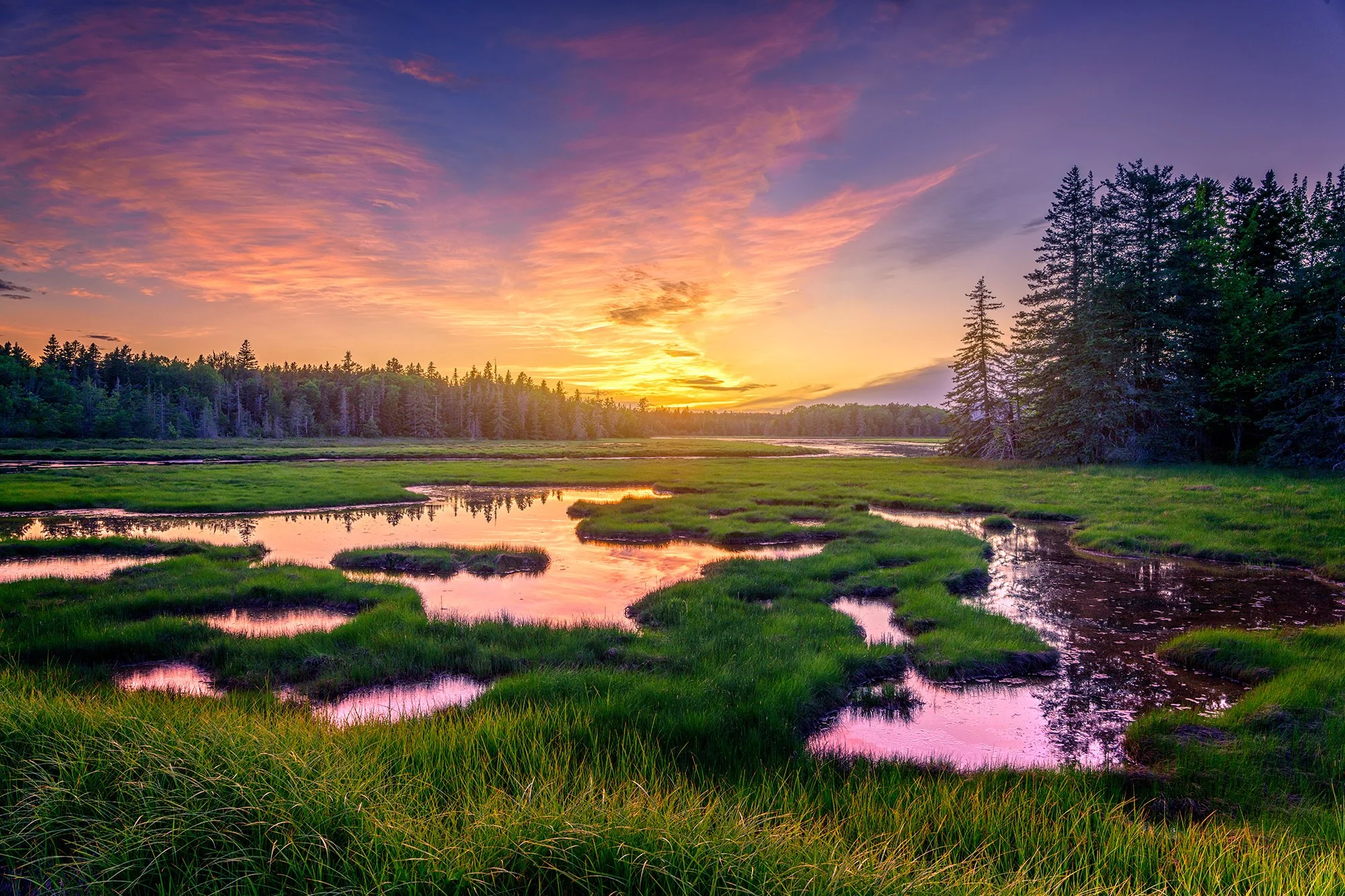
BASS HARBOR MARSH
A BRIEF SUMMARY OF BASS HARBOR MARSH
Bass Harbor Marsh is part of Acadia National Park, located on the "quiet side" of Mount Desert Island, not far from Bass Harbor Lighthouse. It's the largest salt marsh in Acadia, formed where two freshwater streams meet the Atlantic Ocean.
This is a fairly easy location to get to and photograph, as it's simply located right along Route 102 (Bass Harbor Road). This is one of the less well known spots in Acadia by name, but you'll often seen people stopping, especially at sunset, to admire the beauty of the marsh.
Photos and location summary by Rick Berk

Annual Subscription
Lifetime Membership
DATA POINTS INCLUDED WITH BASS HARBOR MARSH SUMMARY
I would rate the difficulty of this trail as a 1.5 on a scale of 1-5 (with 5 being most difficult). The shot is directly off of Route 102/Bass Harbor Road. However, after parking you may need to cross the road and then hop over the guardrail to avoid oncoming traffic.
I used a 3-stop soft edged graduated neutral density filter to help balance the sky's brightness with the darker foreground of the marsh. I parked on the side of the road and crossed over to the north side of the marsh to get the sunset. It's best to go over the guardrail and stand in the grass to give you some space, as the road can get somewhat busy behind you.
Wide angle to standard lenses will work best here, including lenses such as 16-35mm, 24-70mm and others in and around that range.
The above image was taken with a 24mm lens
Sea Level Ft. Elevation
Other Resources Available with Membership
Detailed Directions
Best Time of Day to Shoot
Best Time of Year to Shoot
Equipment Needed
Required Permits
KMZ Trail File
Direction of Shot
Google Maps Birds-Eye-View
Number of Photographers to Expect
Cell Service
Current Weather
Lodging & Camping
Area Guides and Workshops
Other Resources
LOCATION SUMMARIES WRITTEN BY PROFESSIONAL PHOTOGRAPHERS


