
Mono Lake
Near Lee Vining, CA
MONO LAKE TUFA
A BRIEF SUMMARY OF MONO LAKE TUFA
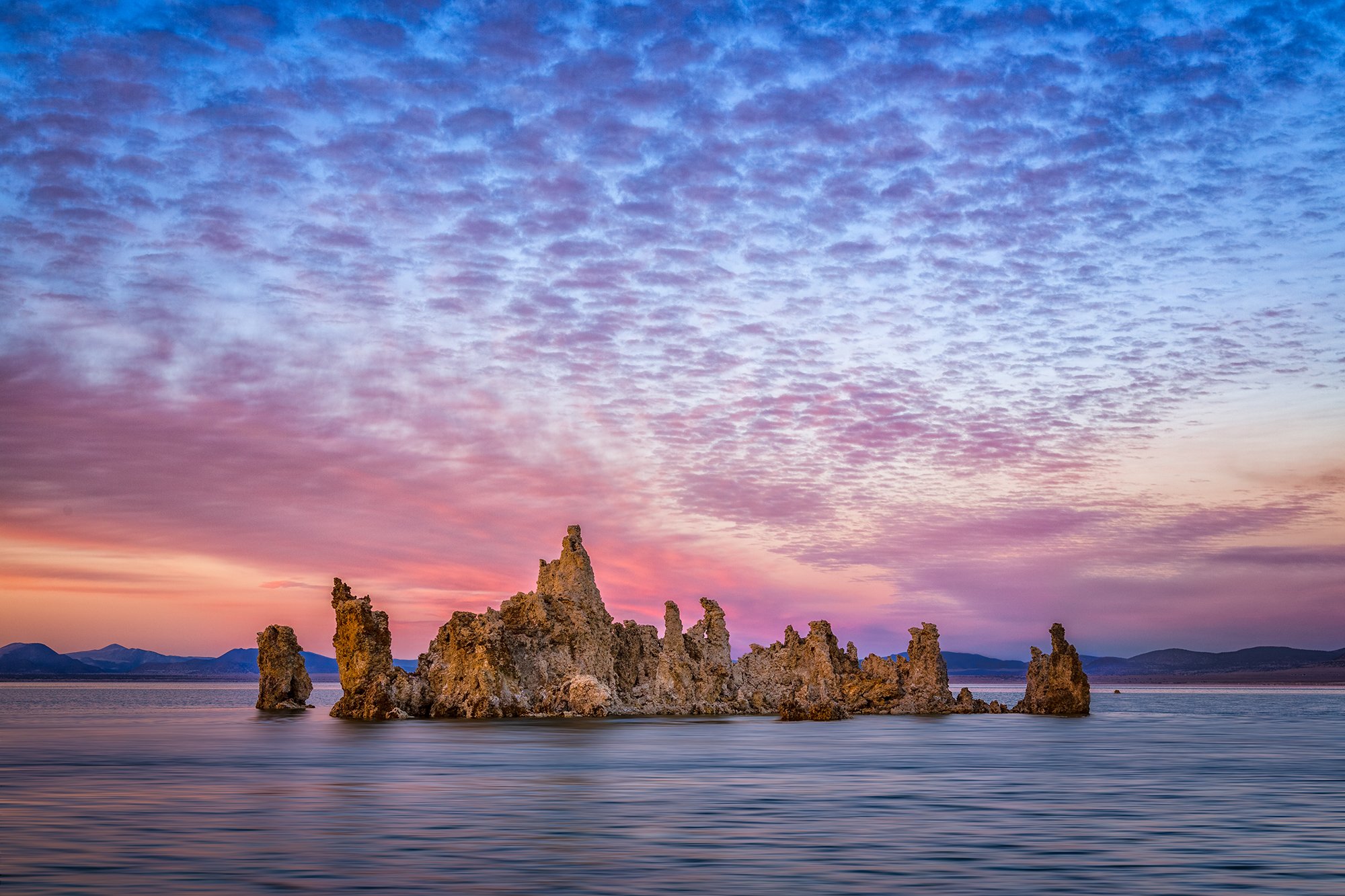
Hauntingly beautiful Tufa Towers emerge from the shimmering blue waters of Mono Lake, one of the oldest lakes in North America, in California's Eastern Sierra Nevada. The Towers line the edges of the 65 square mile lake. There are various viewing areas, but the largest grove is on the southern rim, with a mile-long interpretive trail from the parking area to the shoreline. Wandering among the tufa towers at the water's edge is an otherworldly experience, perhaps most comparable to touring a cave filled with stalactites and stalagmites. But unlike deep dark caves, the towers here have beautiful background skies with sunsets and sunrises to light up the towers and a lake for great reflections.
Mono Lake has no outlet and, until recently, only ever lost its water to evaporation, giving rise to water three times more salty than the ocean. The towers were formed below the water surface when fresh-water springs bubbled up through the ultra-alkaline ancient lake water, causing precipitation of solid calcium carbonate into these tall knobs and spires. When the city of Los Angeles diverted water from the tributary streams flowing into the lake in 1941, the lake water level fell 40 feet by 1981, exposing the underwater towers we see today. The lake is now protected from excessive water diversion, and the lake surface is rising steadily as rain and snow melt from the nearby Sierra Nevada mountain range has returned to flow into the natural basin, forming the lake. Eventually, part of this trail and the Tufa will be underwater again.
SPECIAL NOTE: the tufa are fragile - climbing destroys them and is prohibited, along with collecting pumice or obsidian.
Images and location summary by Deb Snelson

Annual Subscription
Lifetime Membership
DATA POINTS INCLUDED WITH MONO LAKE TUFA SUMMARY
From the parking lot, the trail descends to the shoreline of Mono Lake along a 0ne-mile interpretive trail. The trail is paved for approximately .25 miles but eventually becomes a hard-packed soil pathway through the Tufa towers.
There are a multitude of angles to shoot the tufa towers - remember to shoot both high (standing) and low (from a more crouched position) and both horizontally and vertically. If you time your visit right, the moon reflects brightly in the lake. The Sierra Nevada mountains to the west of the lake light up with the rising sun.
There are additional Tufa's to photograph. The 1st set is found just south of Navy Beach (see map below), and another 2nd set of formations is about a mile east of Navy Beach (see map below). The 2nd set is much larger but requires a 1-mile hike along a sandy/dirt road.
You will need 24mm-105mm or similar.
xxx Ft. Elevation
Other Resources Available with Membership
KMZ Trail File
Directions
Best Time of Day to Shoot
Best Time of Year to Shoot
Equipment Needed
Permits Required
Direction of Shot
Google Maps Birds-Eye-View
Number of Photographers to Expect
Cell Service
Overnight Lodging/Camping
Nearby Restaurants
Area Guides and Workshops
Other Resources
LOCATION SUMMARIES WRITTEN BY PROFESSIONAL PHOTOGRAPHERS


