
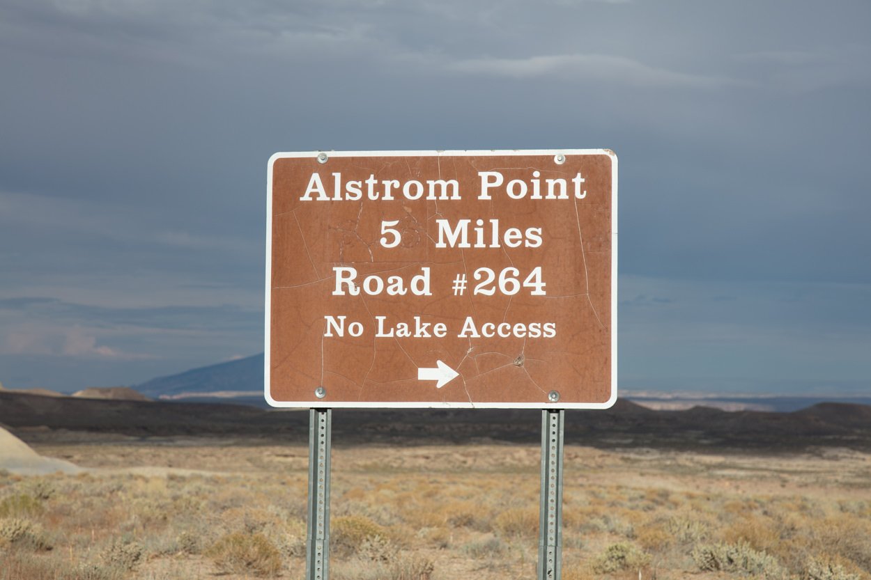
Alstrom Point

Near Bigwater, AZ
ALSTROM POINT
A BRIEF SUMMARY OF ALSTROM POINT
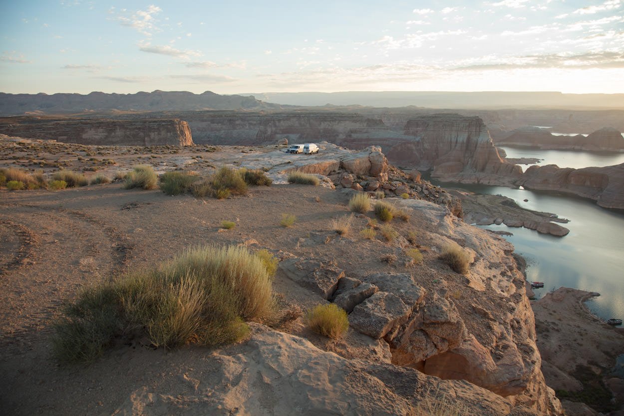
Sunset (or sunrise) Alstrom Point is like few others you will ever witness in the American southwest. But like many beautiful things, there can be a heavy price to pay to see it. The road to Alstrom Point is mean, tough and long and should only be done with a high clearance 4-wheel drive vehicle.
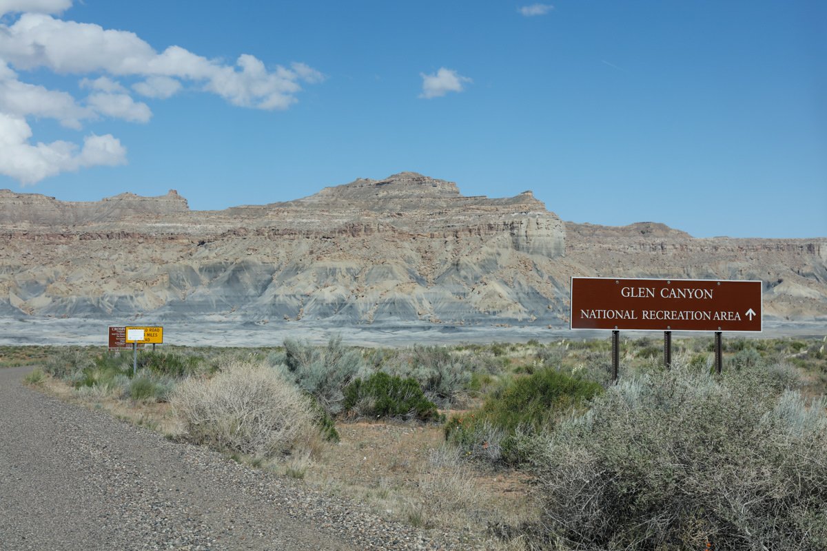
Lake Powell is a product of the Glen Canyon Dam and is the second-largest reservoir in the US (behind Lake Mead). The lake is just north of Page, AZ, and straddles the states of Arizona and Utah (mostly Utah). The scenes created by Lake Powell are stunning as it sets in the area of endless coves, buttes, and colorful sandstone. However, in my opinion, the best views of Lake Powell are from Alstrom Point.
Images and location summary by Tim Wier

Annual Subscription
Lifetime Membership
DATA POINTS INCLUDED WITH ALSTROM POINT SUMMARY
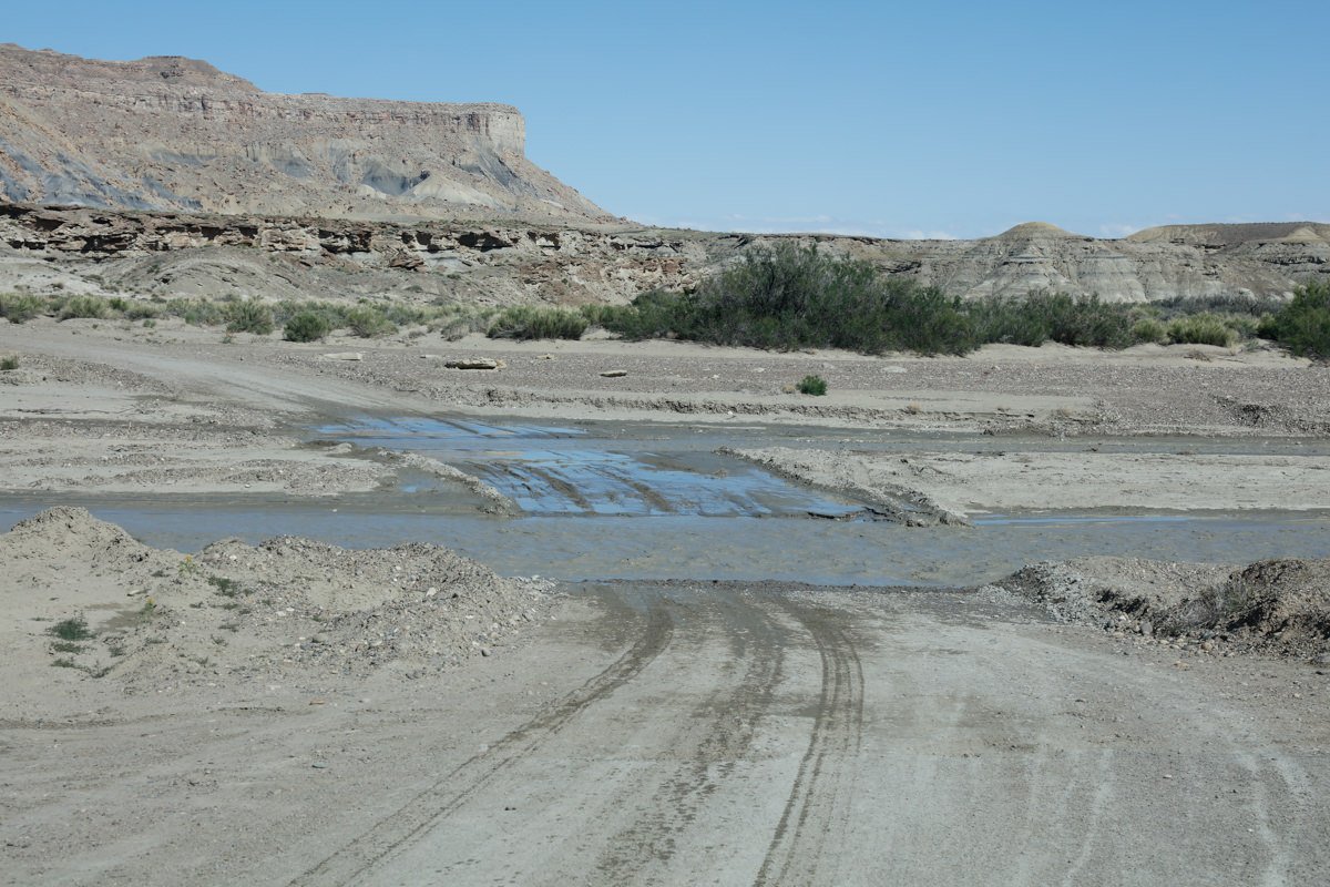
I would rate the difficulty of this trail as a 5 on a scale of 1-5 (with 5 being most difficult). I would only attempt the road to Alstrom Point in a high clearance 4x4 vehicle! The first 23 miles (of the total 25 miles) is on a rocky/dirt road that passes through a few washes. However, at mile 23, you have to climb a pretty nasty uphill which requires high clearance 4x4. And for the next 1.6 miles, the road (if you can call it that) is VERY rocky and bumpy.
Alstrom Point is a stunning location that can take your breath away. However, sometimes it is difficult to capture the essence of this grand vista. Walk around and try to find a nice location that includes something (like a rock or rock formation) as an anchor. Otherwise, you just have a wide shot of a nice lake with some red buttes.
For most photographers, this is a wide-angle vista, so bring a wide-angle lens or do a pano.
4,690 Ft Elevation
Other Resources Available with Membership
KMZ Trail File
Directions
Best Time of Day to Shoot
Best Time of Year to Shoot
Equipment Needed
Permits Required
Direction of Shot
Google Maps Birds-Eye-View
Number of Photographers to Expect
Cell Service
Overnight Lodging/Camping
Nearby Restaurants
Area Guides and Workshops
Other Resources
LOCATION SUMMARIES WRITTEN BY PROFESSIONAL PHOTOGRAPHERS


